The winter of 2013-2014 is off to a rip-roaring start and, as we’ve discussed in previous posts, the mid to long range data suggests we remain locked in an exceptionally cold and snowy pattern. Officially, as of this evening, the Indianapolis National Weather Service has posted some impressive stats (the full report can be found here), including:
- Through Jan. 21st, the 24.4″ of snow ranks as the 3rd snowiest January on record.
- Through Jan. 21st, the season-to-date snowfall of 33.2″ ranks as the 2nd highest on record in the period Dec. 1st through Jan. 21st.
- Through Jan. 21st, the season-to-date snowfall of 33.2″ ranks as the 8th snowiest on record for an entire winter season.
As we look ahead to the upcoming 7-10 day period, we note a continuation of arctic reinforcements- each which will be plenty capable of adding to the snowfall total. Additionally, our cold air mass will only grow even more severe and bitter over time, including multiple days during the aforementioned period where central Indiana will go below zero. Finally, there have been many questions concerning a potential big storm centered on early February. I’m not sure where this rumor started, but it’s far too early to say with any sort of confidence any specifics around a possible big winter storm early February. That said, as we’ll get into briefly below, the pattern does appear to be aligning itself in a way where a widespread winter storm is possible somewhere across the eastern half of the country.
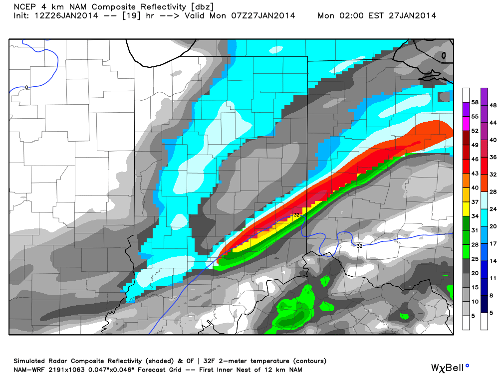
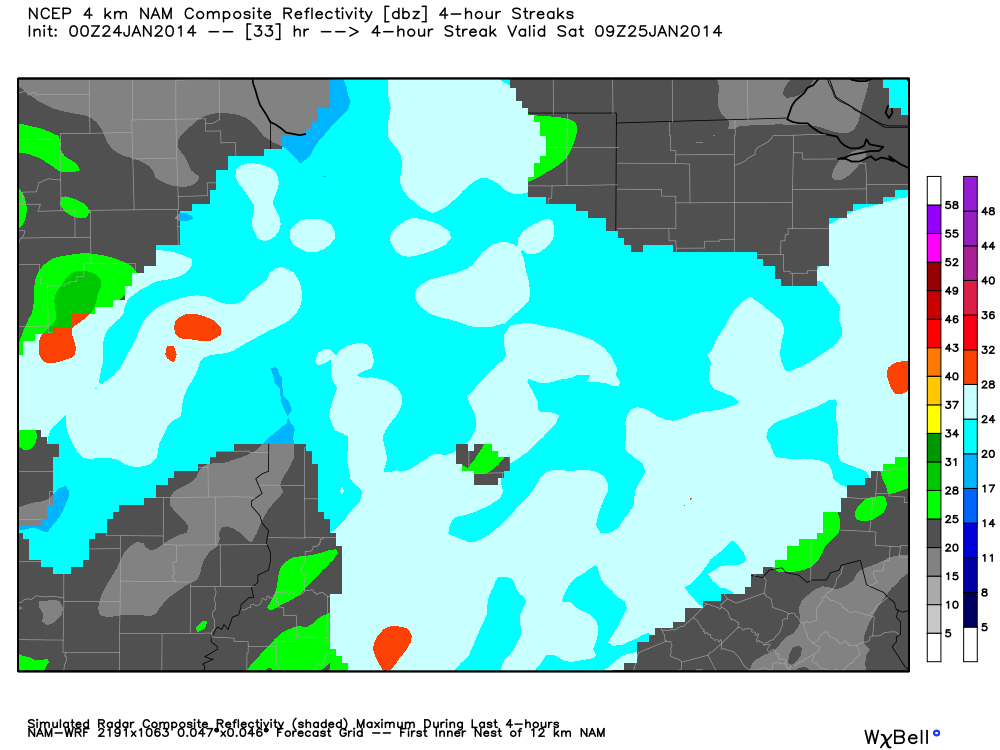
Okay, okay, back to the near term… Let’s start with tomorrow! After a cold and dry start to the day, our next arctic front will blow into the region during the evening. Arctic fronts are notorious for having bursts of heavy snow rates in a scattered fashion and this appears to be the case as the next arctic front moves through Wednesday evening. We bracket the hours of 5p-8p for the possibility of heavy snow bursts racing through central Indiana. While these won’t last long, they’ll likely be intense- capable of depositing a quick 1″-2″ of new snow on a gusty northwest wind within 30-60 minutes. White-out conditions and extremely heavy snowfall rates will accompany the heavier bursts of snow. Latest high-resolution model data shows the heavy snow bursts accompanying the arctic front tomorrow evening:

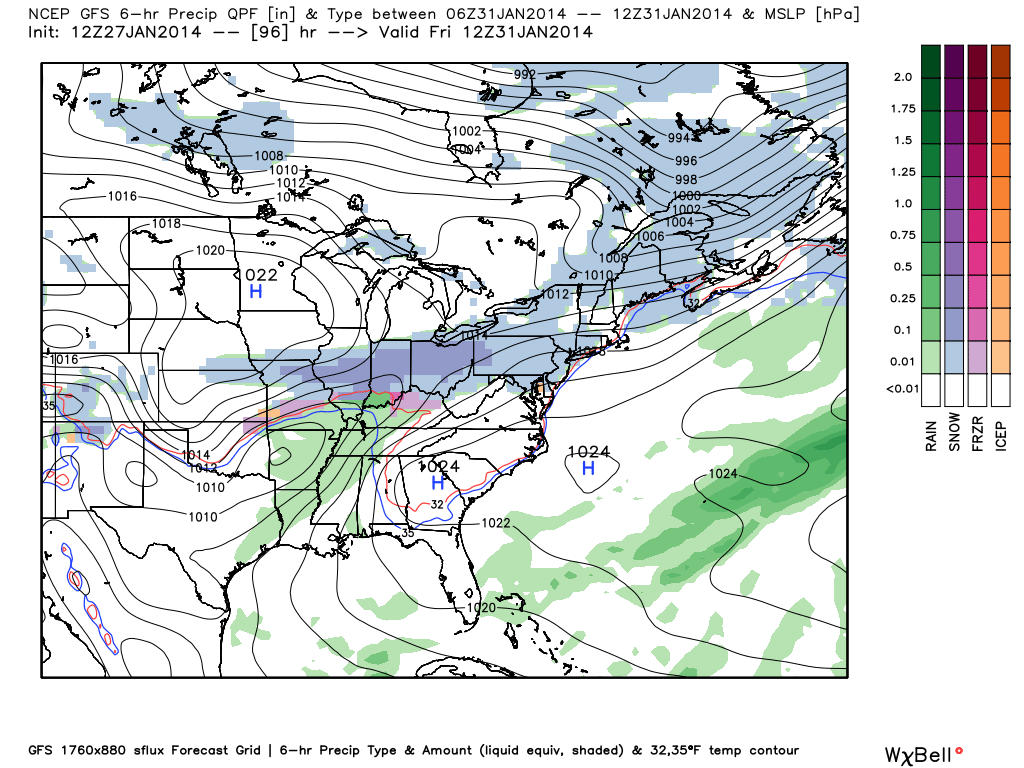
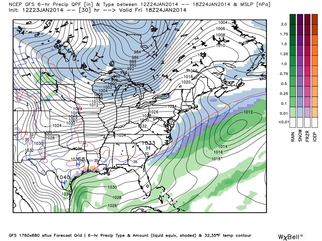
Thursday will be mostly dry and frigid, but all eyes will then begin to turn to our next significant winter event Friday into Saturday. The pressure gradient between high pressure across the Mississippi River Valley and the next approaching arctic front (and associated low pressure) will really being to kick up the wind across our region Friday. We’re afraid we deal with another round of severe blowing and drifting snow Friday, especially Friday afternoon and night. Areas most suspect to drifting and blowing snow will be central Indiana’s open country and may not be too different from the problems our region dealt with Sunday into Monday morning from blowing and drifting.
As we approach Friday night into Saturday, snow will overspread the region and will likely accumulate to the tune of a “few inches” during this time period. Strong winds will remain, shifting from the west to the northwest and eventually north. Open country will remain the prime place for continued severe blowing and drifting problems.

Just as soon as Saturday’s snow systems exits stage right, we turn our attention to potentially another significant snow maker for the second half of the weekend. Latest model data remains consistent on moving another potent clipper system into our region Sunday, including the GFS and Canadian forecast models. We still have time to fine tune the precise track of the storm, but just north of the low’s track an additional 3-5″ type snow is possible Sunday. Note the GFS and Euro in relative agreement on the track of the low, with the Canadian currently a touch further north. We’ll fine tune in the days ahead… Experience with similar patterns from the past suggests central Indiana should brace for more accumulating snow Sunday.


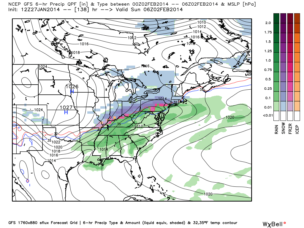
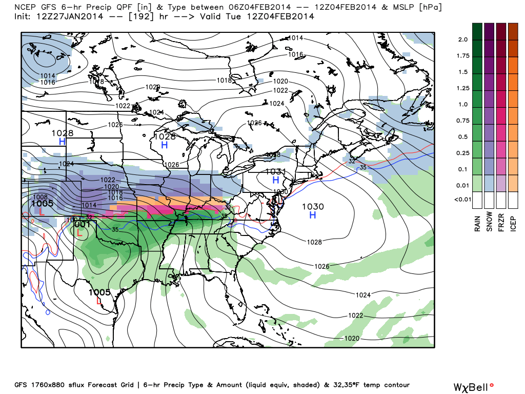
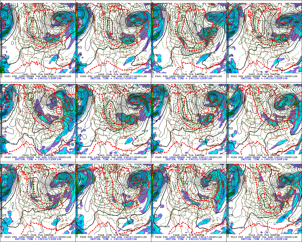
As for the brutal cold, we note multiple pushes of fresh arctic air behind each snow maker. We currently target Thursday morning, Friday morning, Tuesday morning, next Wednesday morning, and next Friday morning as having the most likely shot at dipping below zero. The “coldest of the cold” likely means Tuesday morning takes the crown, with lows potentially dipping into the double-digit below zero range for central Indiana. The European forecast model (below) even shows sub-zero temperatures making it as far south as the southern Appalachians.
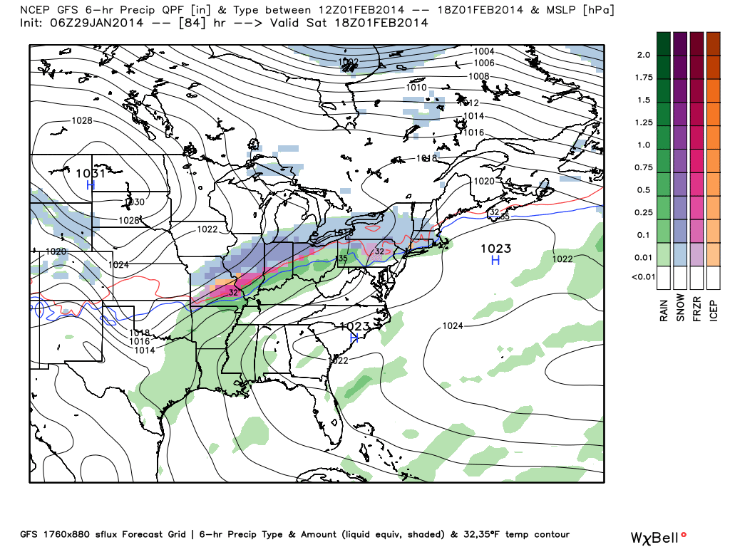
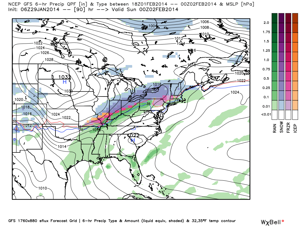
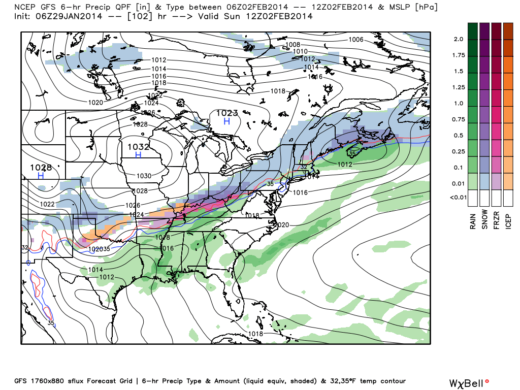
As we look even longer term, there have been many questions centered on the potential of a big winter storm for early February. Before we go any further, we want to stress it’s far too early to make any claim of certainty to the above. That said, there are items we can pick up on to a least “raise an eyebrow” that something of significance may be brewing… Do we mean for anyone to take that verbatim and to the bank? Absolutely not.
The European Weeklies suggest we need to keep an eye on the first week of February. They show a potential phasing of the jet (where the northern and southern streams of the jet stream phase together- often times resulting in a big storm)… That said, we want to again stress this is far too early to be discussing with any sort of certainty. Heh, the next week will keep us busy enough!
Keep the shovel handy! Snow removal companies, thank you for your service and hard work…hopefully you have plenty of coffee on hand!