Yet another winter storm is bearing down on the region and will promise a snowy time of things here Tuesday evening into Wednesday.
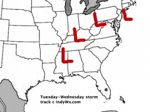
Surface low pressure will begin to organize over the lower Mississippi River Valley Tuesday morning and move northeast…eventually into PA before a secondary low takes over off the Northeast coast Wednesday. We like our track of the storm below.
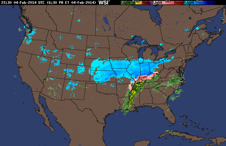
This will really be the first storm that’s tapped into Gulf of Mexico moisture since the major winter storm that pounded our area early last month. Moisture will be plentiful with this system and, when combined with the cold air, will lead to significant snow accumulation for most of central Indiana, with significant ice accumulation expected downstate across southern sections of Indiana.
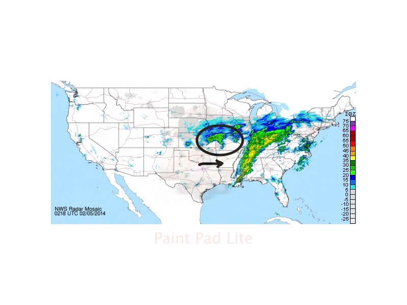
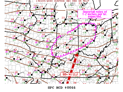
We think snow begins to develop across central Indiana as early as early to mid afternoon Tuesday, but the heaviest of the snow will fall Tuesday night into the wee morning hours Wednesday. In fact, snowfall rates may approach 1″ per hour for a time Tuesday night, especially where the heavy snow bands set up. Just exactly where do these heavy bands of snow develop? It’s a very tough call, but thinking at this juncture would suggest mainly north of Indianapolis. Additionally, latest data suggests a thundersnow report or two may occur tomorrow night within the heavy snow bands. Snow will begin to taper from west to east Wednesday morning, but the open country will have to deal with some blowing and drifting through the day Wednesday as the low departs northeast. We’ll then enjoy a dry and cold couple of days as arctic high pressure builds in before our next winter storm develops for the weekend…
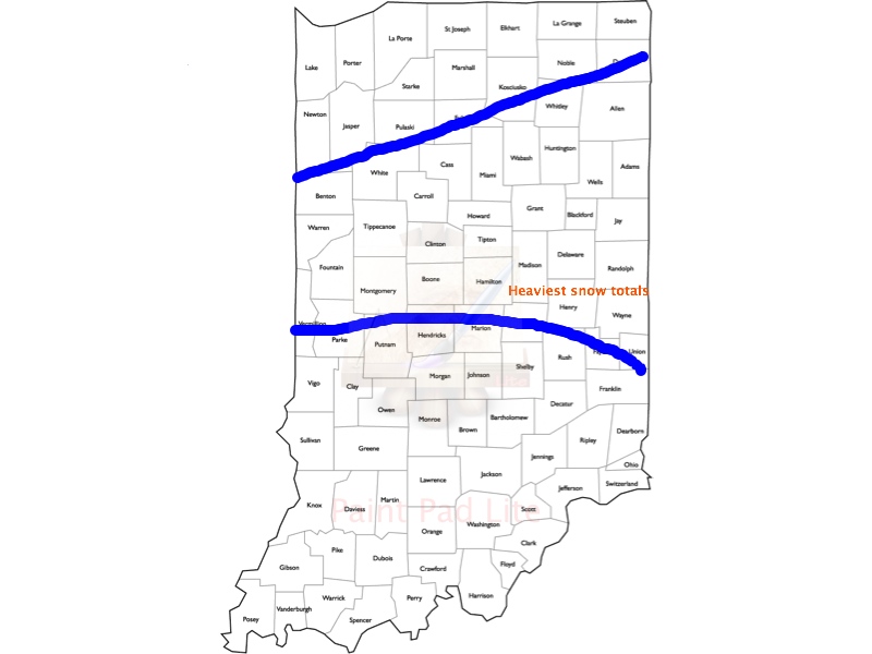
We forecast widespread 4-8″ (localized 8″+ totals possible within convective heavy snow bands) of snow to accumulate by the time all is said and done across central Indiana and our call right now is for the greatest chance of those 8″ reports to fall within the highlighted zone below.
Quick Bullet Point Thoughts:
- Snow develops towards 3-4pm Tuesday.
- Heaviest snow falls Tuesday night into the wee morning hours Wednesday.
- 4-8″ of snowfall expected across central Indiana, with heaviest totals from Indy’s northern suburbs and points north. Locally heavier totals can be expected within the heavier convective snow bands.
- Significant ice accumulation of 0.25″, or greater, possible down state
- Placement of embedded heavy snow bands will have to be monitored closely Tuesday night and may be accompanied by thunder and lightning.
- Snow begins to diminish Wednesday morning, but blowing and drifting continues through the day.
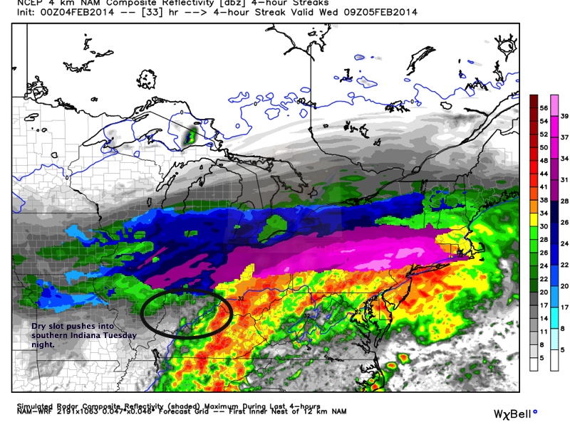
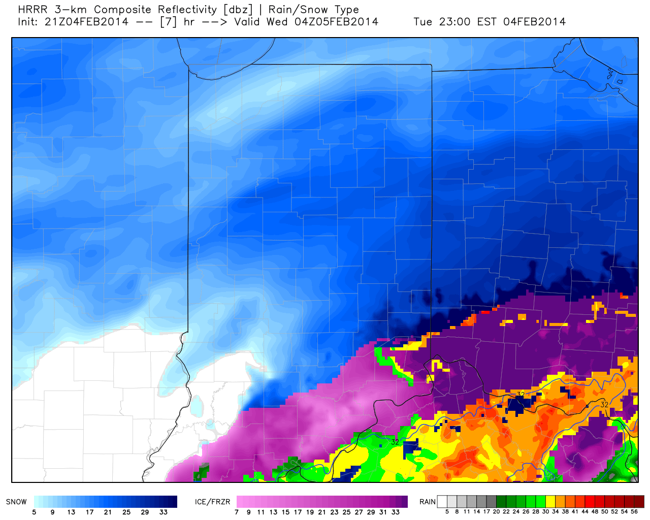
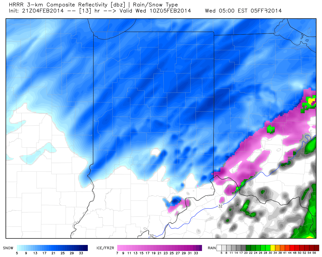
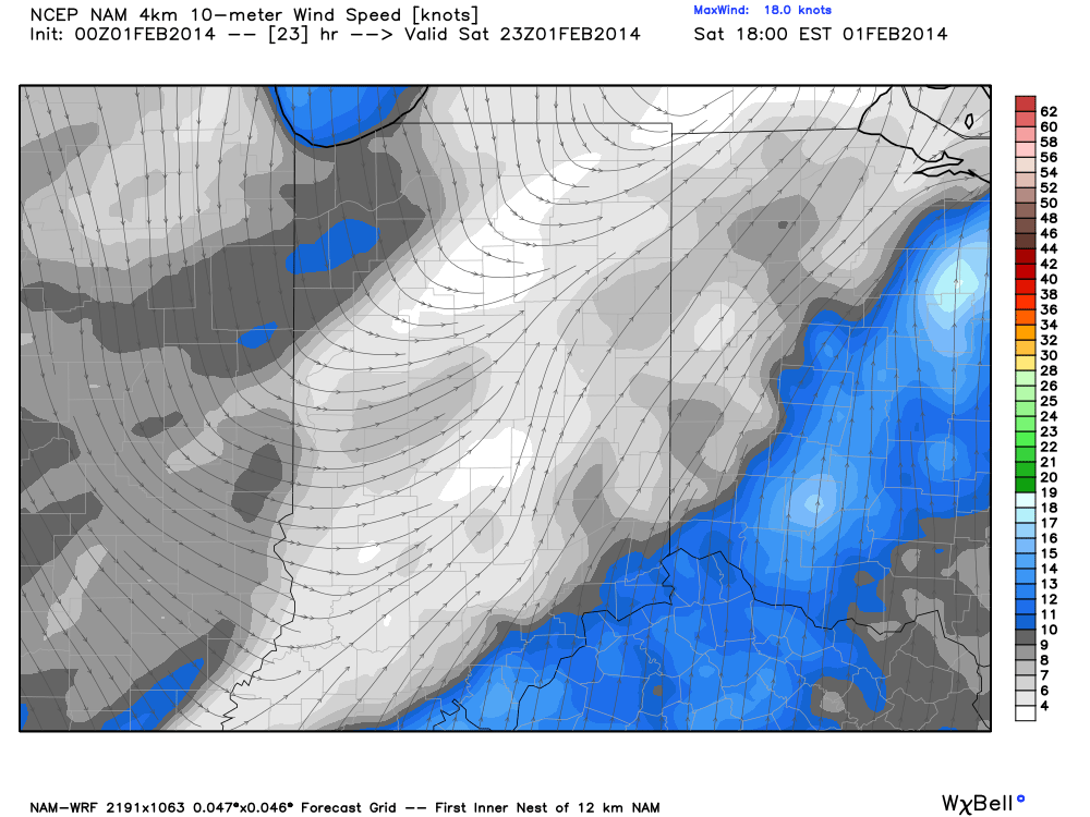
The dry slot, originally mentioned here Sunday, will likely impact southern and south-central Indiana late Tuesday night into Wednesday morning and will essentially shut off the accumulating snow threat south of I-70 during the wee morning hours Wednesday with some light freezing rain and/ or freezing drizzle glazing over the snow that falls. Meanwhile, accumulating snow will begin to taper Wednesday morning north of I-70. The latest high resolution NAM simulated radar, courtesy of Weatherbell Analytics, shows this well.


