Snow Showers Today; Arctic Cold Continues For Now.

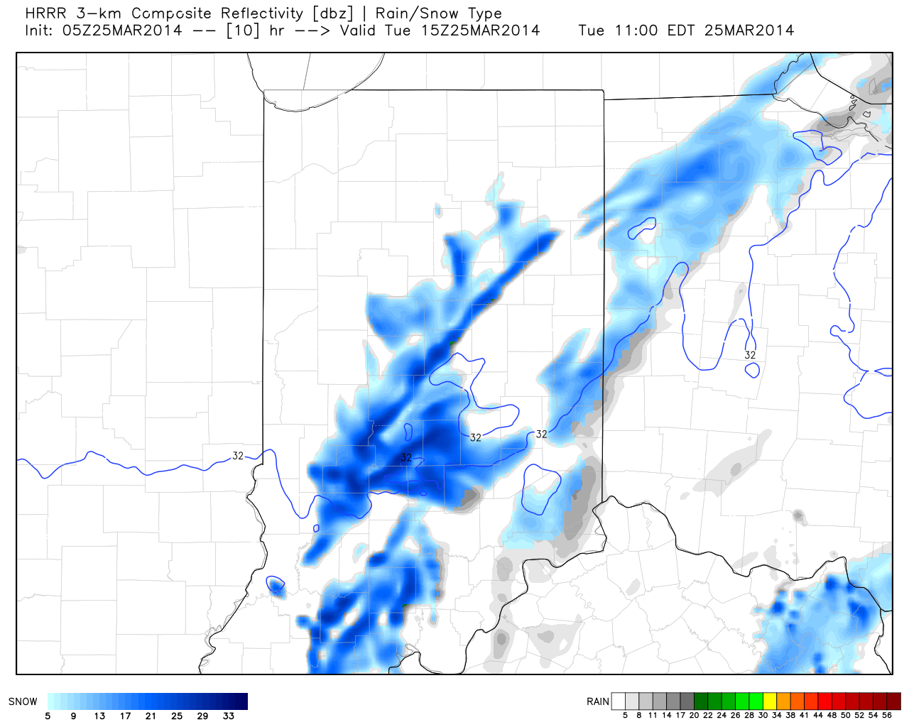
We’re waking up to snow showers and embedded quick-hitting heavier squalls.  The latest HRRR simulated radar shows snow showers continuing through the morning into the early afternoon hours across central Indiana.  A quick coating to less than an inch is possible in spots.

hrrr_ref_indy_11

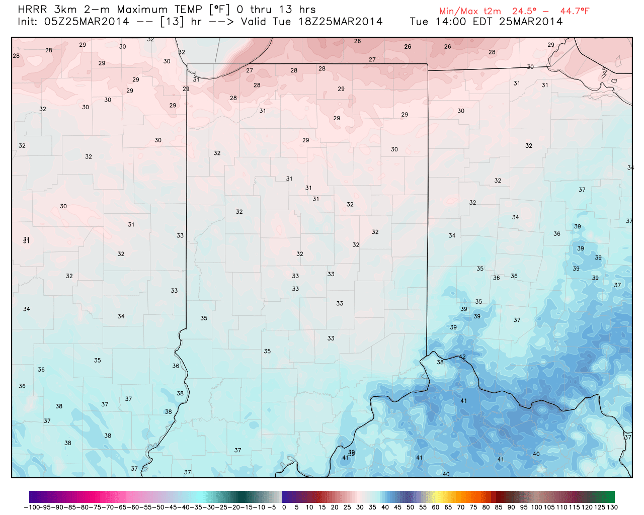
Even though we’re in to late March and average highs should be in the middle 50s now, temperatures will struggle to reach freezing early this afternoon.  Yes, this is considered officially “ridiculously cold” in IndyWx.com terms :-).

hrrr_t2m_max_indy_14

Lows tonight will dip into the teens for many as we clear things out.  This will be 15 to 20 degrees below normal.

Arctic Cold, snow

Out Of Season Cold…

Mon.

Tue.

Wed.

Thr.

Fri.

Sat.

Sun.

 Status-weather-clouds-icon

 Status-weather-snow-scattered-day-icon

 Status-weather-clouds-icon

 Status-weather-showers-scattered-icon

 Status-weather-showers-day-icon

 Status-weather-clouds-icon

 Status-weather-clouds-icon

18/ 37

25/ 33

19/ 40

34/ 42

39/ 58

37/ 46

28/ 60

– – –

Light

– – –

Light

Light

– – –

– – –

Forecast updated 03.24.14 @ 12:00a

Unseasonably Cold And Tracking Snow. . .It sure won’t feel like late March around these parts to kick off the new work week. Instead, we’ll deal with a biting north wind and temperatures more comparable to January.  Needless to say, certainly plan to grab the coat on the way out the door.

As we move into the evening hours clouds will begin to increase and light snow and scattered snow showers will arrive tonight into Tuesday morning.  This won’t be a big deal and we’re still anticipating little, if any, accumulation for most (perhaps up to half an inch in localized spots).  All the same, for a region that’s been brutally cold and snowy for month on end, this probably won’t be a welcome with “arms wide open” type of forecast.

South Winds Deliver Warmer Air. . .A gusty southwest wind will blow milder air north into the region Thursday. Along with the milder air will come moisture and we forecast showers to develop Thursday with a potential thunderstorm Thursday night into Friday morning as a cold front slides through the region.

Nice Weekend. . .Though Saturday will be colder than normal, sunshine should return for the weekend.  Furthermore, we’ll enjoy a southerly flow of air by Sunday which may help temperatures reach close to 60!

Upcoming 7-Day Precipitation Forecast:

  • 7-Day Rainfall Forecast: 0.50″
  • 7-Day Snowfall Forecast: Less than 1″

twicFor weather updates and more “behind the scenes” data on the go, be sure to Follow Us on Twitter @indywx or become a Friend of IndyWx.com on Facebook!

images

Where We’ve Been And Where We’re Going…

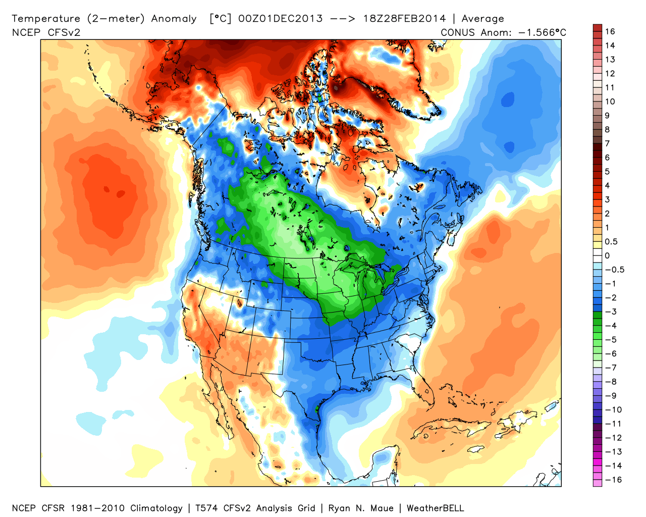
It was a cold winter across the Lower 48, including Indiana:

2

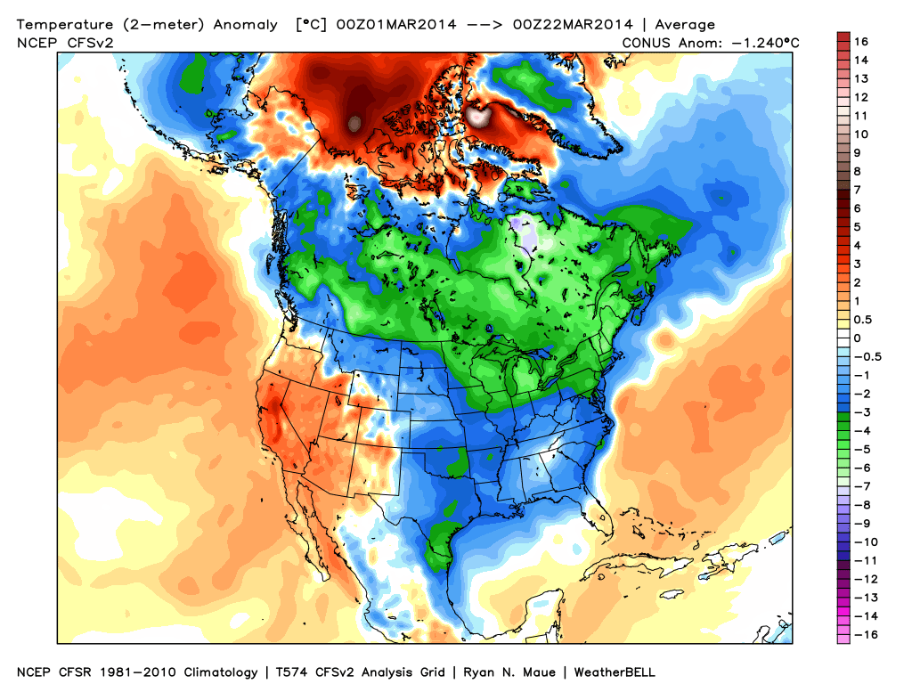
March has followed suite, month-to-date:  Cold continues for the majority of the upcoming week, but we note moderating late week temperatures.

1

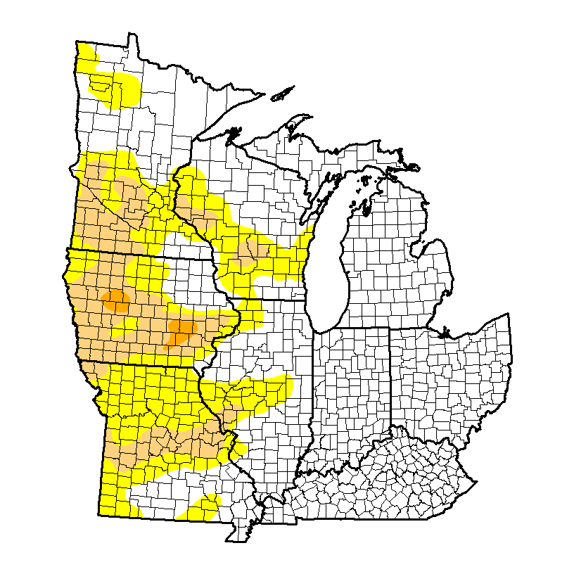
It’s been dry as of late, but after a snowy winter, the region is doing just fine from a drought perspective.  We note abnormally dry conditions west:

4

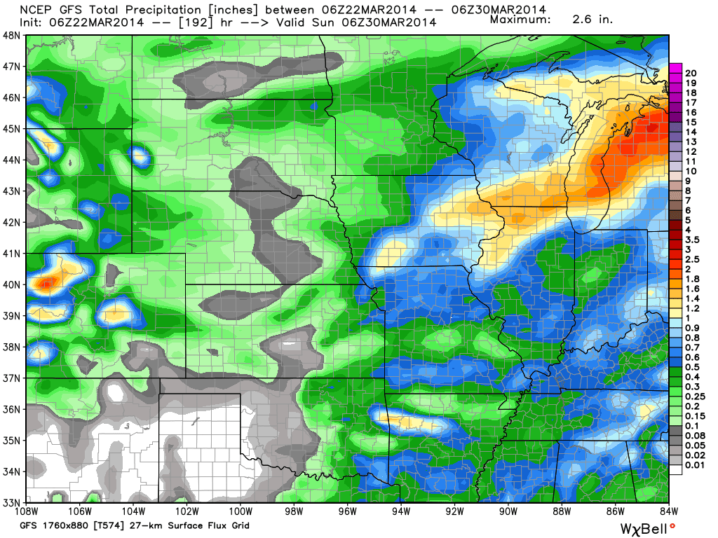
Latest CFSv2 data points to a wet spring ahead.  We also note the latest European weeklies suggesting a potentially “busy” 1st half of April, including a couple of “bowling ball” systems of note.  With the changing seasons, it’s not unusual to see big spring cut off lows slowly moving through portions of the country.

3

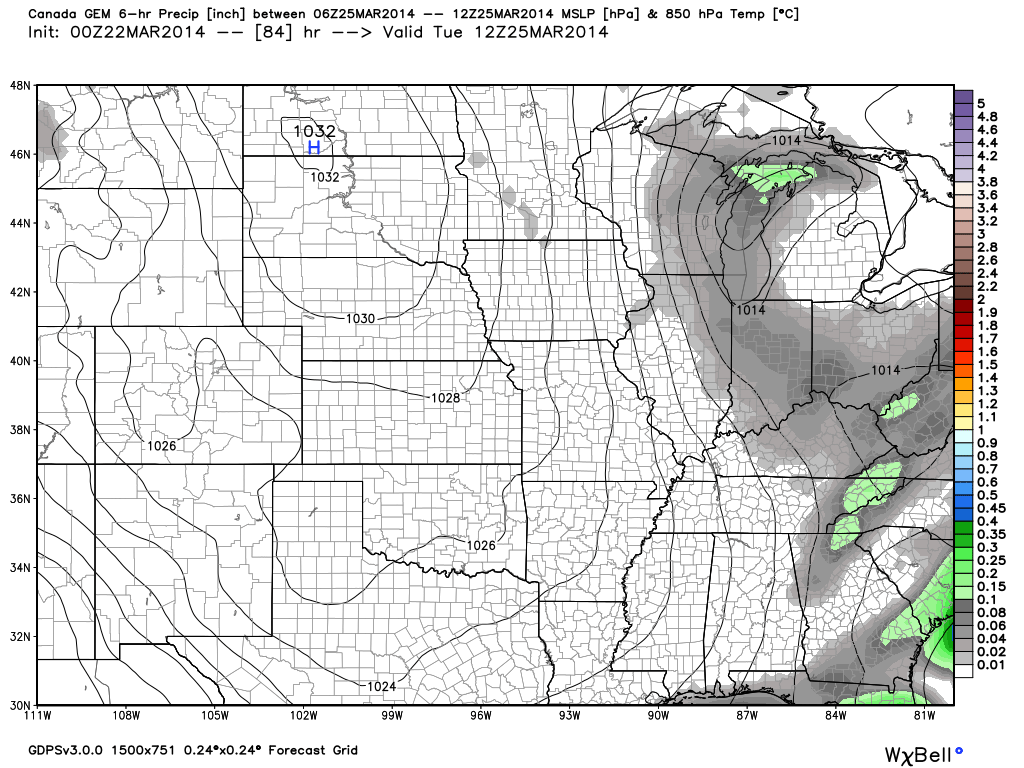
Note the GFS (7-day) and Canadian (10-day) precipitation forecast:

56

We also are still forecasting light snow Tuesday.  Most of this won’t accumulate with the high sun angle and low snowfall rates, but a brief coating to less than an inch is possible in spots:

78

Warmest Day Of The Period…

Fri.

Sat.

Sun.

Mon.

Tue.

Wed.

Thr.

 Status-weather-showers-day-icon

 Status-weather-showers-day-icon

 Status-weather-clouds-icon

 Status-weather-clouds-icon

 Status-weather-snow-scattered-icon

 Status-weather-clouds-icon

 Status-weather-clouds-icon

36/ 63

31/ 47

26/ 39

21/ 37

26/ 36

19/ 38

28/ 54

Light

Light

– – –

– – –

Light

– – –

– – –

Forecast Updated 03.21.14 @ 7:50a

Warm Front Passes. . .A warm front lifted north through the state during the wee morning hours. This sparked a couple light showers (snow burst across northern portions of the state), but wasn’t a big deal and a very nice Friday is on tap.  We’ll note a strong and gusty southwest breeze in play that will help send temperatures into the lower to middle 60s for afternoon highs along with partly cloudy skies.

Here Comes The Cold. . .Just as quick as the warm front passes a cold front will swing through the region and put an abrupt end to the spring tease.  Unfortunately, temperatures will slide the wrong direction over the weekend along with strong and gusty northwest winds.  This front may be accompanied by a couple light showers late tonight into early Saturday.

Tuesday Snow Maker. . .After a cold, but dry open to the work week, a disturbance will cross the Ohio Valley Tuesday and provide just enough moisture to combine with the cold air in place to result in the likelihood of light snow around these parts Tuesday.  We’re not thinking much in the way of accumulation will occur as overall snowfall rates will be relatively light, but we do note some localized light accumulations are possible. Otherwise, expect a mostly cloudy and “ridiculously” cold day.

Moderating. . .Indications are that we’ll begin to enjoy the return of southwest (milder) breezes in here by the end of next week.  As such, temperatures will begin to moderate and perhaps “inch” above the 50 degree mark by next Thursday.

Upcoming 7-Day Precipitation Forecast:

  • 7-Day Rainfall Forecast: 0.10″ – 0.25″
  • 7-Day Snowfall Forecast: Less than 1″

twicFor weather updates and more “behind the scenes” data on the go, be sure to Follow Us on Twitter @indywx or become a Friend of IndyWx.com on Facebook!
images