Battle Developing Mid/ Late June

As we progress into another weekend, weather conditions simply couldn’t be any better for this time of year.  The back half of the weekend will transition to one that’s more unsettled and feature showers and thunderstorms for Sunday.  Modeling today is backing off on the heavy rain event Sunday and hitting another system coming through the pipeline Tuesday into Wednesday with heavy rain.  We’ll keep an eye on things and update our forecast Friday morning.  Regardless, let us worry about Sunday and you be sure to enjoy Friday and Saturday!

The pool of cool will keep things feeling might nice through the first half of the weekend, along with low humidity and plenty of sunshine!

D1

As we look into the long range, there are some questions that arise.  The questions don’t have to do with warming that’s likely to take place late week 2 (90s within reach), but just how long that ridge and associated dome of heat hangs around.  The European ensembles would imply the bubbling heat ridge will stick around for a few days.

Geopotential32at32500hPa_North32America_240

Meanwhile, it should be noted that the European weeklies disagree with its own ensemble package as they bring a cooler pattern and associated trough back into the Great Lakes and northeast region as we get set to head into the last week of June.  Due to licensing issues we can’t show the European weeklies here, but they deliver quite the trough and cooler than normal air mass around, or just after, the 23rd.

Additionally, the PSD agrees and delivers a cool pattern around June 20th.

z500_anom_f360_ussm


So, while we’re likely to see the hottest weather of the season so far towards Day 10, confidence of this hot weather sticking and holding is very low.  Timing will have to be resolved as it always does in long range weather.  Overall, what’s more likely to happen is that this will be a transient hot pattern and we flip the script to one that’s cooler than average as we go into the last week of the month.

Doesn’t Get Any Better This Time Of Year!

Thr.

Fri.

Sat.

Sun.

Mon.

Tue.

Wed.

 Status-weather-clear-icon

 Status-weather-clear-icon

 Status-weather-clouds-icon

 Status-weather-storm-night-icon

 Status-weather-storm-night-icon

 Status-weather-clouds-icon

 Status-weather-clouds-icon

55/ 75

54/ 77

55/ 79

60/ 80

60/ 76

55/ 75

55/ 79 

– – –

– – –

– – –

Moderate

Heavy

– – –

– – –

This time of the year, weather conditions simply don’t get any better than what we’ll enjoy over the next 72 hours.  Expect bright sunshine, pleasantly cool temperatures, and unseasonably low humidity levels. Our next storm system is gearing up for the back half of the weekend and we’ll promise a wet and stormy time of things Sunday afternoon into Monday.  Rainfall totals continue to look impressive (not what we need after a rainy week), as widespread 1-2″ totals look common in the Sunday-Monday time period.  Another pop of dry, cooler air will blow into town Monday night into Tuesday.

Wednesday Evening Video Update; Drier, Cooler Air Coming!

Good evening, friends.  Here’s a video update as we get set to welcome a cooler, drier regime into central Indiana to wrap up the work week.  Additionally, we’re also tracking another potential heavy rain maker for the second half of the weekend (not that we need more heavy rain)….

PS: The IndyWx.com mascots have attempted more times than not to interrupt my video updates, so I only thought it was time to give them a little face time.  Meet Cameron (left) and Newton (right).

10389646_756078747757579_4757052835498909820_n


Tuesday Night Update; Southern Indiana Under Gun For A Big Severe Weather Day Wednesday.

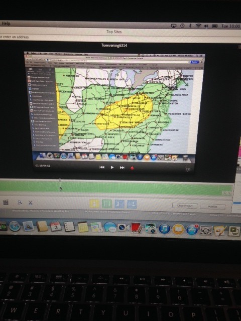
It’s been a bit of a frustrating afternoon as I’ve been trying to upload a video discussing our thoughts around tomorrow for a couple of hours….only to no avail.

photo-6


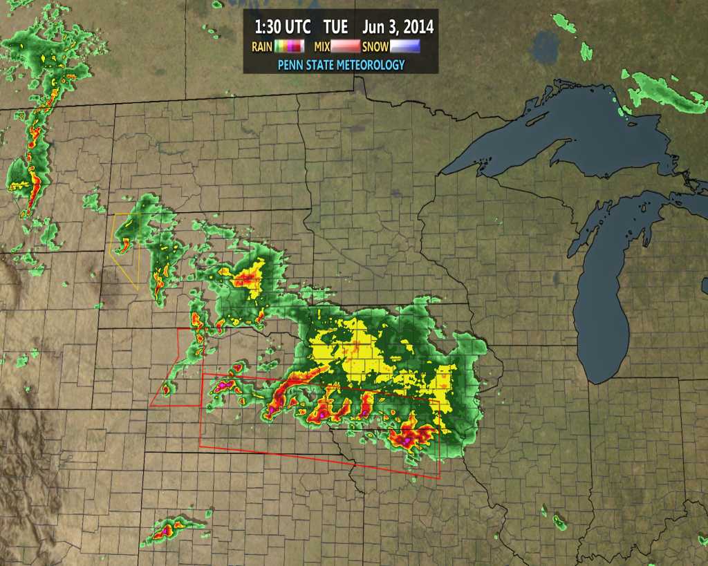
So this post will have to do.  Really our thoughts remain unchanged concerning the way things unfold late tonight and Wednesday.  The severe thunderstorms to our northwest continue to rumble as of the 10 o’clock hour.

ncrad23

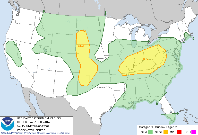
The Storm Prediction Center holds firm to the Slight Risk for the Ohio Valley and northern Tennessee Valley Wednesday.

day2otlk_1730

We wouldn’t be surprised to see a portion (most likely the southern half) of the Slight Risk area upgraded to a rare Moderate Risk area with the update from the SPC early Wednesday morning.

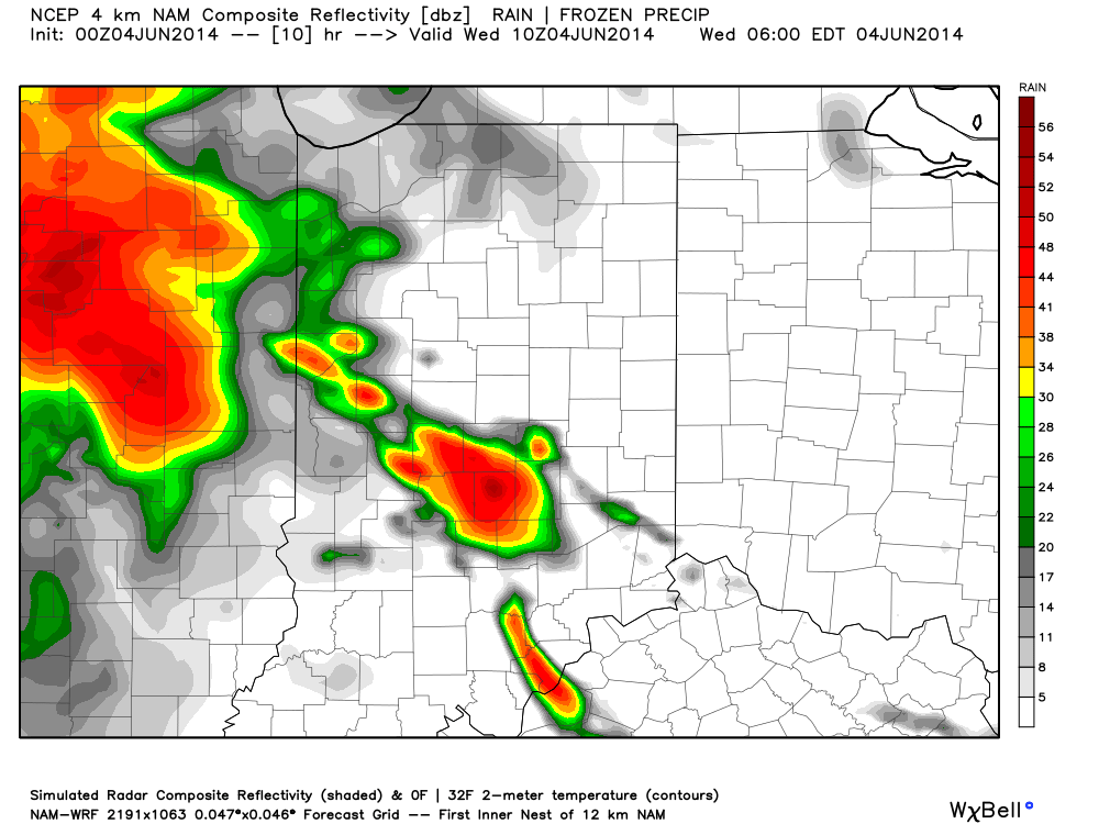
Our thinking hasn’t changed in that we believe the current complex of severe storms arrives into north central Indiana in a weakened state early Wednesday morning.  The rush hour will likely include heavy rain and plenty of thunder, though we think the majority, if not all, of this activity Wednesday morning will remain below severe levels across our immediate region.  Showers and thunderstorms will rumble into the area, especially north of the city during the predawn hours and include plenty of heavy rain.

hires_ref_indy_11

A second round of showers and thunderstorms will fire during the afternoon Wednesday and is likely to turn severe across south central Indiana and points south Wednesday afternoon.  Dangerous conditions are a good bet, including large and destructive hail, damaging straight line winds, and tornadoes.  Certainly if you have plans from Indianapolis to Louisville or Cincy tomorrow afternoon and evening please keep tuned to the latest weather conditions and radar updates.  Further north, the severe potential is much less certain.  We continue to think areas north of the I-70 corridor will struggle to shake the stability provided from the early morning rain and storms.  We caution though that this remains a now-cast scenario and will require a close eye tomorrow afternoon.

Looking farther ahead, we’ll enjoy a refreshing blast of air Thursday-Saturday with bright sunshine, low humidity, and cooler temperatures.  Warmth and humidity will return Sunday with rainfall potential around 1″ additional precipitation.  This will be followed by yet another big push of cooler, drier air early next week.  More on this in the days to come.