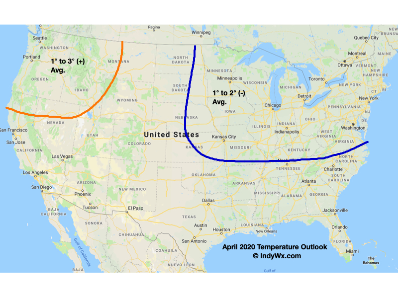
Average highs in April rise from the upper 50s early in the month to the upper 60s by late-April. We also tack on an average of 10° on overnight lows (upper 30s early on to upper 40s by late April) with 3.8″ of rain and an average of 0.2″ of the white stuff.
As we look at April 2020, there are growing indications for cooler and drier than normal conditions- at least during the 1st half of the month. A lot of this has to do with teleconnections finally aligning with one another (as opposed to all of the conflicting signals we dealt with throughout the bulk of the winter).

Additionally, the MJO is expected to move through Phases 4 and 5 over the next couple of weeks and this also is a cooler, drier look, overall for our portion of the country.
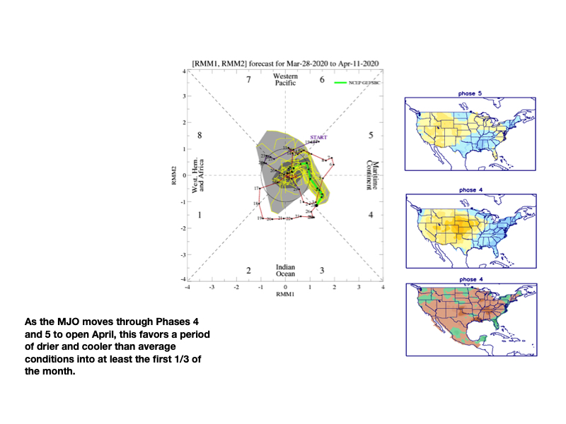
The majority of long range data is going to this cooler, drier look through the 1st half of the month.
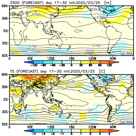


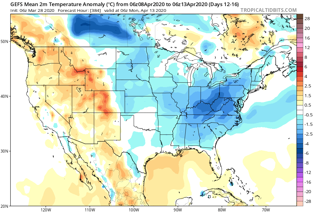
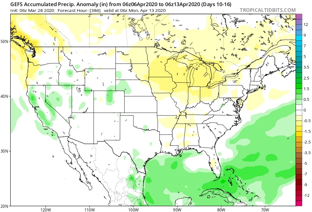
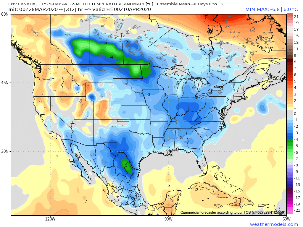

With the guidance painting an overall cooler and drier than normal theme through the 1st half of the month, the question then becomes what takes place for the 2nd half of April? We’re thinking a rebound is ahead, including a more active, warmer period, but the timing of this shift is admittedly tough (does this take shape mid-month or the last week to 10 days of the month)? With a boiling warm Gulf of Mexico, the threat of an increasingly busy time of things in the severe weather department is also anticipated for late April. This, of course, is after what should be an unusually quiet time of things through the first half of the month.
With all of this in mind, here’s our April Outlook:
