 Highlights:
- Cool open to the work week
- Mid and late week fast-moving storm systems
- Weekend timing questions
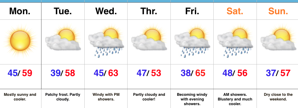
Fall Feel To Open The Week…A dry frontal boundary will pass through central IN late tonight. Our winds will shift to the NW after midnight and help drive in a cooler air mass to open up the new work week. Despite lots of sunshine, temperatures will be running below average to open the work week.
A fast-moving storm system will scoot through the lower Great Lakes region Wednesday. This will help serve to strengthen our winds (SW direction) along with create a chance of scattered showers Wednesday evening. Another pop of unseasonably cool air will blow into town Thursday.
Yet another storm system will press through the region as we get set to head into the weekend. Rainfall totals don’t look particularly impressive, but we’ll lean more towards the Friday night/ Saturday morning storm system as being the better rain-maker of the (2) systems this week. Cooler air will flow in behind the storm system for the weekend.
Upcoming 7-Day Precipitation Forecast:
- Snowfall: 0.00″
- Rainfall: 0.50″ – 0.75″
