We’re going to enjoy another day of sunshine, but moderating temperatures (finally) will help being outdoors become a little more tolerable (we think we “warm” into the middle 20s today). That said, another winter weather maker is brewing and will result in an active Friday-Sunday ahead.
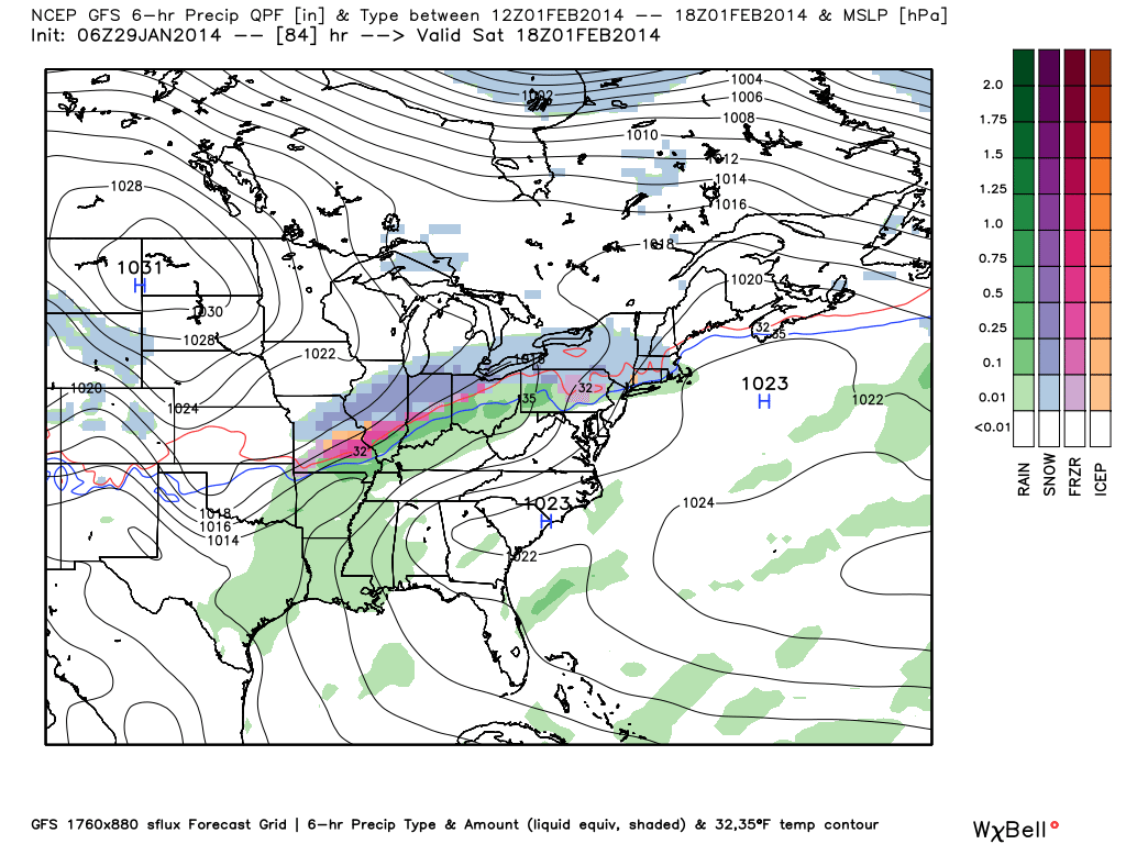
A cold front will sink south Thursday night and could result in a little light snow (not a big deal). As we move into Friday and Saturday, model data handles our sensible weather differently. Precipitation type will be highly dependent upon exactly where the cold front stalls. We want to show you the GFS as it depicts the variety of precipitation types. It should be important to note that the GFS, European, and Canadian, though different in their respected solutions this weekend, are close enough to go with a “blend” of all three models for our official forecast.
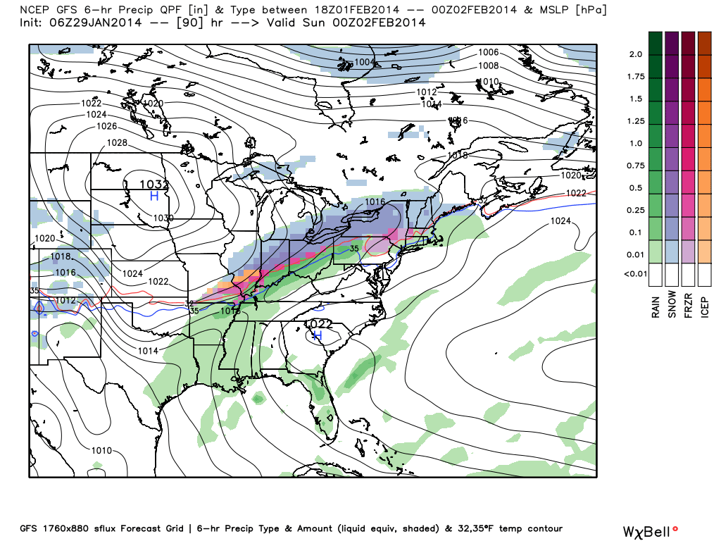
We think snow overspreads the region Friday morning and could deposit a quick couple inches across the metro area Friday. It’s as we get into Friday night and Saturday that we’ll note another (stronger) wave moving along the front. In response to this wave of low pressure, warmer air (both at the surface and aloft) will push north. Exactly how far north is still up for debate as a battle will be established with push back being provided from an area of high pressure across the upper Mississippi River Valley. We feel as if south-central Indiana will get in on some mixing issues with sleet and perhaps a cold rain Friday night into Saturday. Depending on how strong the wave of low pressure is will determine exactly how far north the rain line makes it. For now, we think Indianapolis and northern suburbs remain in a wintry mix of snow, sleet, and possible freezing rain through the majority of the day Saturday. That said, we do note this will warrant tight focus in the days ahead as any deviation from the track of the low or strength of the cold high to our north could greatly impact our weekend weather.

Finally, precipitation will begin to taper late Saturday night as the cold high to our north eventually wins out. It’s possible all of central Indiana deals with a quick pop of accumulating snow as precipitation ends Saturday night/ wee morning hours Sunday.
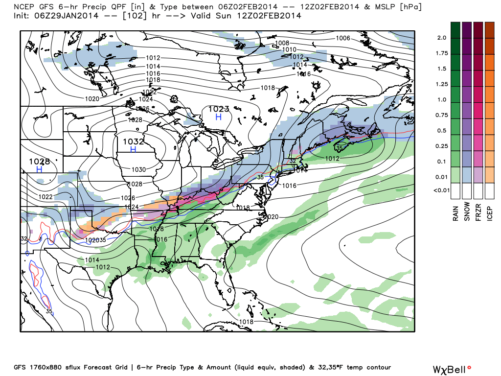
We stress that this is still a highly changing weather situation and most likely will require some “fine tuning” as we move forward. This morning we think heaviest snow (potentially approaching half a foot) falls across north-central Indiana, including Kokomo, Marion, and Lafayette. A wintry mix of all precipitation types will fall south of there, including the Indianapolis metro. South of I-70, we think rain will be the predominant precipitation type, with only a light accumulation of snow as precipitation ends.
As stated above, stay tuned…
Leave a Reply