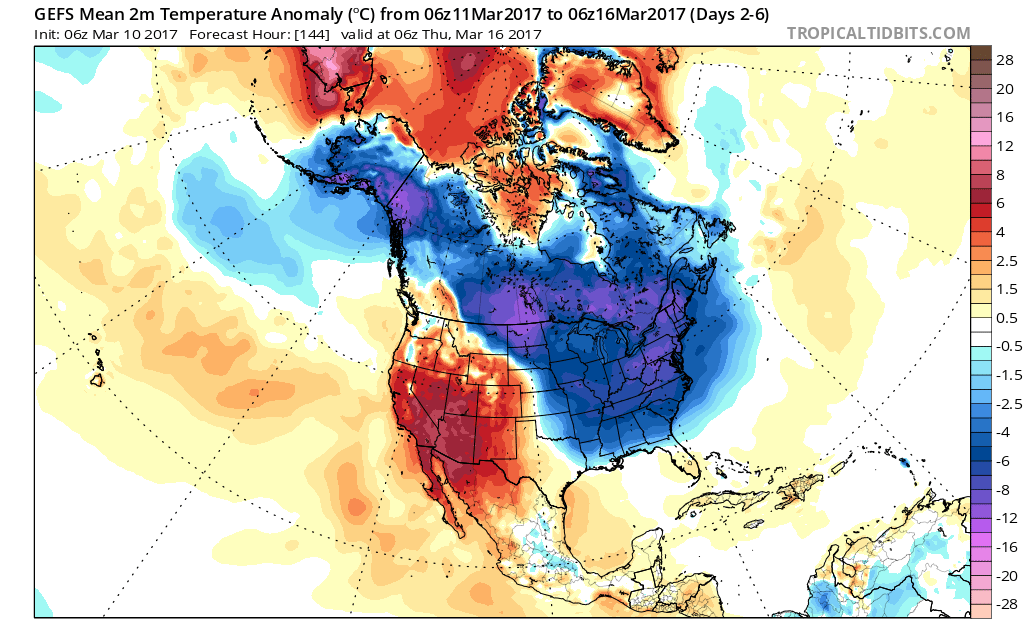
Today will begin a rather extended period of unseasonably chilly air that will grip the region. It’s not until the latter portions of next week that we should begin to see slowly moderating temperatures.
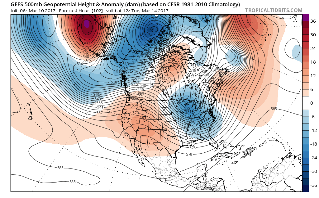
The reason for this is a persistent trough setting up over the Great Lakes and eastern portions of the country. From time to time, individual disturbances will come racing along in the fast northwest flow aloft and help to reinforce the cold and also create snow potential.

Forecast models continue to show an eastern trough into the middle parts of next week.

This is an impressively cold pattern for so late in the season.
This is the type pattern that will promote multiple nights in the teens over the upcoming week. We forecast coldest nights to be Saturday night, Sunday night, Wednesday night, and Thursday night. Each has the potential to send neighborhoods into the middle-upper teens.
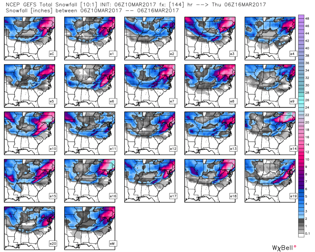
As far as snow goes, we still are keeping an eye on the early stages of the work week. We’ll fine tune things this weekend, but models continue to show energy diving southeast Monday that would help snow overspread the region during the day, continuing into Tuesday morning. This time of year, snowfall rates and time of day means a world of difference between snow flying in the air, versus accumulating. The potential is there for light accumulation Monday night as reinforcing cold air pours in.
Stay tuned! Much more later!

