Before we discuss what may lie ahead closer to Christmas, our going forecast for Friday night and Saturday’s snow storm hasn’t change…4-5″ for the greater Indianapolis region by late Saturday morning.
Since really back in the middle of October we noted a distinct pattern change that has resulted in a colder than normal regime around these parts ever since. As we look ahead, there really aren’t any indicators that would suggest we’ll deal with warmer than normal air for any period of significant time through the remainder of the year. Furthermore, there are multiple computer models hinting that we’ll have to deal with a significant winter storm and potentially a shot of brutal cold as we rumble closer to the busy Christmas week.
It’s very important to note that we still have several days to watch the goings on for Christmas week, but the stage has at least been set for the possibility of a storm of “importance” being around the region as we near that particular time period.
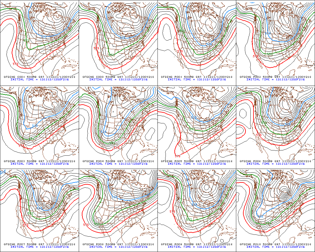
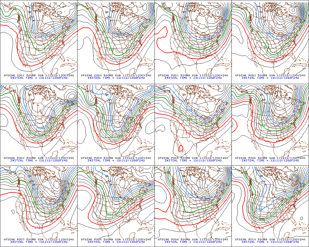
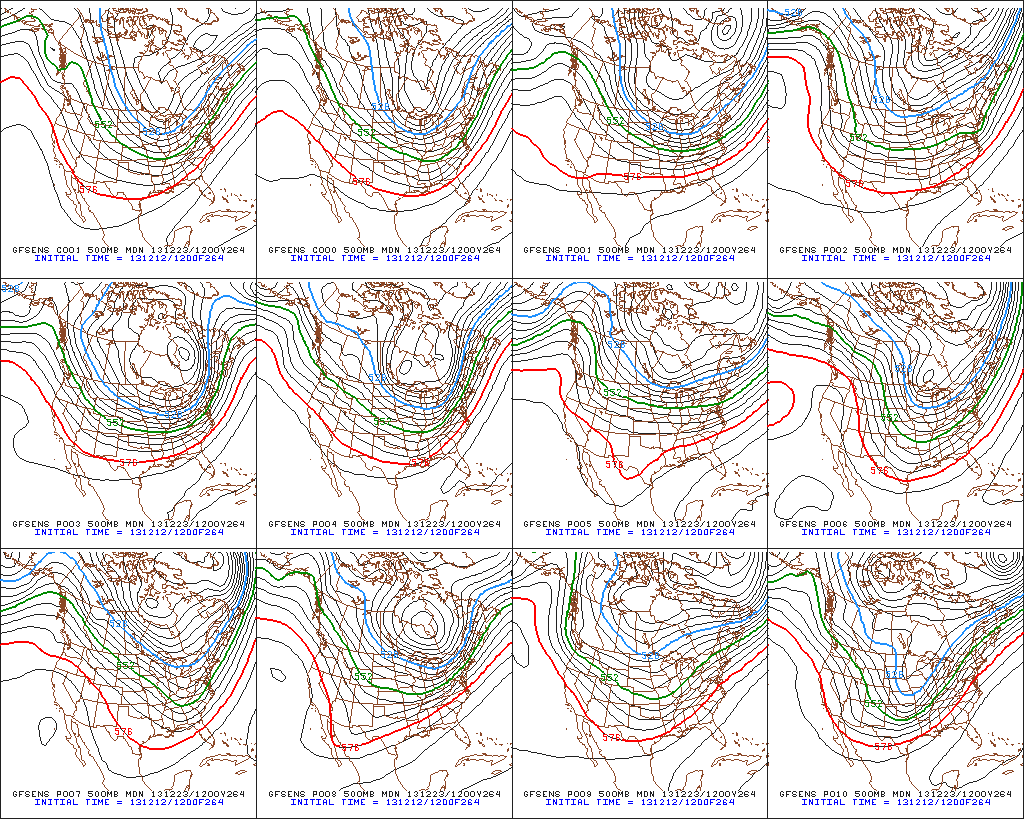
Confidence is growing on brutal cold (most likely record-breaking) initially dumping into the Plains states towards the latter portion of next week. With time, we think this cold slugs it’s way east. Before the arctic intrusion gains control of the Mid West and Ohio Valley, we think this is the area that stands the greatest chance of dealing with a major winter storm. We have strong ensemble support (pictured below) of the evolution of the overall pattern, but we caution that the precise details will have to be ironed out.
The “sensible” weather that would ensue here across central Indiana could vary wildly from a significant full-blown winter storm with all of the precipitation falling in the form of a wintry variety (i.e. snow, sleet, freezing rain) to a situation that features a western track with briefly milder air surging north into portions of the region and leading to a rain-to-snow situation. The accumulation ideas would swing from a significant, plowable, snow storm to as little as a coating with arctic air blowing in behind the rain to snow scenario.
At the end of the day right now we’re confident on two things: 1.) a major winter storm around the Mid West/ Ohio Valley as we near Christmas week and 2.) brutal arctic air swinging into the area around Christmas. Questions will have to be answered as we move ahead to determine the precise precipitation amounts and type.
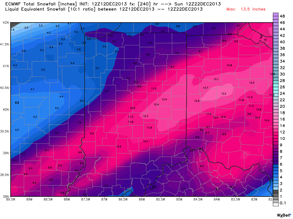
In closing, just for fun, we thought we’d provide a look at the latest European forecast model data. Here’s a look at the upcoming 10 day European model snowfall forecast. Of course, these amounts account for the 4-5″ expected here tomorrow night and Saturday, but (2) additional systems also add to the potential growing snow pack…a clipper system Monday and the “more important” system next weekend. Stay tuned.


