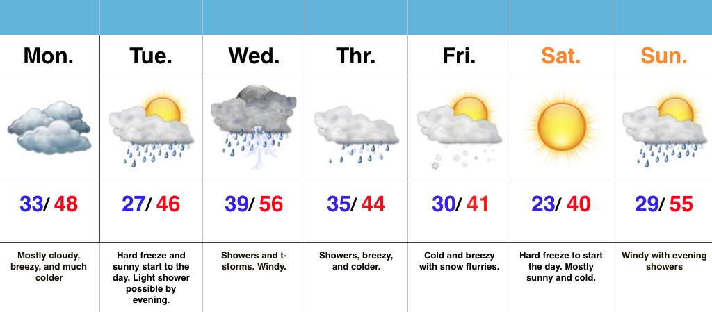
- Prolonged unseasonably chilly pattern
- Mid week thunderstorms
- Snow flurries and another hard freeze late week
Have The Jackets And Sweaters Handy…A cold front slipped through central IN this morning and a NW wind shift is already doing the “dirty work” in delivering a much colder air mass to greet us out the door this morning. Get used to it, as a very chilly week is on tap!
A hard freeze will occur tonight as skies turn mostly clear and winds diminish. Tuesday will dawn sunny, but clouds will increase late and a light shower is possibly by the evening hours.
Better coverage of showers and thunderstorms will push into the region Wednesday morning. While it’ll be briefly warmer (still slightly below average though), don’t get used to it. Much colder air will be with us to wrap up the work week.
A secondary push of late season arctic air will blow into town Thursday with showers before transitioning to snow flurries/ scattered snow showers Friday morning. The coldest morning in this late season chilly pattern looks to arrive Saturday morning, including widespread lower 20s.

