Highlights:
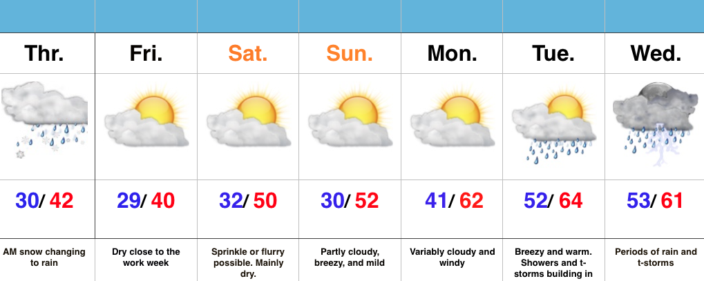
- Snow changes to rain
- Dry close to the work week
- Warm, but wet pattern develops next week
Snow Transitions To Rain…Snow spread over central IN during the overnight and most neighborhoods accumulated between 1″-2″. Warm air advection will result in snow transitioning to rain from south to north as we progress through the late morning hours. All in all, it’ll be a raw Thursday.
Weak high pressure will build in and result in dry conditions Friday with sunshine returning.
A fast moving system will clip the region Saturday with a sprinkle or flurry possible, but this doesn’t appear to be a big deal in the least.
The bigger story? The developing unseasonably warm period developing next week, but we caution this will also be a wet period as a prolonged SW flow transports moisture-rich Gulf of Mexico air into the region. Heavy rain totals will be a good bet.

