Updated 03.29.24 @ 6:57a
Don’t get used to any one particular pattern for any length of time over the next few weeks. “Active” will sum things up best in a single word as a transitional regime takes hold.
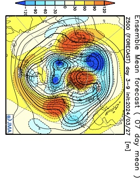
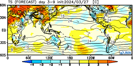
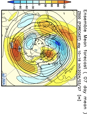
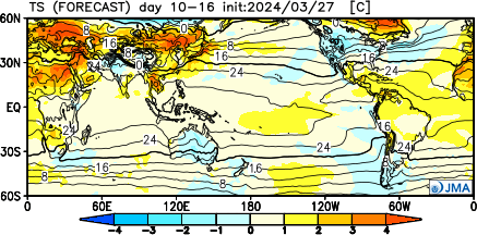
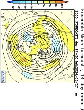
The NEW JMA Weeklies highlight this transitional theme best over the upcoming (4) week period.
Week 1
Week 2
Weeks 3/4
To no surprise, especially given the transitional nature of the pattern, the upcoming few weeks should feature above normal rainfall for a good chunk of the Great Lakes and Ohio Valley.

We’ll also want to keep tabs on the potential of greater than average severe weather episodes, notable considering we’re almost into April. It’s a byproduct of the “topsy-turvy” look to the overall pattern.
Pattern drivers, including the EPO, back up the transitional them over the upcoming couple weeks. Reminder, negative phase favors chilly conditions and positive phases favor milder air (compared to average). This look, too, screams wet and stormy.

Bottom line, buckle up for an active storm track and associated heavier than normal rainfall over the next few weeks. Temperature regimes will feature a bit of it all, including above and below normal periods, likely all balancing out slightly above normal when all is added up.
Leave a Reply