Updated 02.29.24 @ 5:13a
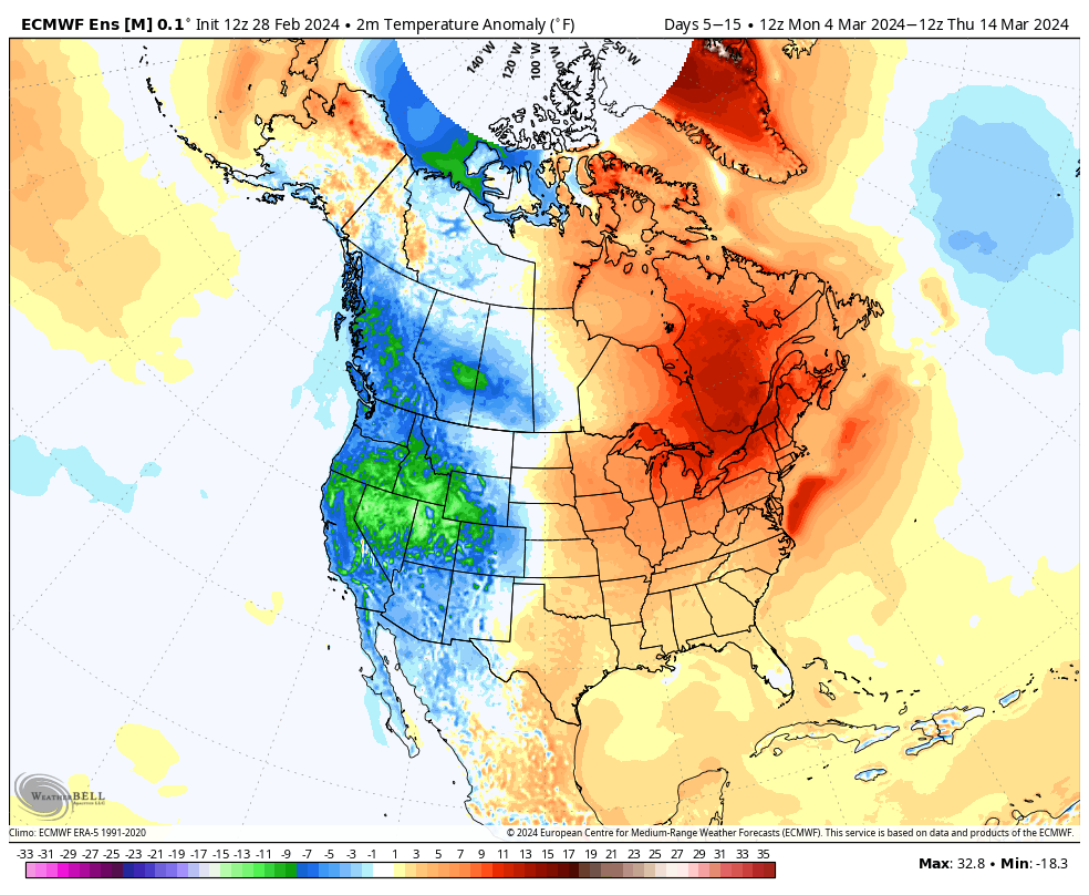
Tomorrow we’ll welcome in meteorological spring and the first couple weeks of March appear to continue the unseasonably warm trend. At times, additional warm records will likely fall.
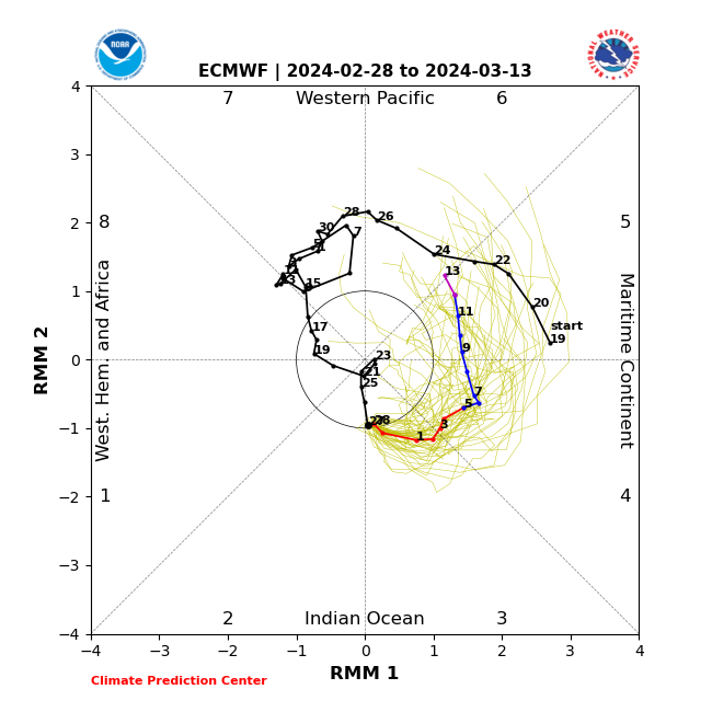
This is strongly correlated with the Madden-Julian Oscillation highly amplified in the classic warm phases this time of year. (You can absolutely say goodbye to any sort of sustained cold prospects this time of year with the MJO in phases 4, 5, and especially 6). Now, down the road, we’ll want to watch and see if we can maintain this amplitude and rumble into the transitional colder Phase 7 before a potential opportunity to see cold grow more impressive should we *finally get into Phase 8 late month. Remember that we made an attempt at that back in mid-February before things instead collapsed into the neutral phase. Moral of the story for folks longing for one more bout of sustained cold prior to the warmer months ahead, “don’t hold your breath.” The trend certainly isn’t your friend.
Back to the present. No matter what the teleconnections say, an amplified MJO will always win out. And the current MJO forecast to roll through the phases listed above screams that our recent warm times will “keep on keepin’ on” as we navigate the 1st half of March.
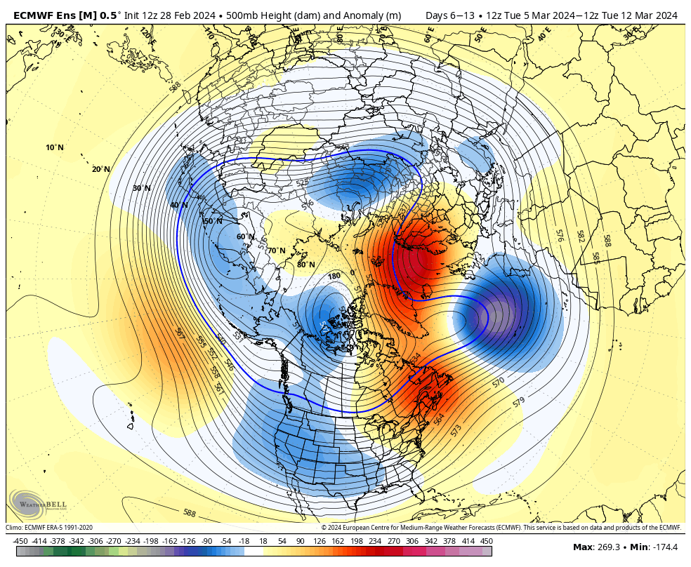
The Phase 5 and Phase 6 composite analogs at 500mb (upper air pattern) for an El Niño March:


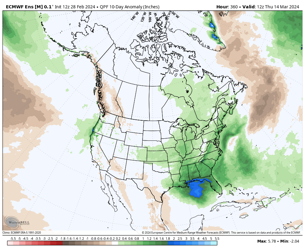
What this should also result in is an active first half of the month, including above normal rainfall and likely at least another early season strong to severe weather event before we get to mid month.
It’s a classic pattern that should feature low pressure systems ejecting out of the Southwest and South-central into the Plains and western Great Lakes region. That puts our neck of the woods on the warm/ wet (and at times stormy) side of the equation.
As we move into late-March and early April, we’ll have our eyes focused on the MJO and whether or not we can, indeed, get into those traditionally colder phases. Stay tuned.
Leave a Reply