Updated 02.20.24 @ 5:30a
Today and Wednesday (at least during the daytime) are about as quiet and pleasant as it can get for late-February. After another cold start, we’ll quickly warm into the 50s later this afternoon. We’ll do even better than that come Wednesday as highs flirt with the 60° mark. Patio, anyone?!
Moisture won’t make a return until overnight Wednesday into Thursday morning. We note modeling is honing in on central and southern Indiana for the potential of heaviest rain during the period (most of which falls Thursday morning into the afternoon) and we may also see a couple of thunderstorms thrown into the mix, especially downstate. A solid 0.50″ to 1″ appears most reasonable for area rain gauges.

Behind this feature, a brief drop in temperatures can be expected for the weekend, but we won’t really even be able to call this air mass “cold” by late February standards. Nonetheless, trailing upper level energy and just enough cooler air will be enough to ignite a few snow showers Saturday.
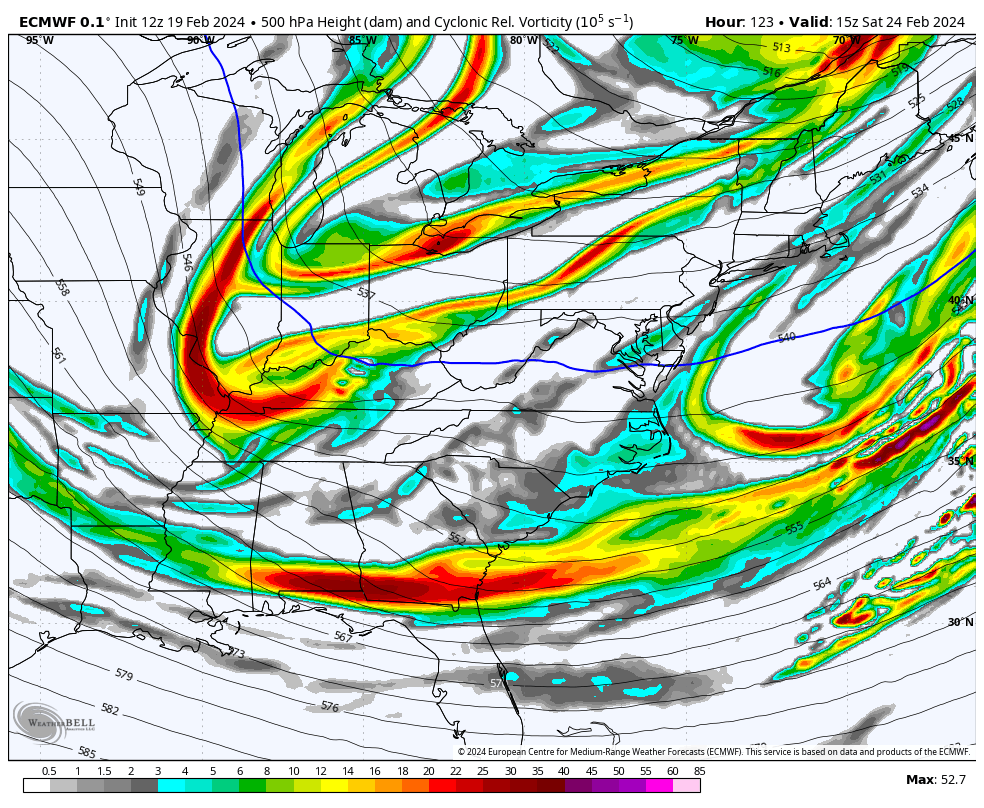
We want to reiterate that this upcoming weekend’s snow potential is nothing compared to last weekend and we’ll be right back into the 50s and 60s by Sunday!
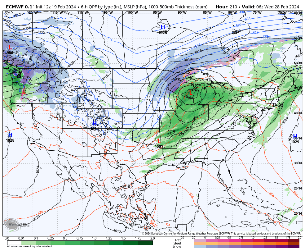
That brings us to early next week. While still a bit too far out to get specific, the potential of a more potent storm system is there and we’ll have to keep close tabs on the threat of a more widespread rain and embedded strong storm threat as we get closer. More on this feature in the days ahead.
Leave a Reply