Updated 02.09.24 @ 5p
Scattered showers/ embedded thunder overnight, opportunity for slushy, light snow accumulation, and long range rumblings highlight this evening’s rambles…
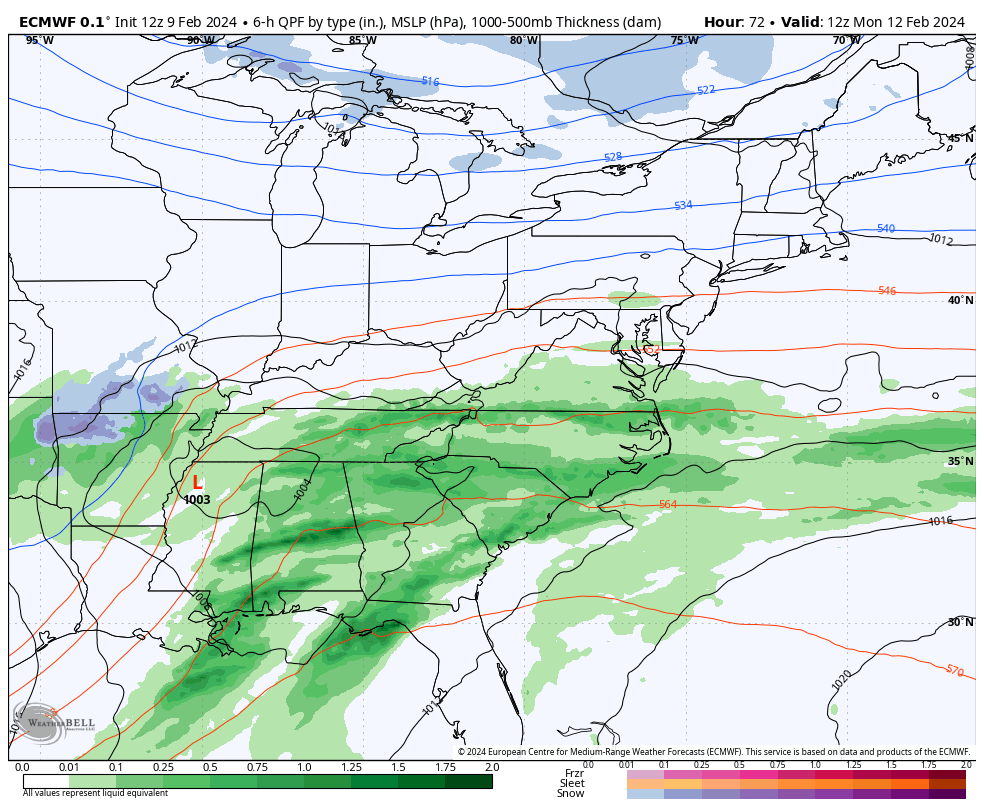
I. A thin line of broken showers and perhaps a rumble or two of thunder will push southeast across central IN during the predawn hours Saturday. More widespread, concentrated rain and embedded thunder will work across the southern 1/3 of the state overnight and early Saturday morning. Across central IN, rainfall amounts of 0.10″ to 0.25″ will be possible with this activity with more widespread 0.25″ to 0.50″ totals across the southern portion of the state.

The front will pass southeast across the region predawn Saturday with a northwest wind shift taking place from northwest to southeast prior to sunrise Saturday. Cooler (not cold by February standards) air will flow into the region over the weekend.
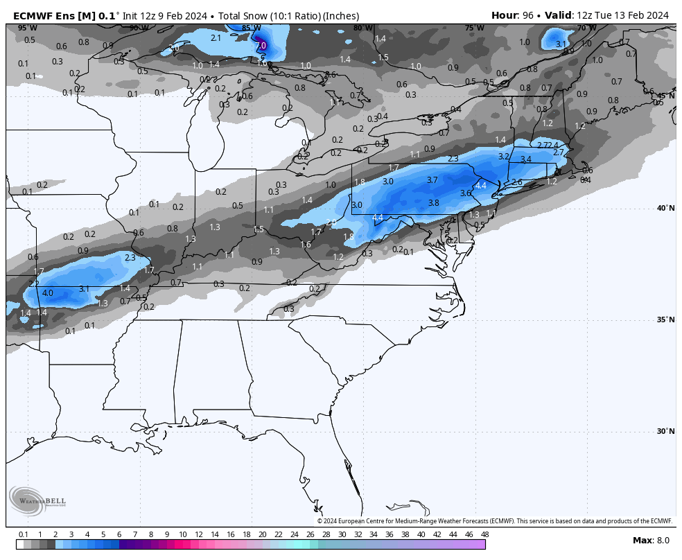
II. The second piece of energy that will lead to a significant rain and associated severe weather episode across the South and a big ole snowstorm for our friends across the Northeast early next week, still appears to mostly bypass our immediate region. It’s possible southern portions of the state (mostly south of Indianapolis) could see a light, slushy snow accumulation, but I think even in these areas the 1″, via today’s EPS is too “generous.” The reason? Snowfall rates, marginal temperatures, and the unseasonably warm ground. Further east, this will be a much different animal with a notable snowstorm anticipated for the central Appalachians into southern New England. Regardless, at least locally, Monday evening into Monday night would be the period to watch for the potential of the slushy wet snow accumulation potential.
III. The upcoming week will undoubtedly be much cooler than what we’ve grown accustomed to from February ’24 so far, but nothing overly cold for this time of year by any stretch of the imagination. We’ll watch for the threat of a couple of clipper systems that could deliver mixed rain/ snow or light snow, but significant snow makers aren’t on the horizon in the week ahead as of this evening. We’ll continue to closely monitor.
The opportunity is present for a shot of colder air behind one of these clippers next weekend.

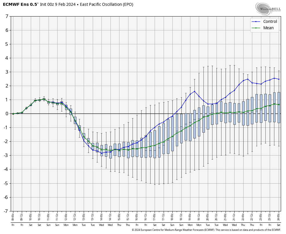
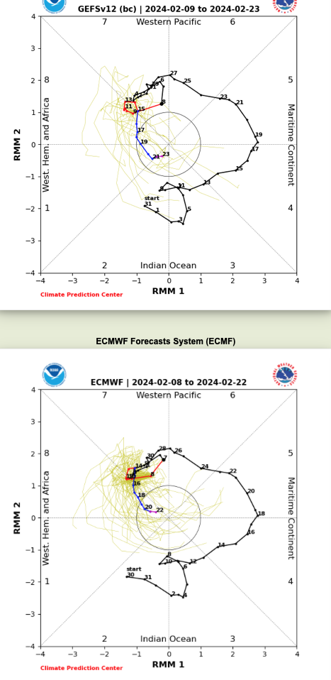
IV. The reason for “pause” this morning in the long standing idea here of a return to prolonged colder than normal weather into March came from a positive trend in the EPO and what at least appears (from this distance) any sort of MJO venture into Phase 8 will be very brief. If (still a bigger “if” than we prefer) we don’t keep that EPO negative and the MJO goes into the neutral phase, even a negative NAO won’t be able to impact the area with notable cold. Can the other players on the field at least keep the period closer to average or slightly cooler than normal? Yes, but any prolonged or significant cold would be highly unlikely if the EPO/ MJO combo doesn’t come to fruition. You better believe we’ll be watching trends carefully over the weekend into early next week.
Leave a Reply