Updated 01.08.24 @ 5:07p
We open this evening by taking a look at the latest ensemble charts, courtesy of today’s 12z European run. While there’s simply no way of being able to guarantee the upcoming 10-day’s worth of snow in one single back yard, long suffering folks of significant winter weather across not only central Indiana, but a widespread chunk of the Ohio Valley, couldn’t ask for a more classic pattern.
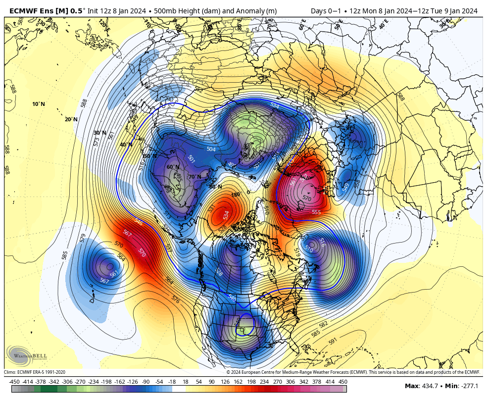
First, the textbook high latitude blocking kicks off the active storm track and then bitterly cold, arctic air pours into the eastern portion of the country. Signs of this potential blocking and storminess were starting to show themselves back in the latter part of the summer. We added a couple of those analogs into building this year’s winter outlook, including the potential of blocking. By the way, it was back in January of 2019 when Indianapolis last recorded our last double digit below zero temperature (11F below zero). I still like our chances of getting into that territory between the 14th and 18th. Wind chill values will likely be much colder.
Now, back to the present. We don’t have any changes regarding tonight and predawn Tuesday. A “thump” of heavy wet snow, mixed with sleet will make for messy travel north of I-70 towards 11p to midnight, continuing into the predawn. Thankfully this will arrive when most are off the roads, but just a heads up if you have late night travel, expect slick conditions starting around 11p, or so. In fact, some of the latest guidance suggests IND may be looking at 1″/ hr snow rates during the onset of this precipitation late evening. Northern ‘burbs, it wouldn’t surprise me at all to accumulate a quick 2″ to 3″ of wet snow and then some sleet before the transition to rain predawn. Even though we’ll all be dealing with a wind-whipped cold rain by daybreak, those living from the northern ‘burbs and points north should expect slushy and slick conditions for the AM commute.
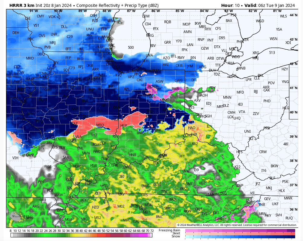
After a brief milder surge and continued gusty winds during the daytime Tuesday, colder air will wrap back into the region allowing rain to transition to light snow tomorrow night, continuing into Wednesday morning. Additional slick spots are likely for the Wednesday morning commute, though late tonight and early Tuesday will likely be more problematic north.
Attention then shifts to our late week winter storm. While I have a hard time seeing the incredibly potent GFS solution verifying, I do like the stronger low pressure options (when compared to the flatter wave idea). – Always have to watch out for rapidly strengthening lows that like to cut up west of the mountains when you get the true arctic branch diving in with the expected trajectory currently modeled. Bottom line, at this distance we don’t see any need to deviate from the idea of rain to start, switching to a wind-whipped snow event, complete with plummeting temperatures and strong, potentially damaging, winds. I’d plan on additional travel impacts late week into the weekend.
The “big cold” follows behind this storm and then we’ll eye the opportunity for additional snow next week…
Leave a Reply