I was out and about earlier today and taking note that local lawns are much greener than they typically have been over the past few years by early September. We can thank recent rains and warmth, but it’s been a wet year, overall, to date. Think back to all of the winter snows and then add the copious spring and summer rains. The end result so far? 2014 is running close to 2″ above normal precipitation at IND.
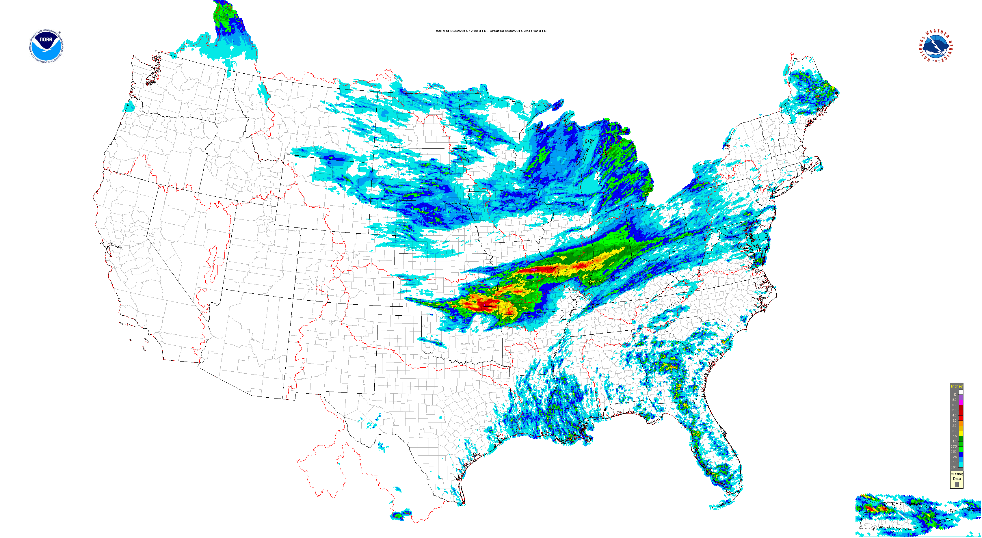
Overnight rains went close to forecast. We picked up 1″ on the dot in the city, including northern ‘burbs. (IndyWx.com HQ in southern Boone County also picked up 1″). Heavier rains and localized flash flooding took place down state.
A look at today’s rainfall:
Moving forward, the pattern over the upcoming (2) weeks appears wetter than normal.
In the shorter term, the GFS and Canadian paint a wet picture out by Days 7-10 (BTW- the European agrees).
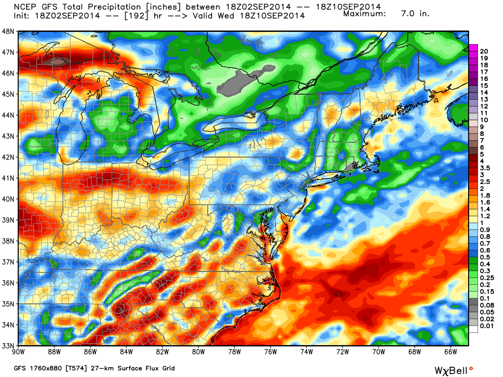

Modeling suggests 2-3″ type rainfall is possible over the upcoming 7-10 day period. A transient pattern can be thanked for the overall wet forecast.
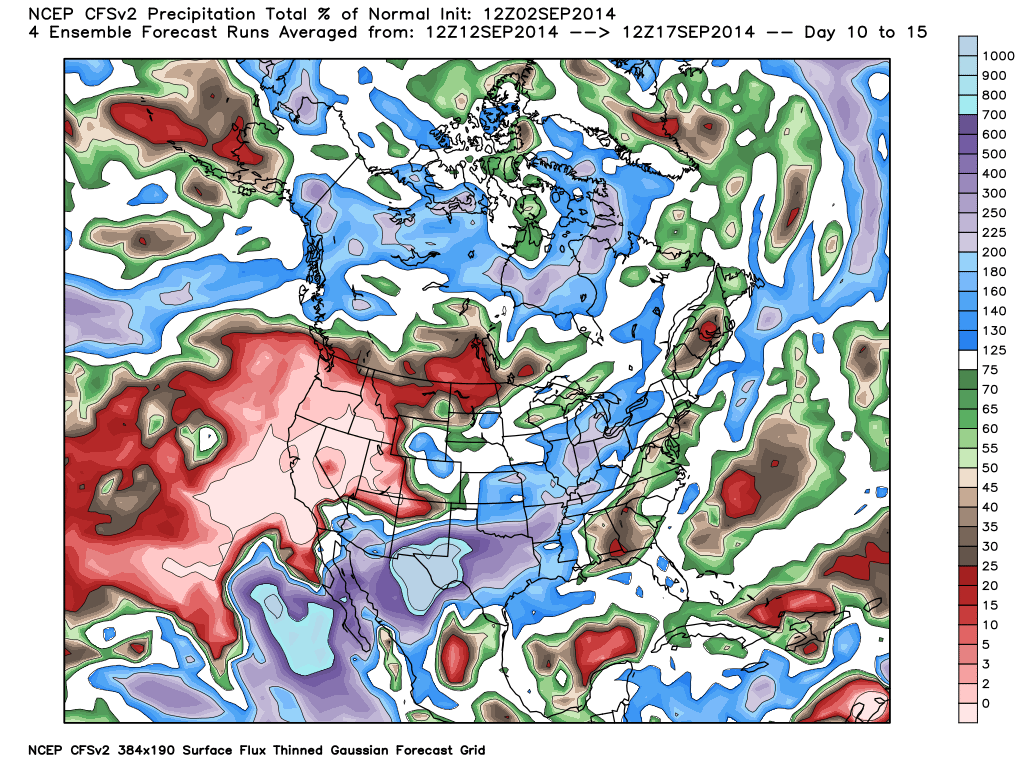
The CFSv2 also suggests precipitation runs 150%-200% of normal levels through mid September.
As harvest begins across some Hoosier farm lands, note the increased wetness in the pattern through the upcoming 14 days, or so.
The region will remain in an active pattern through the next couple weeks, at least, as we lie in the battle ground between a stubborn southeastern ridge and an increasingly active early fall northern stream. A wetter than normal mid west will ensue…
Leave a Reply