Updated 08.06.23 @ 9:54a
Despite a few light morning showers, our Sunday will feature dry conditions through the remainder of the daylight hours along with increasing sunshine. The disturbance responsible for Saturday’s severe weather and unsettled conditions is on the way east while we wait a new potent disturbance on deck from the west. Unfortunately, this second disturbance has eyes set on our region tonight and will pose a dangerous overnight severe weather risk.

All modes of severe weather will be possible, including damaging winds, large hail, and a couple of quick spin-up tornadoes. It wouldn’t surprise me if a portion of the current ‘Slight Risk’ area is upgraded to an ‘Enhanced Risk’ across southern IN in future SPC (Storm Prediction Center) updates this afternoon.
From a timing standpoint, storms should approach western Indiana towards 10p, or so and then continue to advance east, southeast into the late evening and overnight hours.
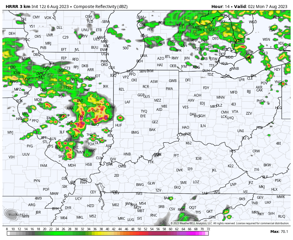
Discrete cells may try and organize into more of a congealed line as we push closer towards midnight and, as such, the threat of a damaging wind event will become the eventual primary concern as we move through the early Monday morning hours across the southern half of Indiana.
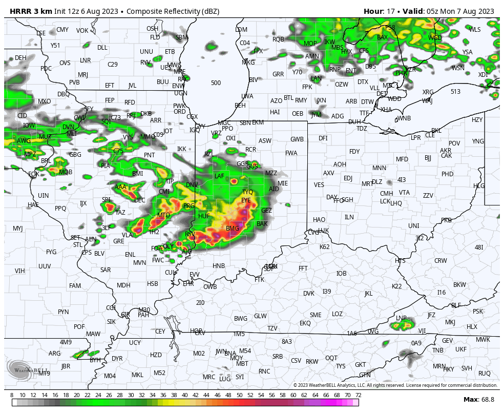
Before heading to bed this evening, be sure to have a means of getting the latest warning information as there will likely be multiple warnings issued late this evening and into the early portion of the overnight.
Quieter (albeit briefly) weather conditions will return as we move through the first couple days of the new work week.
Leave a Reply