Updated 06.29.23 @ 12p
The storm complex currently entering IL will likely have a downstream impact on Indiana later this afternoon into the early evening hours. Several ingredients are in place that leads to a higher confidence in this storm cluster including a widespread damaging wind threat (55+ MPH gusts).
High resolution data continues to show this complex gaining steam as it rolls across central Indiana between 4p and 6p. We caution, these kind of storm clusters can pick up momentum downstream so it’ll be important to remain weather-aware and in position to act when (don’t think it’s a matter of “if” any longer) warnings are issued really anytime after 3p.
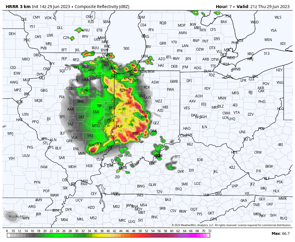
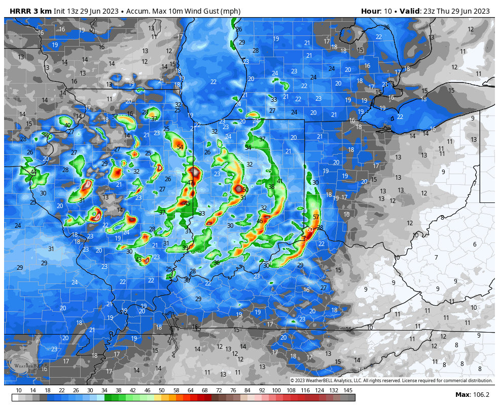
Ingredients are in play that may carry this wind machine across the entire central IN stretch and even into northern KY and southwestern OH by evening.
I’d recommend taking the opportunity to ensure your electronic devices are charged and severe weather safety plan is in place now prior to this activity moving in over the next few hours. Unfortunately the evolving look to current radar trends just after the 12p timeframe only raises confidence of this being a rather widespread damaging wind maker with resulting power outages.
Leave a Reply