Updated 05.27.23 @ 10:32a
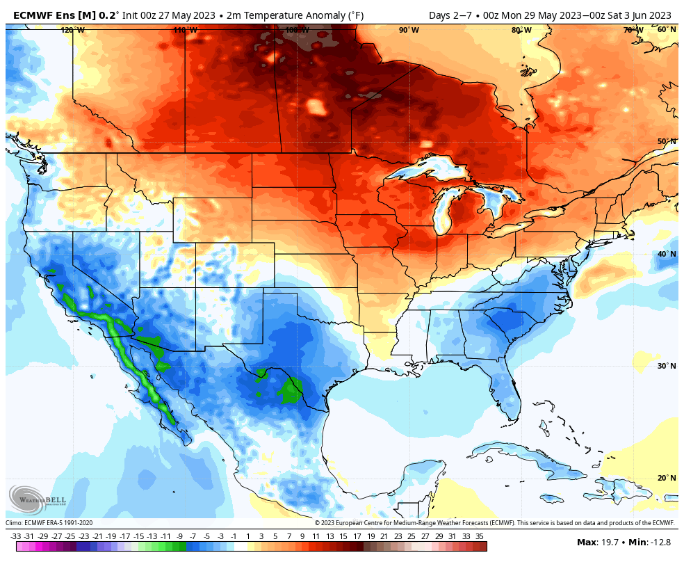
Meteorological summer (June through August) is only a few days away and, as you’d imagine, hotter days are on tap. BUT…we continue to believe the 90° days will be brief over the next couple of weeks.
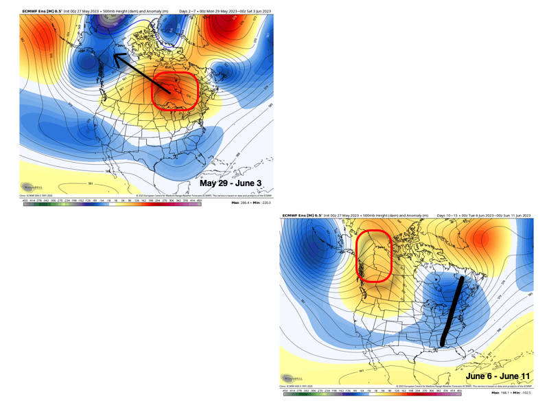
Note the upper pattern evolution shown below. Upper ridging briefly expands over the northern Great Lakes into the Ohio Valley and north-central in the Day 2-7 time period. However, by the Day 10-15 period, that same ridge has retrograded northwest in significant fashion and a significant eastern trough takes up residence.

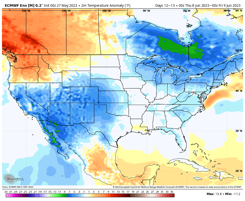
The transitional hotter pattern of next week will be replaced with cooler than normal temperatures during the second full week of June.


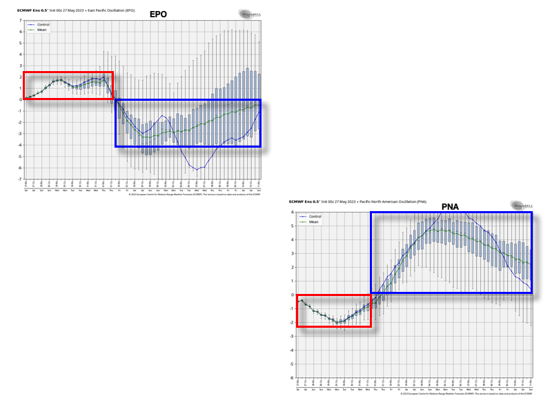
The reason for such a pattern transition as noted above has to do with (2) primary drivers: the EPO tanking negative just past the beginning of the month and the PNA spiking strongly positive.

These will work in tandem to pull that upper ridge and associated hot dome into what will likely be more of a permanent June position while the ‘mean’ trough will likely reside in the eastern portion of the country for the better part of the first month of meteorological summer.
While still not an overly wet pattern by any stretch of the imagination (remember, we don’t think wholesale changes take place in the precipitation pattern until the 2nd half of the summer this year), the transition of regimes will likely generate at least better opportunities for needed moisture in the Week 2-3 period.

