Updated 04.18.23 @ 7:15p
Today’s guidance is starting to hone in on the most likely scenario as we close out the work week and head into the weekend. After a couple days of what sure seemed like “far fetched” solutions being printed out by the GFS, it’s trended much closer towards what the European was showing this morning. The model is actually more like a “blend” of the two ideas from this morning.
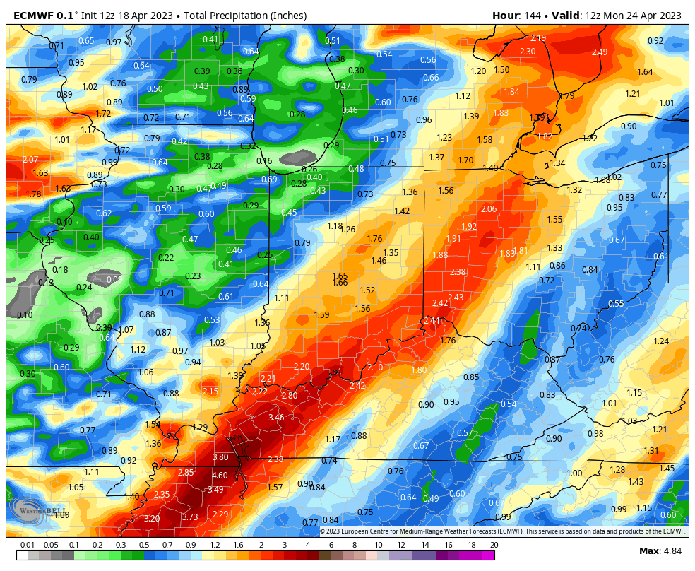
We continue to believe the initial wave of moisture will arrive Thursday evening (after a very warm and dry day). This will then be followed by a second surge of moisture Friday night into Saturday morning (lasting into Saturday afternoon across eastern Indiana). This second wave of precipitation will likely be more widespread and heavier for the eastern half of the state during the aforementioned time frame. As colder air gets pulled into the region, wrap-around precipitation will mix with wet snow (yet again) Saturday night into Sunday morning. High pressure should then build overhead allowing for the coldest air to settle in Sunday night and Monday morning (potentially with a repeat Tuesday morning depending on the timing of our next system). If skies clear as anticipated, the potential remains for overnight lows to dip into the upper 20s.
As mentioned above, forecast models are now in much better agreement regarding rainfall placement and amounts (heaviest across central and eastern IN) with this event.

We’ll see if these trends hold firm overnight and be sure to cover this (and more) in our Client video discussion Wednesday morning!
Make it a relaxing evening!
Leave a Reply