Updated 01.28.23 @ 6:18p
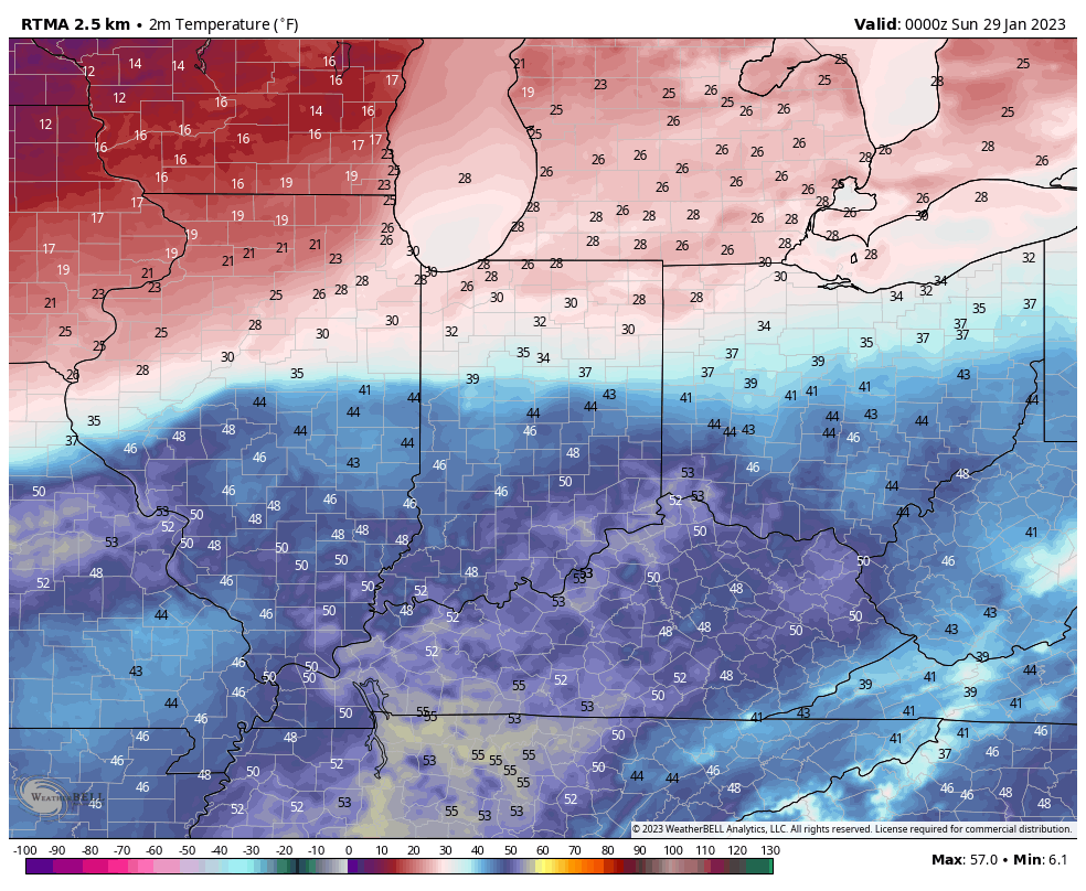
Talk about a temperature spread across the state this evening. Northern IN features temperatures in the upper 20s to around 30° while many across the southern portion of the state made it into the 50s today.
Light rain will overspread the region through the overnight, but “light” is the key word. Most can only expect a couple tenths of an inch of rain tonight.


Much colder air will ooze south into central Indiana Sunday morning. It’ll be a day with highs at midnight before temperatures crash through the day. Most of our Sunday will be below freezing. Unfortunately for snow lovers, the precipitation will be to our east before the temperatures fall. That said, be mindful of the potential of some black ice on untreated surfaces Sunday morning as the colder air settles in.
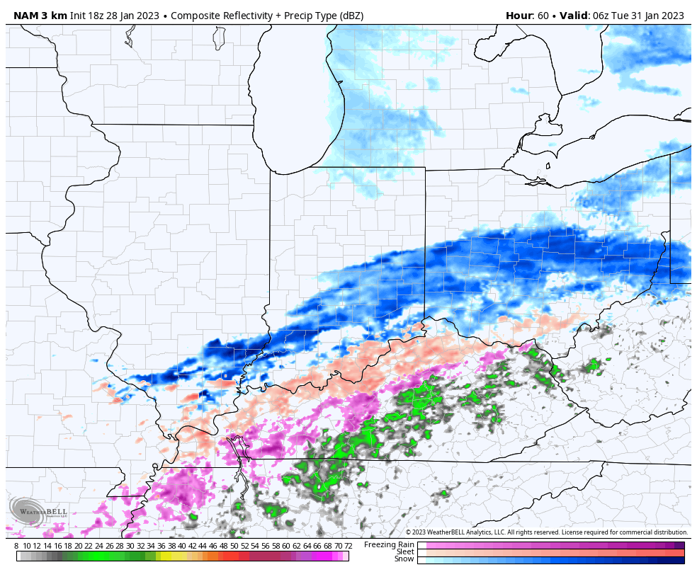
Another wave of moisture will ride east along the pressing arctic boundary Monday. This time, cold air will be in place prior to onset and some light snow is possible across central IN Monday evening, including the threat of an icy mixture of sleet and freezing rain downstate. Again we want to reiterate this should be very light in nature.
Thereafter, high pressure should control our mid and late week weather with dry and seasonably cold conditions until a reinforcing shot of cold blows into town next weekend.

Leave a Reply