Updated 05.18.22 @ 7:30a
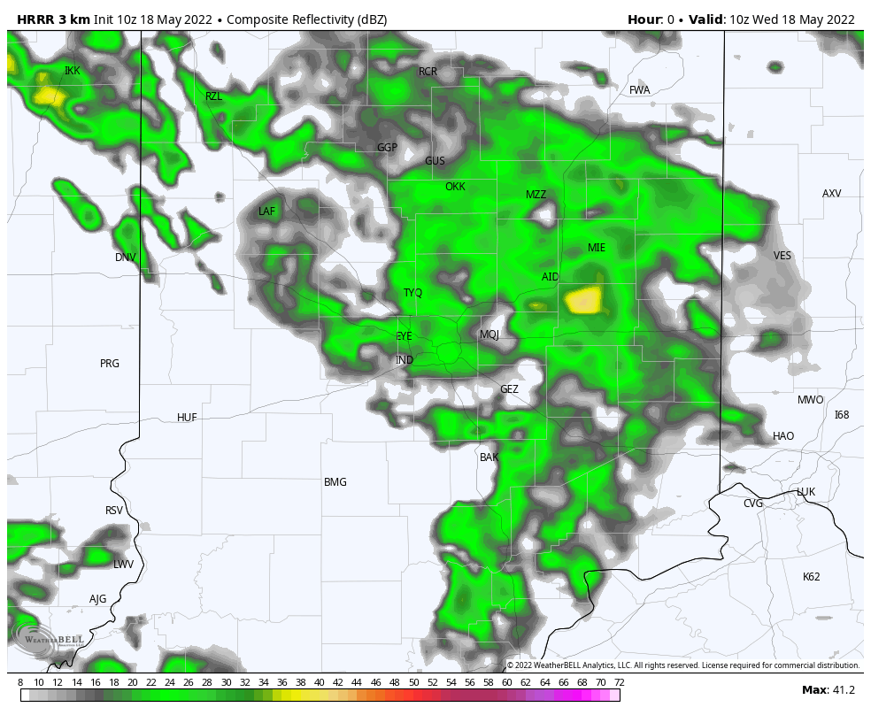
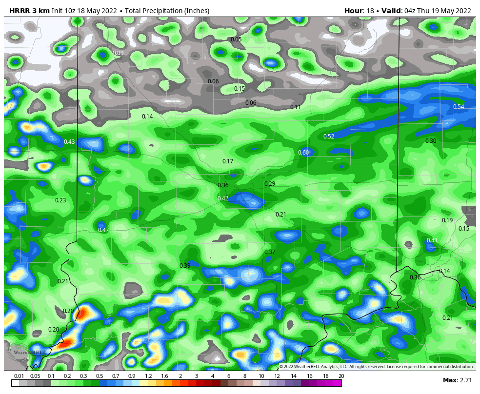
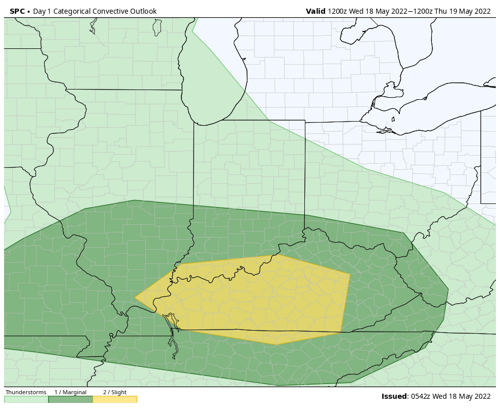
I. Unsettled weather will continue much of the day before exiting off to the east around the evening rush hour. Some embedded stronger storms are possible across southern Indiana (where the SPC also includes in a Slight Risk of severe weather). Otherwise, we’re generally looking at rainfall amounts less than half an inch north of the city and between 0.5” and 1” south of the city.
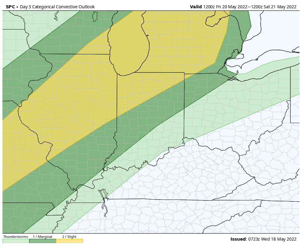
II. Thursday and Friday (for most of the region) will be dry. Heat and humidity will be the big story as southwesterly winds tap into the Gulf of Mexico ahead of the approaching weekend front. The exception to this may be across northwestern portions of the area where a few severe storms are possible late in the day on Friday. The Storm Prediction Center continues to include this area in a Slight Risk (damaging winds are the biggest concern).
III. Greatest coverage of showers and storms should arrive here Saturday evening into Sunday morning. While a few strong storms are possible, due to the timing in the day, most of these should remain below severe levels.

IV. Cool, refreshing air will settle overhead to close the weekend and by Monday morning we’ll be talking about widespread low-mid 40s. That sure will feel mighty nice after feels like temperatures climb into the 90s Friday.

V. While next week will open on a nice note, wet and active times will return by midweek and signal what very well looks like a wet close to the month of May.
Leave a Reply