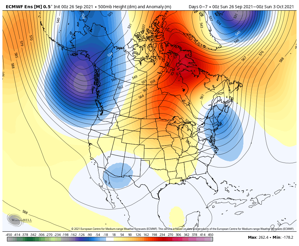
A ridge will expand across the northern Plains and upper Midwest during the 7-day forecast period ahead. Meanwhile, a ‘mean’ trough will take up shop across the Northeast and the Pacific Northwest.
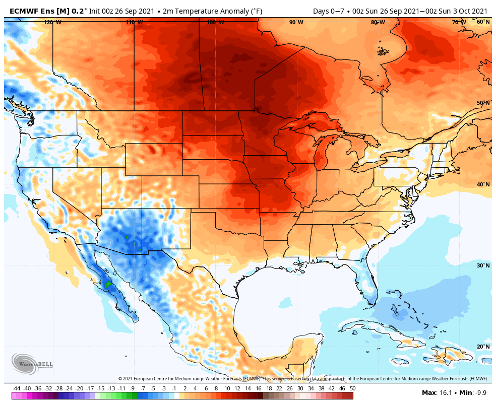
Well above normal (near record) heat will center itself across the central and northern Plains into the upper Midwest. Overall, a slightly warmer than normal period is ahead for a good chunk of the country, front loaded early week.
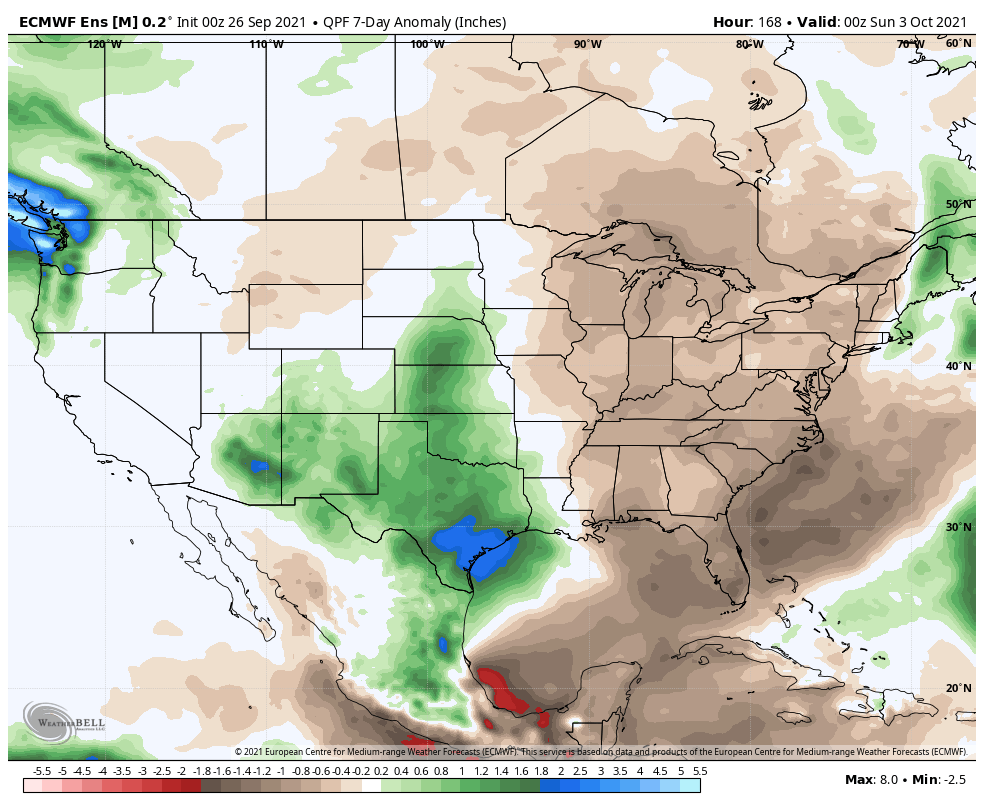
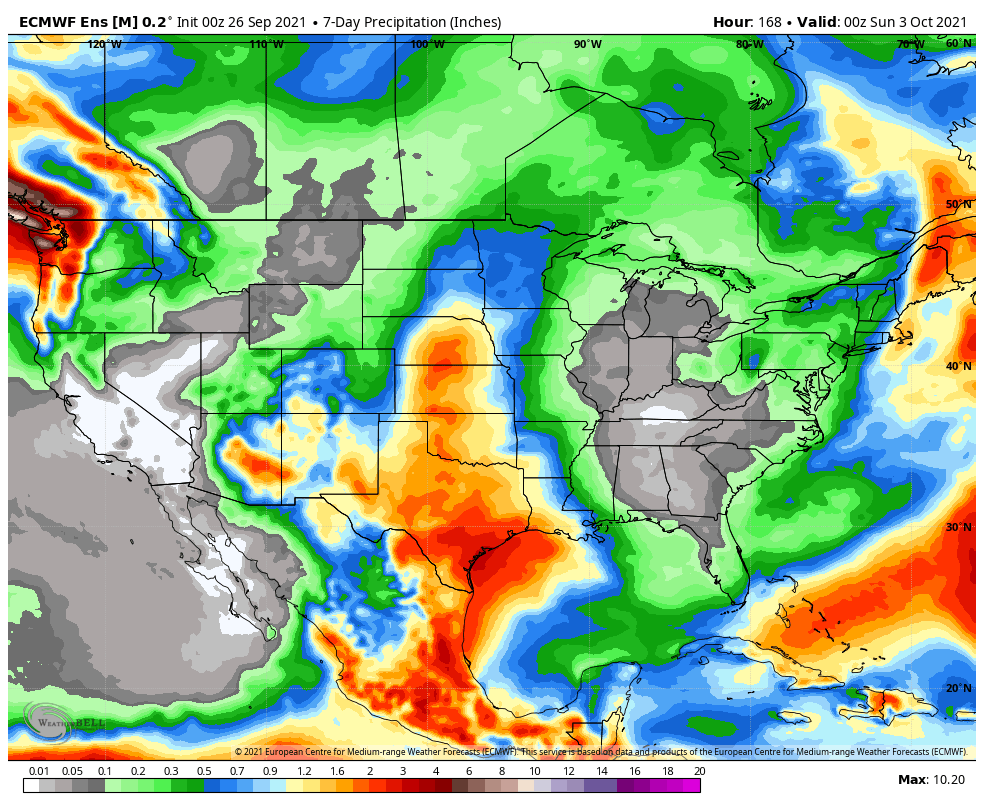
Well above normal precipitation is expected across the southern Plains and southern Rocky Mountain region, into the Four Corners. Widespread drier than average conditions can be expected across the East.
A weak system will approach our region late week with the potential of some light rain (0.10″ to 0.25″ type stuff). Otherwise, it’s a quiet pattern, locally.
Forecast Period: 09.26.21 through 10.03.21
A very quiet weather pattern will dominate the 7-day forecast period. Plentiful sunshine and warmer temperatures can be expected through the early and middle part of the work week before we cool closer to normal late in the period. While there’s plenty of disagreement, the GFS is a little more bullish on bringing in a weak storm system late in the period that could* produce a few showers Friday. If this does, indeed, take shape, it only appears as if we’re looking at 0.10″ to 0.25″ type rainfall. We’ll keep an eye on things. Otherwise, it’s a dry and very uneventful stretch ahead over the upcoming 7 days.
Leave a Reply