Updated: 01.10.21 @ 11:28a
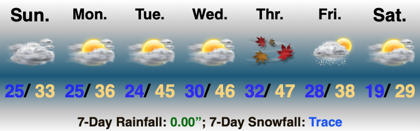
Moderating Trends Gets Underway Monday…The 2nd half of the weekend will feature more of what we’ve grown so used to as of late: overcast conditions. With the thick cloud deck in place, afternoon highs won’t budge much. As we flip the page to the new work week, a milder westerly and southwesterly air flow will turn gusty at times (especially by midweek), but this will also help boost temperatures to levels around 10° above normal. We should also see a little more of that vitamin D through midweek.
We’re still targeting a cold front to blow through our neck of the woods Friday. This, coupled with just enough upper level energy, will likely be enough to ignite a brief period of scattered snow shower action Friday PM. Colder air will settle into the area next weekend…
Leave a Reply