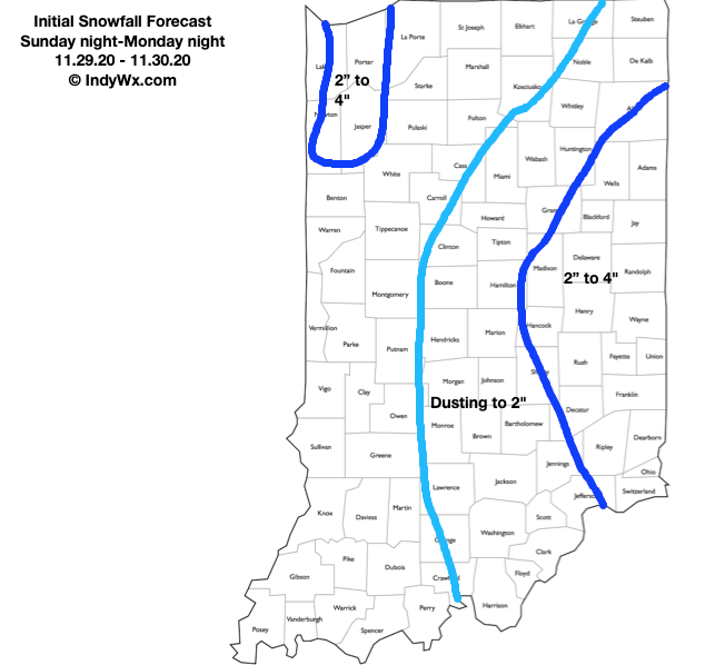
Type: Impactful Wintry Weather
What: Accumulating Snow/ Wind
When: Sunday night and Monday
Temperatures: Low-Mid 30s
Wind: N 15-20 MPH; Gusting to 35 MPH
Blowing Drifting: Minimal to Moderate in lake enhanced zone, as well as east-central IN
Pavement Impacts: Salting required; plowing likely required in lake enhanced zone, as well as east-central IN
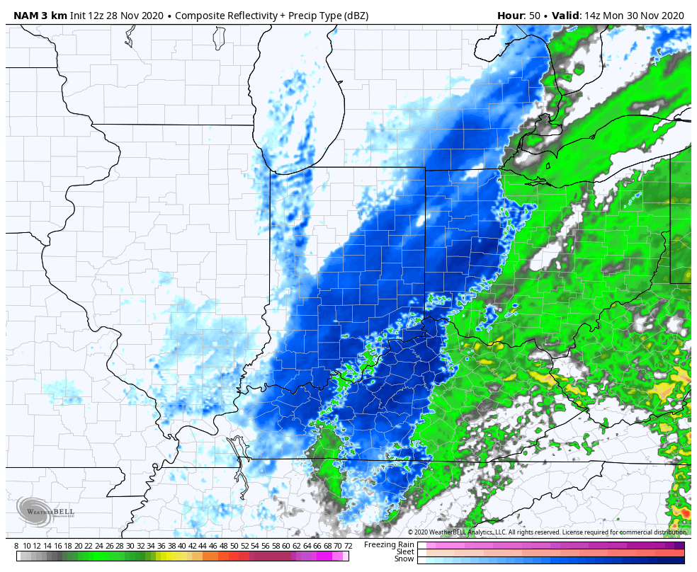
Summary: While not nearly as robust as what guidance earlier this week printed out, the season’s first widespread wintry event looms Sunday night into Monday. This is a byproduct of phasing between the southern and northern jet stream (initially set off by the evolving strongly positive PNA), but there are important differences in the speed of the initial vort. max being a bit more progressive that will keep this from bombing out like earlier guidance showed. Consequently, this will result in a much further east system (may still not have seen that eastward trend finish). While our forecast specifically focuses on Indiana, if you have travel plans east of here into Ohio early next week, please pay special attention to the local National Weather Service products as impacts will be greater from heavy snow and strong winds.
Locally, we anticipate precipitation overspreading central Indiana (from southwest to northeast) around, or just after, midnight Sunday night. Initially, this should be in the form of a cold rain before precipitation transitions to wet snow prior to sunrise. Moderate snow should be falling across east-central Indiana from the mid morning hours Monday into early afternoon. Additionally, by this point, a more organized band of lake-effect snow should be firing up off Lake Michigan. This is a bit of a wild card as a combination of ingredients favor a pretty robust lake snow band making it further south than typical. As the wind direction veers towards more of a northwesterly flow late Monday afternoon and evening, it’s possible this lake effect snow band pivots into the Indy metro and surrounding ‘burbs. We’ll keep a close eye on this as time draws closer. Within this snow band, heavier accumulations are possible. Snow showers will continue into Tuesday morning before diminishing.
Confidence: Medium
Next Update: Tonight (video package, including longer range update).
Leave a Reply