This morning is once again reminding us that we can deal with wintry “issues” at times even in the midst of an overall mild pattern. As we move down the road, it sure appears as if additional opportunities for wintry weather will present themselves as the pattern evolves towards more of a traditional regime to support such.
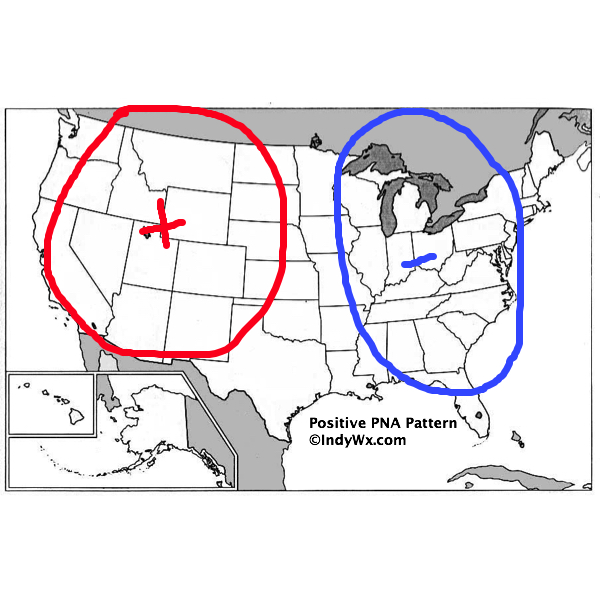
More specifically, we’re targeting the period between 11/30 and 12/10. Though still not a “textbook” pattern, the PNA is trending more positive with each run. This favors as eastern trough (example below).

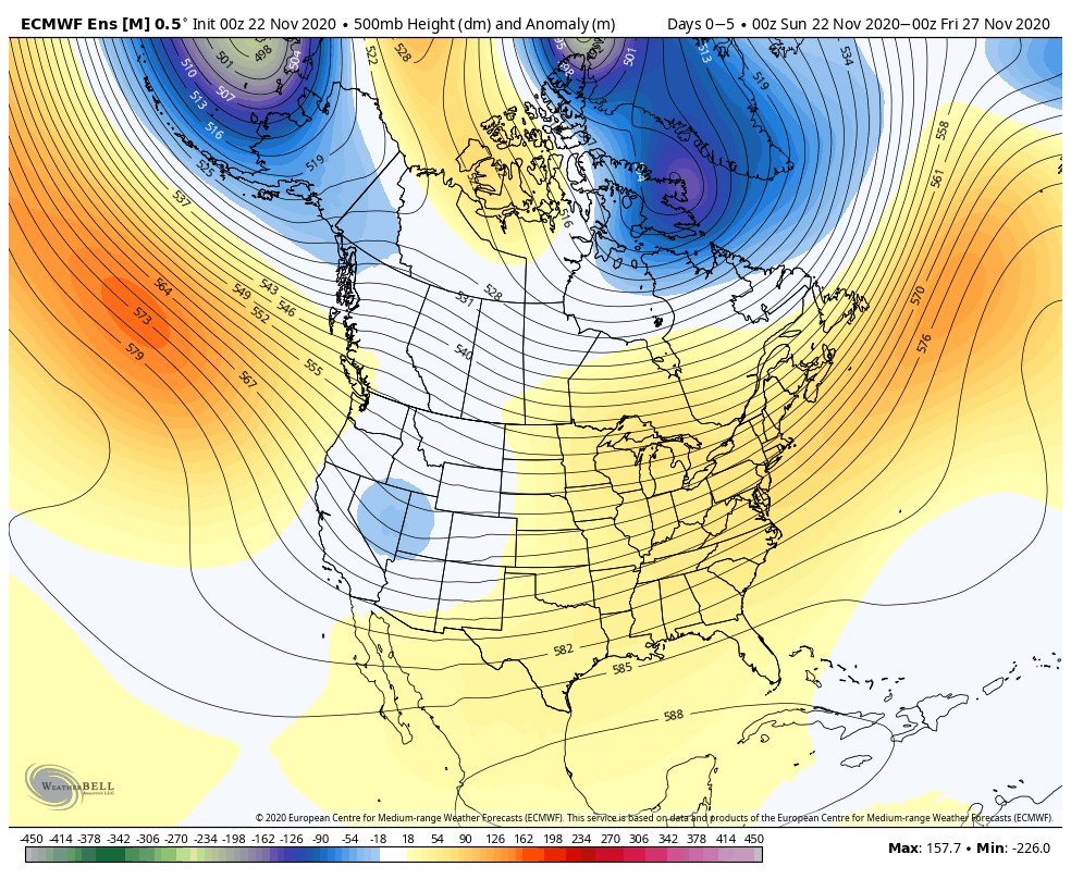
Note how the upper pattern evolves in the coming couple of weeks:
You might be asking yourself, “what would take this pattern to lock-in and become more textbook?” We need the two positives (initially over Saskatchewan and Manitoba to “connect” with the one in the northwestern Atlantic). As it is, we do note the heights continue to build and push towards Greenland. I’m not sure we can pull it off, but the evolution towards a strong PNA can force the issue and eventually lead to a negative AO. Regardless of whether or not we get to that point, which would lead to a more long lasting colder/ stormy regime, I think we’ll have a minimum of 2 opportunities for eastern wintry “fun and games” during the aforementioned period above.
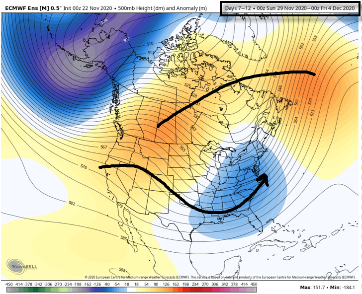
As we get into Week 2 (11/29-12/4), note how the pattern has the look of an active subtropical jet as the “horseshoe” block tries to get established over the top. This is likely still not an overly cold pattern, but one plenty capable of additional wintry fun, even with marginally cold air.
Stay tuned. The closer we get, the more specific we can be regarding the storms. From this distance, if I’m a fan of winter weather, you have to like where you’re sitting as we open up meteorological winter.
Leave a Reply