Our annual Winter Outlook will debut Sunday morning, November 1st.
A frontal boundary will remain draped over the Ohio Valley through midweek before lifting north as a warm front late week. As we gear up for the weekend, this same front will barrel southeast as a cold front. While it won’t rain the entire time, the end result will be quite an active week with periods of rain (at times heavy).

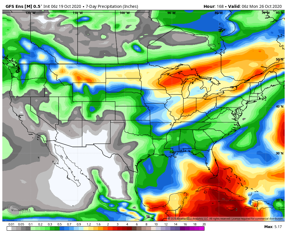
Looking ahead, it appears as if best chances for concentrated rain will come Tuesday night into Wednesday morning, Friday evening, and Sunday into next Monday. This is a hectic pattern and we’ll fine tune if needed. Widespread 1”-2” rain totals (locally heavier amounts) can be expected for the northern half of the state by early next week with 2”-3” totals (again, locally heavier) across the southern half of Indiana (generally along and south of I-70).
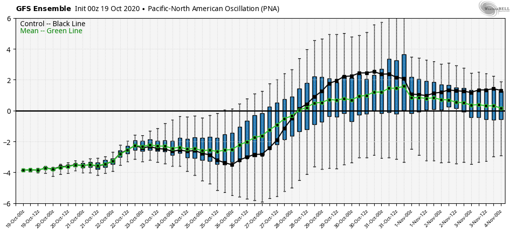
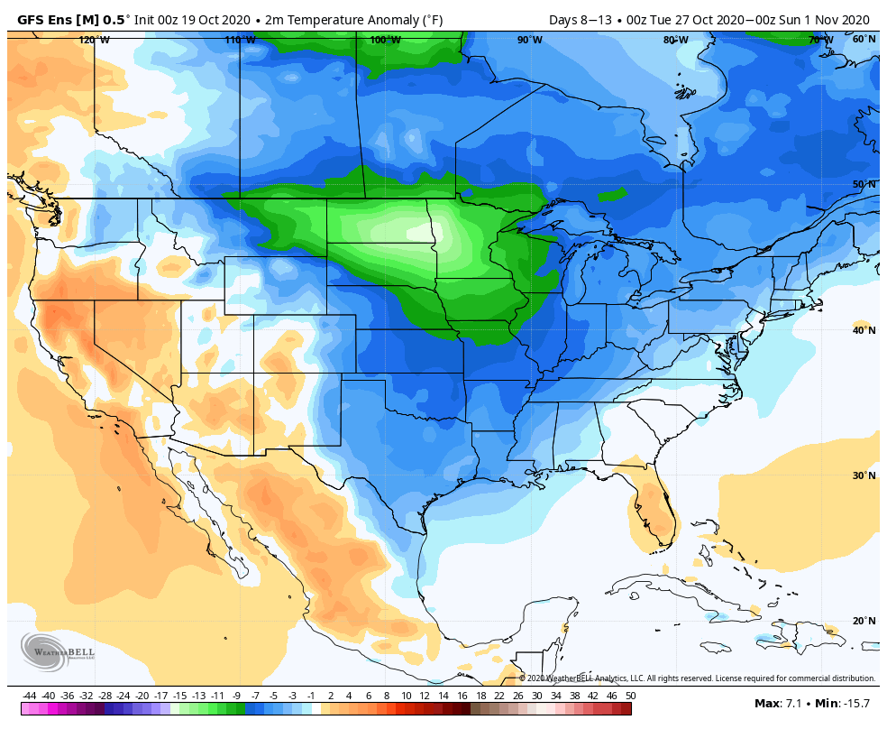
As the PNA pops positive, a colder than normal airmass, and coldest so far this autumn, will settle southeast prior to Halloween. This is the type of pattern that should generate a multi day hard freeze with temperatures falling deep into the 20s early morning.
Leave a Reply