As we get set to open the month of July, there’s increasing confidence in a developing heat wave to the likes we haven’t experienced in a few years. It seems there are other sources and vendors that have tried to “manufacture” heat waves each of the past few summers and we’ve had to play those “doomsday” forecasts down. This is a different scenario this time around, but there’s yet another interesting case study (one that we can take into the late summer, fall, and winter) in front of us that ultimately may have some say as to the longevity of the upcoming heat wave.
Before we get to that, let’s take a look back at some of the more recent stretches of significant heat Indianapolis has had to deal with. In scrolling through the climate logs, it was a bit surprising how the late summer and early fall has featured the most significant heat over the past few years:
Log of consecutive 90° + Days:
I. September 2nd – 8th, 2015 (7 days)
II. July 21st – 25th, 2016 (5 days)
III. September 21st – 26th, 2017 (6 days)
IV. September 2nd – 6th, 2018 (5 days)
V. July 17th – 21st, 2019 (5 days)
This can help paint some perspective around the magnitude and longevity of the upcoming heat wave. We think there’s the potential for 9-10 consecutive days of 90° + beginning Friday, the 2nd. Admittedly, this now appears as if it’ll be a more significant stretch of heat than once believed a couple of weeks ago, but we also believe there will be some rain to help serve as saving grace before the pattern begins to shift after the first week to 10 days of the month. We’ll handle that with our short-term forecast updates in the coming days and weeks (reminder that we’ll be posting right through the holiday, as per usual).

We still believe the ridge axis will shift southwest after the 9th or the 10th and this will open the door for slightly cooler air and much better rain chances (isolated to widely scattered coverage is all we can expect after tomorrow until around the 9th). We’ll have to be on guard for the threat of northwest to southeast riding storm clusters by mid-month, but this will come on the heels of an oppressive and rare hot, humid stretch of weather across central Indiana.
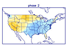
What will be of interest is the impact the MJO may (or may not) have on this heat wave. Today we note there’s rather significant disagreement amongst the models regarding the overall amplitude into mid-July. The GEFS (image 1) is quite energetic while the European (image 2) is less than impressed. For what it’s worth, the GEFS as of late has been performing better in handling the MJO than the European.


Should we, indeed, make it into Phase 2 towards mid-month, we’d be looking at the likelihood of more significant cooling along with wetter conditions, but we stress this is very low confidence from this distance given the difference in the modeling. Stay tuned.
Leave a Reply