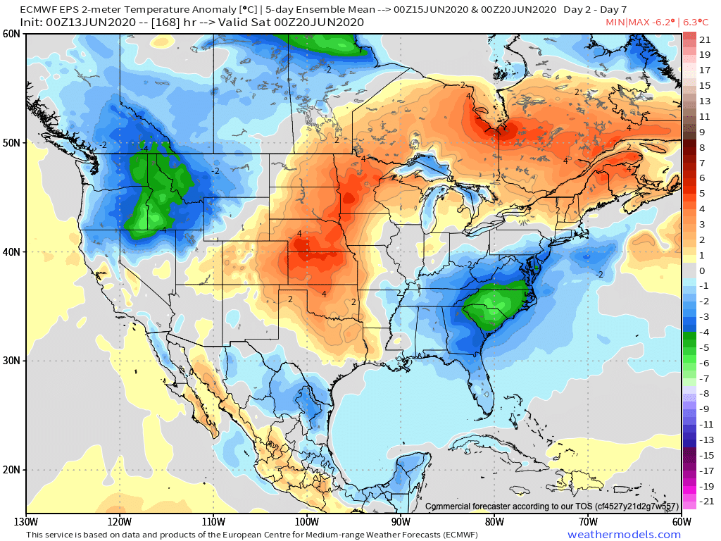
I. Unseasonably cool weather dominates the area to open the period with a late warming trend.
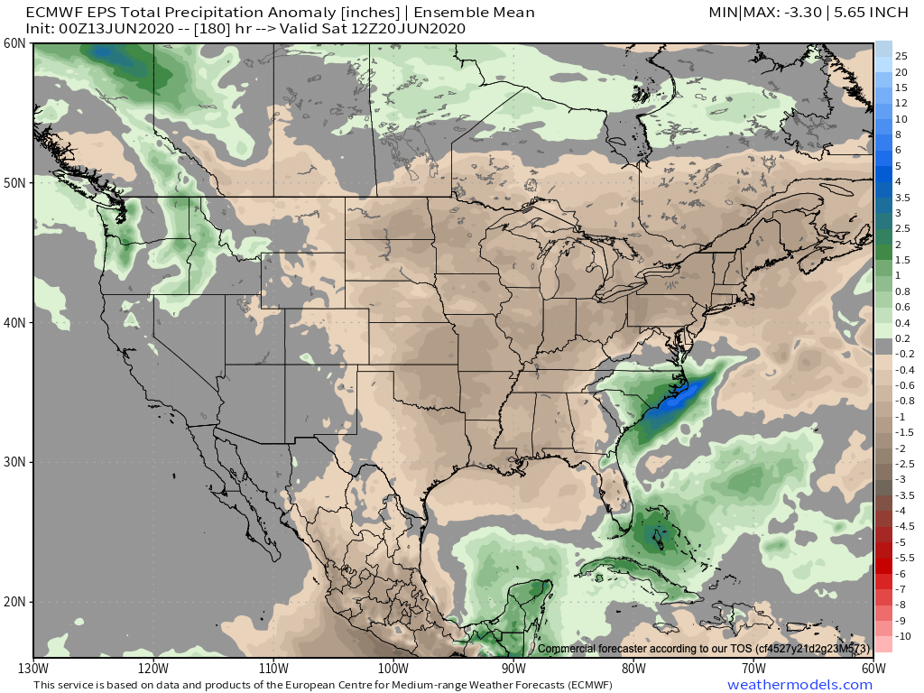
II. Widespread dry conditions persist through the upcoming week.

Forecast Period: 06.13.20 through 06.20.20
A very quiet weather pattern is ahead through the forecast period. A weak disturbance will move southeast this morning across the region. While northern parts of the state picked up measurable rainfall this morning, most of this will scoot east of immediate central Indiana. This system will also serve to reinforce the cool pattern in place into early parts of next week. In fact, overnight lows tonight will fall into the 40s as far south as central Indiana. Anyone else craving fall?! The pattern beyond will feature a warming trend along with continued dry weather. Heat and humidity will build in earnest late in the period along with an opportunity for scattered showers and thunderstorms next weekend ahead of an approaching cold front. Between now and then, enjoy the quiet conditions.
Leave a Reply