With meteorological summer looming around the corner, will the pattern follow suit? At least in the short-term, warmth and humidity will have things feeling very much like summer, but this warmer regime likely won’t hold. The culprit? You guessed it- developing negative EPO, strongly positive PNA, and the MJO re-amplifying with eyes sets on the cooler phases to open June.
After a chilly May (month-to-date), most will welcome this weekend’s heat and humidity with open arms! This is courtesy of finally kicking the “cut off” low to the curb and replacing its’ influence with an upper level ridge. Scattered shower and thunderstorm activity is possible through the short-term, but coverage will be of the “splash and dash” variety- very typical of summer-time!


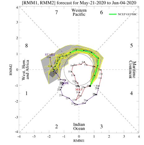
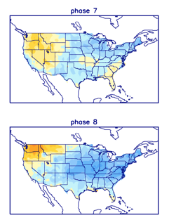
This warmer regime will be fleeting as a combination of ingredients align in a manner to drive cooler, more refreshing air back into the region as we close May and open June. Most notably this is being driven by a negative EPO, strongly positive PNA, and the MJO set to roll through Phases 7 and 8 during said period.
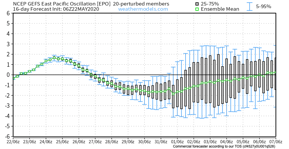

Accordingly, we note the models shifting things up quite significantly as we go into the Week 2 time period (May 29th-June 4th).


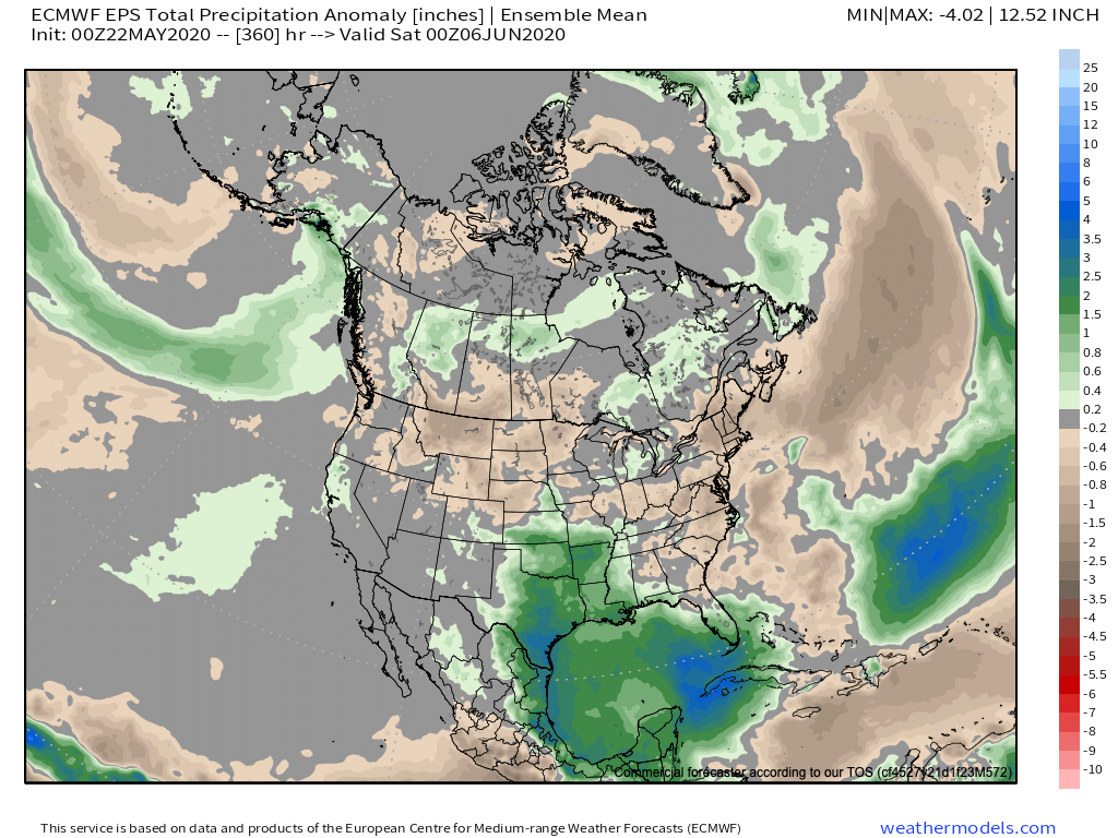
The cooler regime will likely also come with a drier overall pattern to open June, at least compared to average.
Leave a Reply