I. After a cold and dry open to May, (Month-to-date, Indianapolis is running 8.4° below avg. and 1.24” below normal in the precipitation department) changes have arrived.

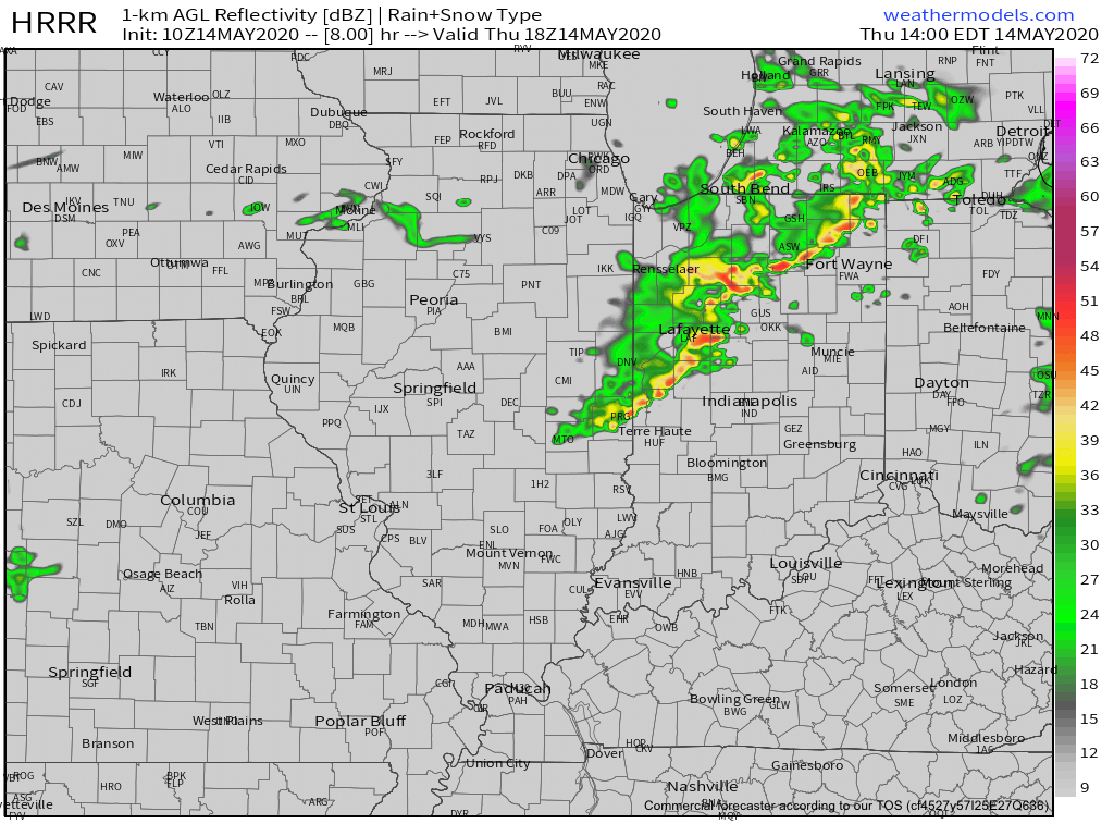
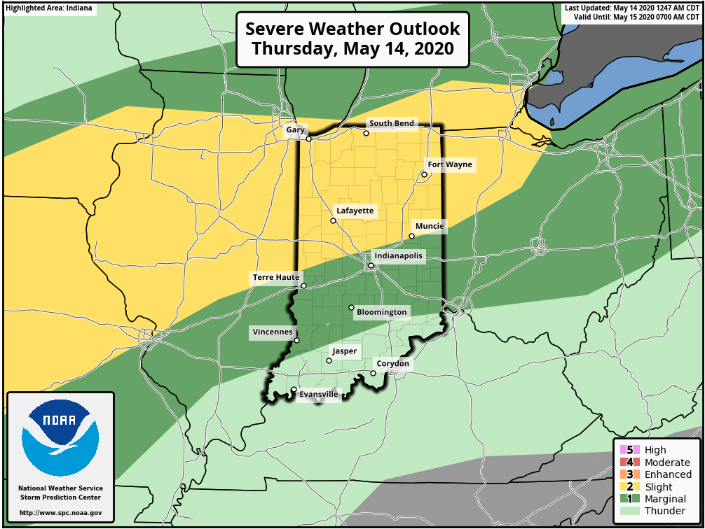
II. A warm front will lift north through the state today and deliver those warmer changes. The transition from cool to more of an early summer feel will be met with a couple rounds of storms today. Some of those storms will be strong to severe (damaging winds being the greatest concern), especially north of the city. Strongest storms should arrive across the northern half of the state during the early to mid afternoon hours.
III. A “half-n-half” weekend is expected. After a wet Friday, drier air is expected to arrive to help us out Saturday. Showers and storms will return Sunday courtesy of a cold front and associated surface low. Locally heavy rainfall will be possible Friday & Sunday and when you add in what falls today, most of the state from the city and points north can expect widespread 2”-2.5” with locally heavier amounts.

IV. An area of low pressure and upper level trough is now shown to “cut off” over the Mid-Atlantic region in the medium range period. This is forecast to dramatically cool the Monday through Thursday time frame (instead of 80s, we’re now talking upper 50s, 60s and low 70s during the period). This is worth keeping an eye on as models can struggle handling these kind of features, but as it stands now, after a brief encounter with warmth this weekend, it doesn’t appear as if we’ll get back to the heat until Memorial Day weekend.
Leave a Reply