This unseasonably cold pattern was bound to produce a couple of additional wintry challenges (at the very least) before all was said and done, and this week isn’t disappointing. Guidance today has continued to trend snowier for northern parts of the state, and we fully expect periods of heavy, wet snow to begin falling across the northern 1/3 of Indiana tomorrow evening, continuing into Friday morning before eventually ending during the afternoon.
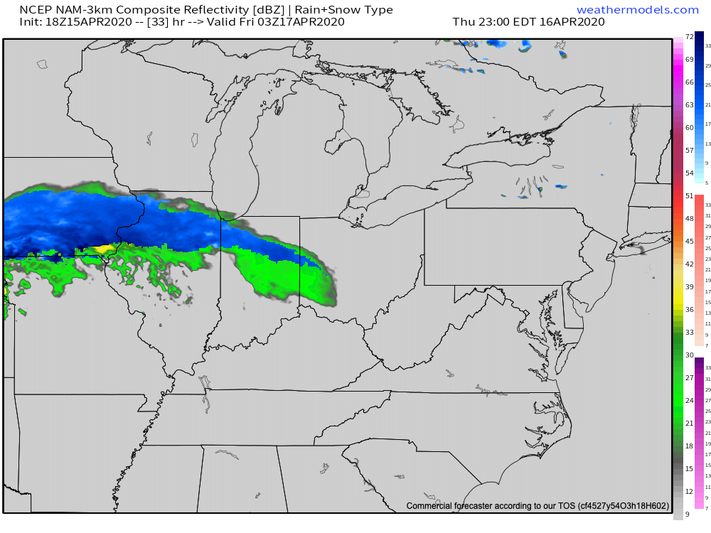
Snow will likely reach peak intensity around sunrise Friday morning, including 1″ to 2″ per hour snowfall rates. With the unseasonably cold air in place, we expect road crews to have to activate the plows as the snowfall intensity, combined with time of day will make a mess of area roadways across northern Indiana.
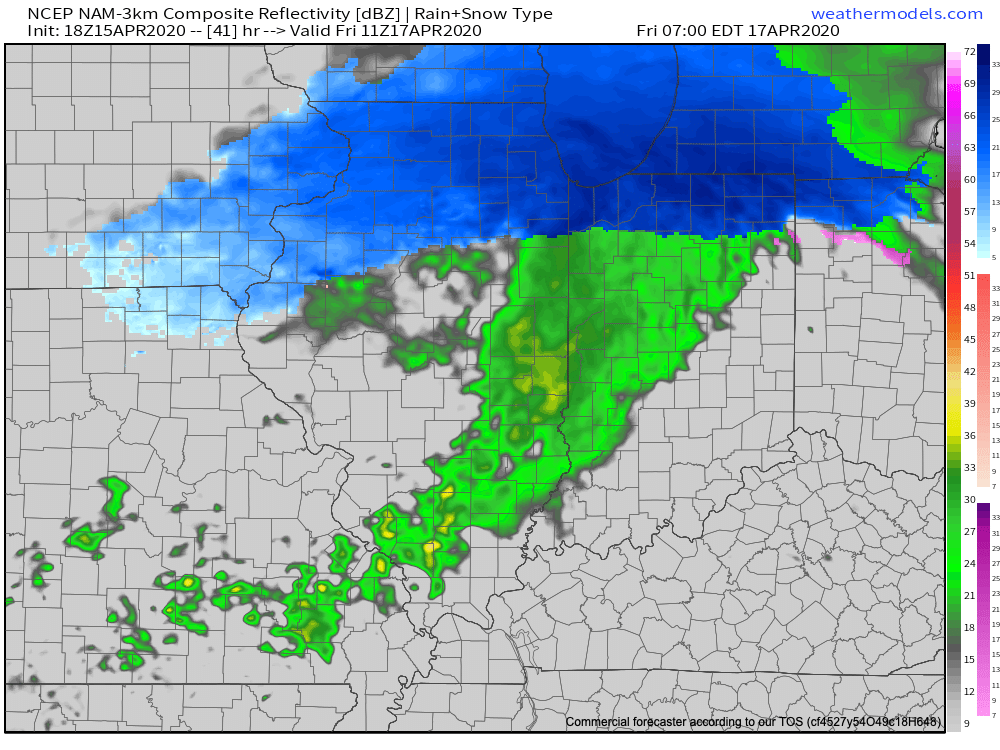
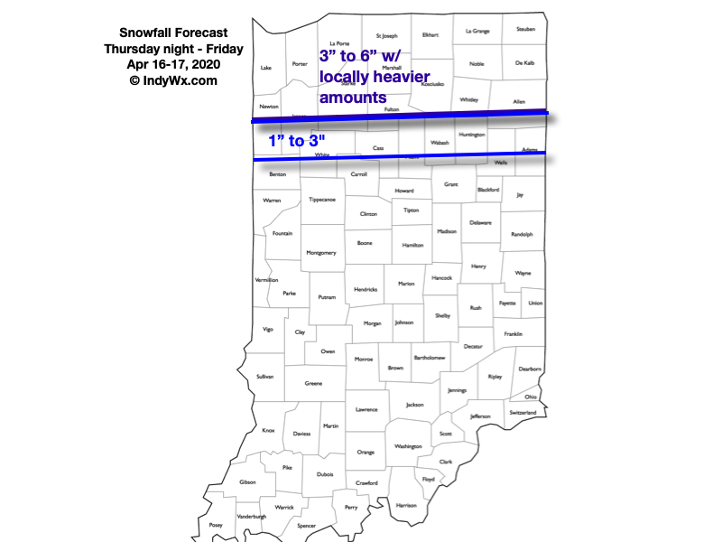
The snow will begin to diminish from west to east during the late morning and into the early afternoon Friday, but not before dumping several inches on the region. Our updated snowfall forecast is below. We’ll be back early in the morning with a fresh video update. Have a relaxing evening!
Leave a Reply