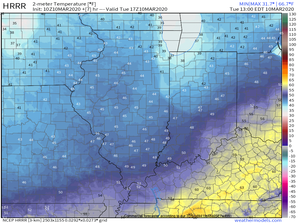
Before we get into the longer range weather pattern, rain this morning has been locally heavy in spots. Moving forward today, that rain will push east of the state and we’ll turn cooler. Temperatures will settle into the middle to upper 40s this afternoon across central Indiana.
Another couple of weak systems will scoot through the area as we push through the remainder of the work week. The first, tomorrow, will impact areas primarily to our north, however, a cold front will sweep through the state Thursday night and early Friday with light rain and an abrupt wind shift to the northwest. Rainfall amounts with the passage of this cold front should average only between a trace and 0.05″.
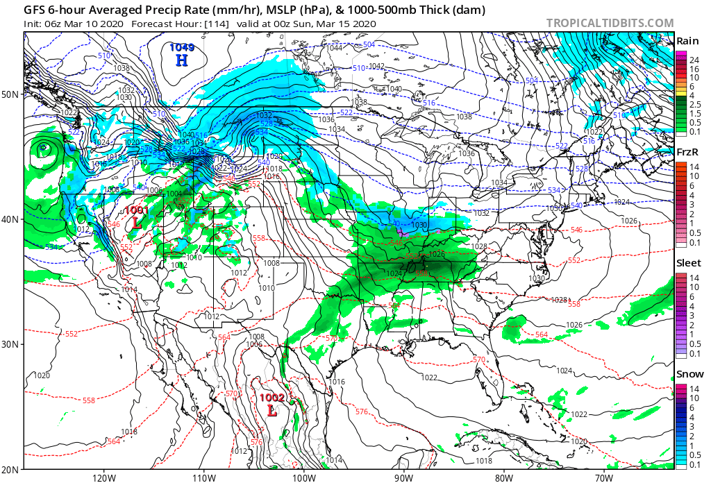
A third system will push east across the TN Valley Saturday into early Sunday. With marginally cold air in place across the Ohio Valley, precipitation may transition to wet snow or a mix of rain and snow along the I-70 corridor during this time frame. The northward extent of the precipitation shield is in question and we’ll have to keep a close eye on this system over the next couple of days.
As we look longer term, a tight thermal gradient is expected to setup shop across our region. This will force a cold pattern across the west with eastern seaboard warmth. We’ll be in that “back and forth” battle zone of sorts, locally.
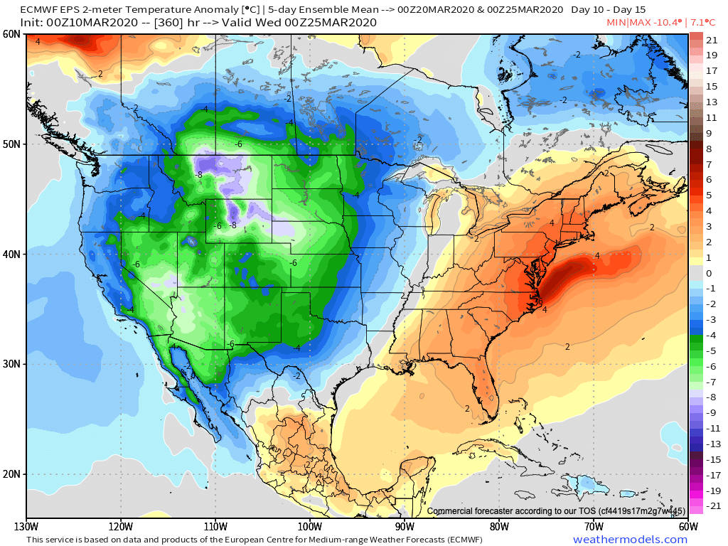
What this will also do is help assist in a hyper storm track through the MS River Valley and Ohio Valley. Above to well above average precipitation is expected during the middle and latter part of March across our region.

Unfortunately, local landscaping companies, turf management, farmers, and others with ag interests are likely to experience delays as we move through the 2nd half of March and into early April.
Leave a Reply