After a relatively quieter stretch of weather as of late, all signals ahead point towards an increasingly busy time of things over the upcoming couple of weeks. After (2) systems that will track in more of west-east fashion across the Ohio Valley during the 1st half of next week, the mean storm track will shift towards one that features low pressure systems moving out of the south-central Plains into the western Great Lakes thereafter.
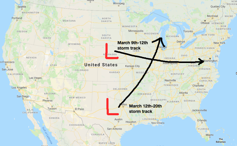
What this will do is replace a couple of systems (the mid-week one likely to still dish out wintry precipitation across the northern Ohio Valley/ Great Lakes region) during the first half of next week that feature cooler air and lighter rain with a more traditional spring flavor. The storm systems that impact our area during the mid-March time period will include heavier rain potential, along with warmer/ more humid air and the risk of stronger storms.
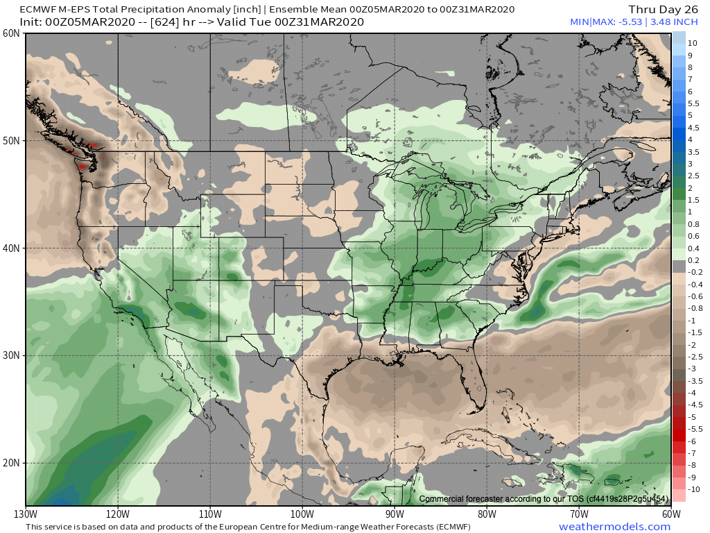
Just in the next 2 weeks, we count a total of (5) storm systems that will impact the region. In the face of what the latest JMA Weeklies were trying to suggest around drier conditions, it appears as if our wet March forecast will play out nicely.

Note the longer range computer model guidance from the GEFS and European Weeklies also see the wet anomalies greatest through an area that includes the Ohio Valley.

We’ll also have to begin paying attention to the potential of increased severe weather threats into the Ohio Valley with the expected mid-March storm track.
In the short-term, if you can deal with today’s snow and wintry feel, a gorgeous weekend is dialed up, including plentiful sunshine and quickly moderating temperatures (low 50s Saturday and low 60s Sunday).
More later!
Leave a Reply