Relatively quiet weather will be with us through the 1st half of the work week and this will allow us to focus on what’s coming down the road. A complex system will begin to impact central Indiana Thursday night or Friday morning and continue through the day Saturday.
What initially began to tip us off to this potential had to do with the positive (upper ridge) over Hudson Bay. That’s still the case this morning, but now modeling is better able to see the associate storm threat “underneath.”
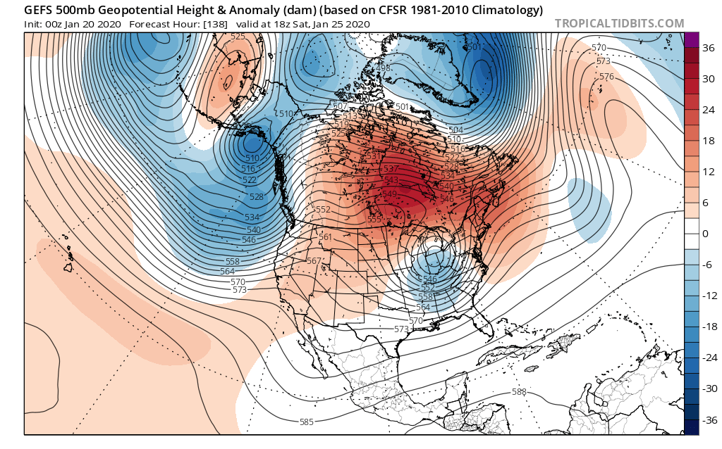
The question now has to do with how organized this feature is. Should it get it’s act together, this is the type pattern that an associated storm should be able to spread heavy, wet snow from the central Plains, Ohio Valley, and into the Mid-Atlantic and Northeast (even with marginally cold air available).
There’s also the possibility the system doesn’t organize until it reaches the Mid-Atlantic region. If that’s the case, we’re only looking at mixed rain and snow showers in the Friday-Saturday time period (light rainfall amounts and little, if any, snow accumulation).
It’s a complex pattern that will require close attention over the next few days. Stay tuned. A more in-depth video update will arrive this evening.
Leave a Reply