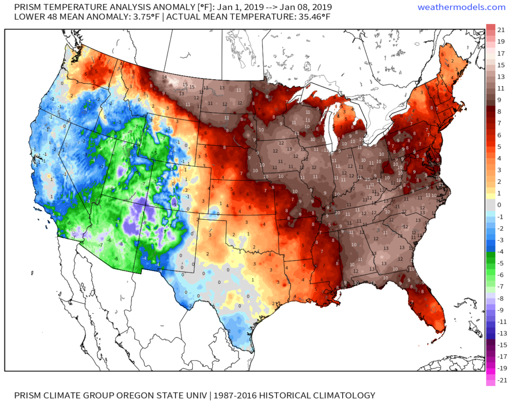
With a full week now in the books, January has opened much warmer than average from the northern Plains into the eastern portion of the country. Widespread anomalies of 10° to 15° above average dominate from the northern Plains into the Southeast.
However, behind the scenes, significant changes are afoot that will likely deliver a drastically different weather pattern into the Lower 48 around and after the 20th. (Next week will begin the colder transition, but it’s not until the 20th and beyond we think the cold has more staying power).
You know we’ve put all of our eggs in the MJO/ EPO basket through at least mid-February. After that point, it’ll be prudent to additionally pay attention to the NAO and AO.
We note the MJO is set to rumble out of the warm phases and towards much colder phases around and after the middle part of the month. The amplitude of this movement suggests a rather rude shock may await…
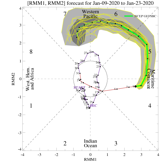
Phase 5 is, obviously, a blow torch across the East, but things begin to trend colder through Phase 6 and more substantially so by Phase 7.

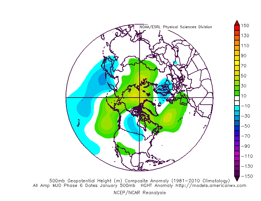
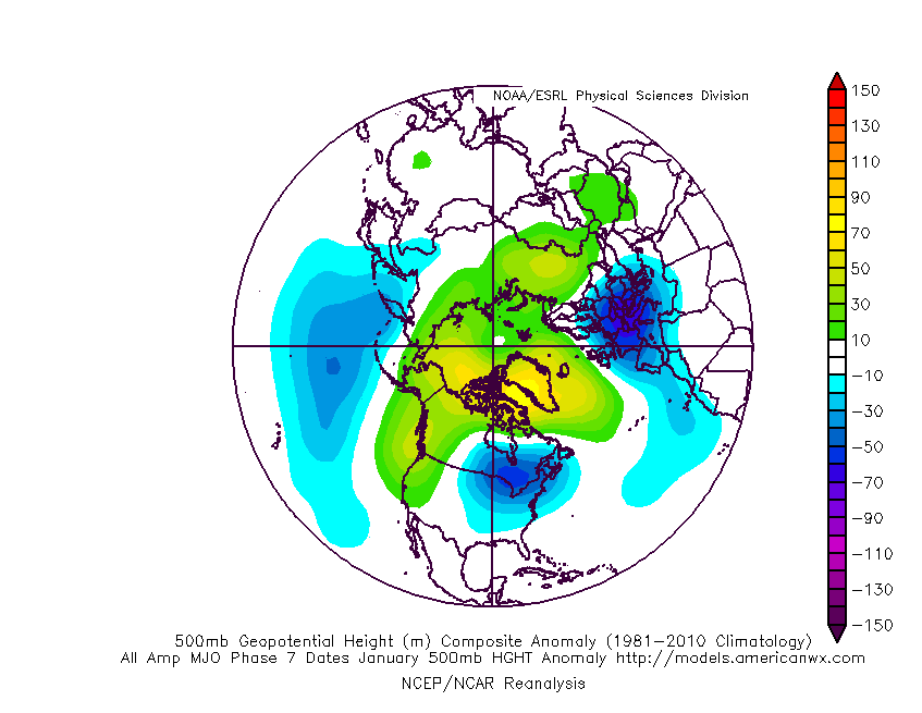
On the composites above, note the way high latitude blocking gets established and matures during the transition through Phase 6-7.
(There are reasons to believe this amplitude will continue, taking things into Phases 8,1, and 2 as we close January and head into February). Just for fun, here’s what Phase 8 should produce:

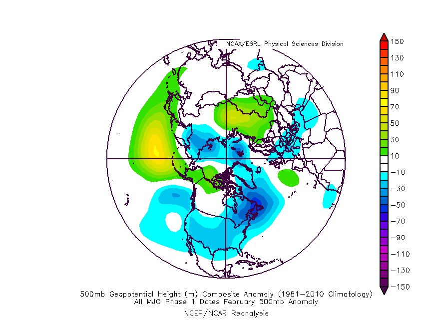
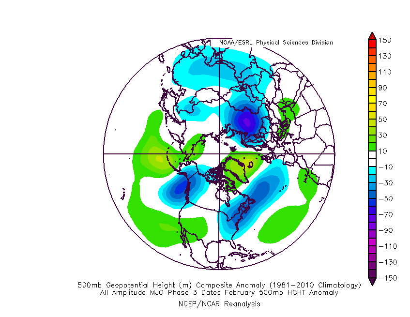
A large part of the reason behind thinking winter “locks-in” has to do with what we think will likely be the MJO making a trip through Phases 1,2, and 3 as we open February.
For those interested in the 500mb pattern through those phases (during the month of February), here you go:

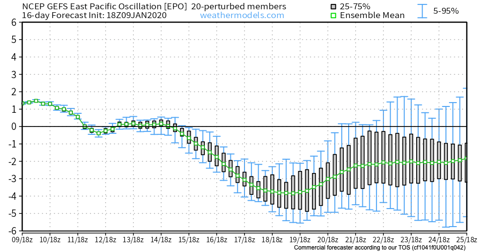
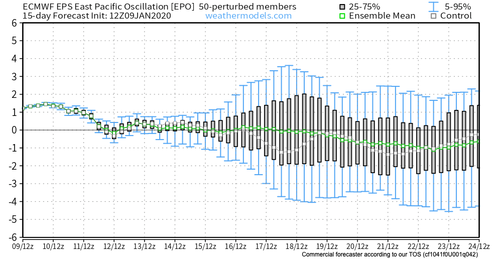
It’s not just the MJO that’s set to push winter back into the region, but the EPO, as well. Note the GEFS and EPS in good agreement developing a negative EPO as we push past the middle of January:
One can argue as to the drivers behind what we think will be a colder (and eventually significantly so) shift in the pattern, but a big reason in our minds has to do with the sea surface temperature (SST) configuration. As the winter pattern matures, we think it really was only a matter of time before the analog research (from way back in the summer) began to pay off.

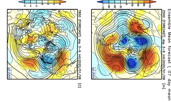
Out of all of the various modeling out there, I think the JMA Weeklies show how things will likely play out best over the next 2-3 weeks. Note the significant changes between this week (image 1) and the Weeks 3-4 (image 2) time period. Cold is set to begin overwhelming the pattern, but with what should still be an active storm track with resistance from the southeast ridge. This would lead to a continued active pattern with the expanding cold.

Fun times ahead. Stay tuned…
Leave a Reply