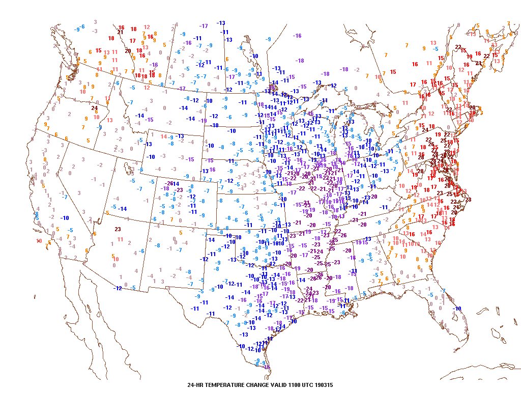
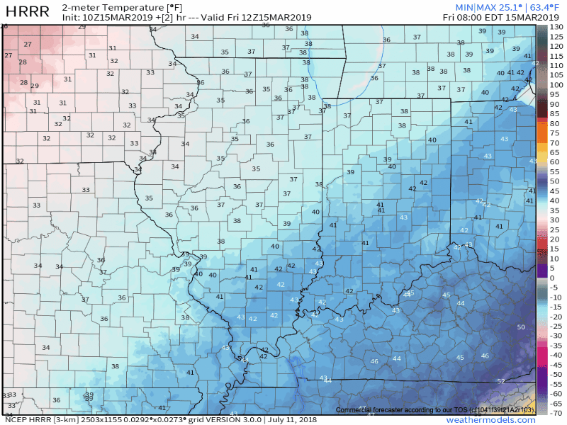
Out the door, it feels much colder when compared to this time yesterday.
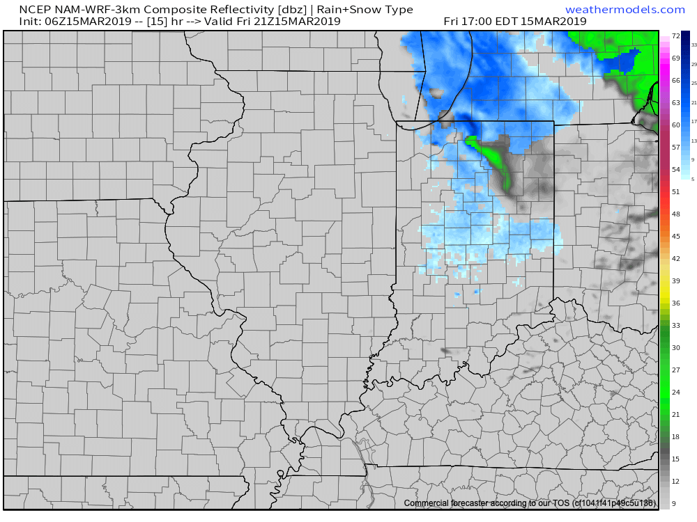
Temperatures will continue to fall through the day today, and eventually turn cold enough for a little wet snow to mix with the leftover showers this afternoon- especially from the city and points north.
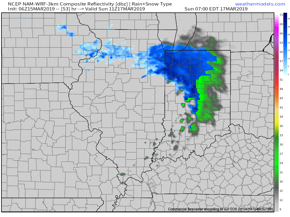
Looking ahead, after a dry Saturday, an upper level disturbance will dive southeast and lead to a mixture of rain and snow across the northern half of the state. Across northern Indiana, mostly snow is expected- where a light, slushy accumulation is possible.
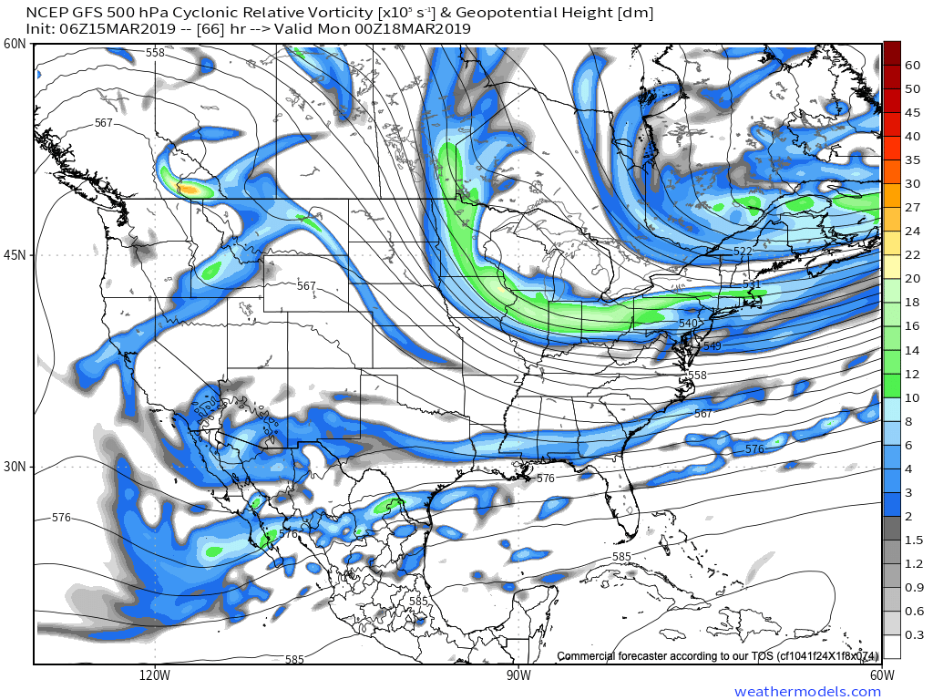
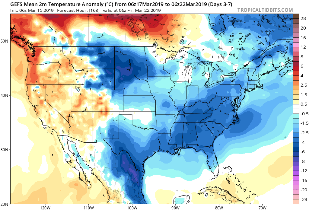
Thereafter, high pressure will build in for early portions of the new week, supplying dry and chilly conditions.
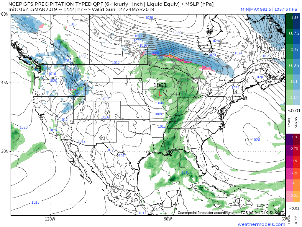
It’s not until late next weekend when the next weather system of significance begins to impact the region with rain.
Overall, the upcoming (7) days will run cooler than average and drier than average for a large portion of the region from the Northern Plains into the eastern portion of the country. After the “bumpy” past few days, we’ll certainly enjoy the overall calmer period.
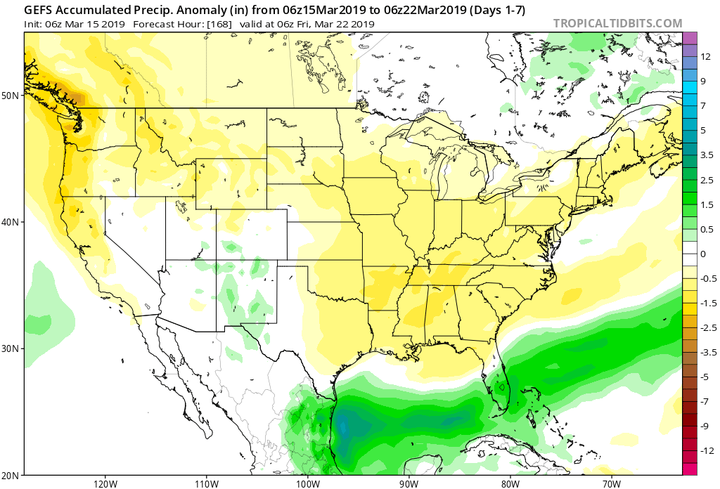
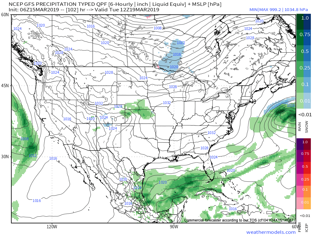
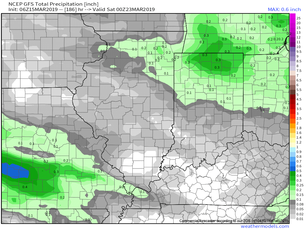
7-day precipitation numbers are paltry to say the least (on average only expecting around 1/10 of an inch of liquid for central Indiana). Most of what’s painted below is what is expected to fall with this Sunday’s system.
Leave a Reply