Type: Accumulating Snow
What: Accumulating snow
When: Thursday afternoon into Friday morning
Temperatures: Upper 20s to near 30
Wind: E 5-10 MPH
Blowing/ Drifting: Non-existent to minimal
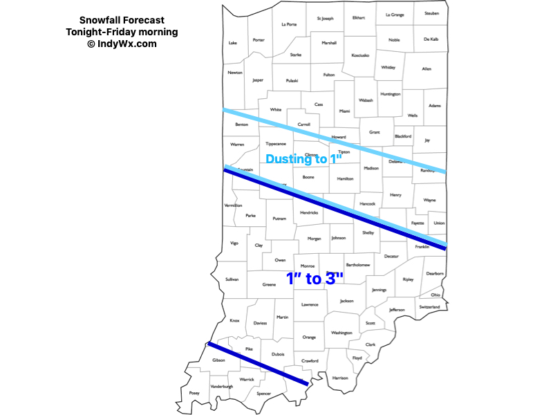
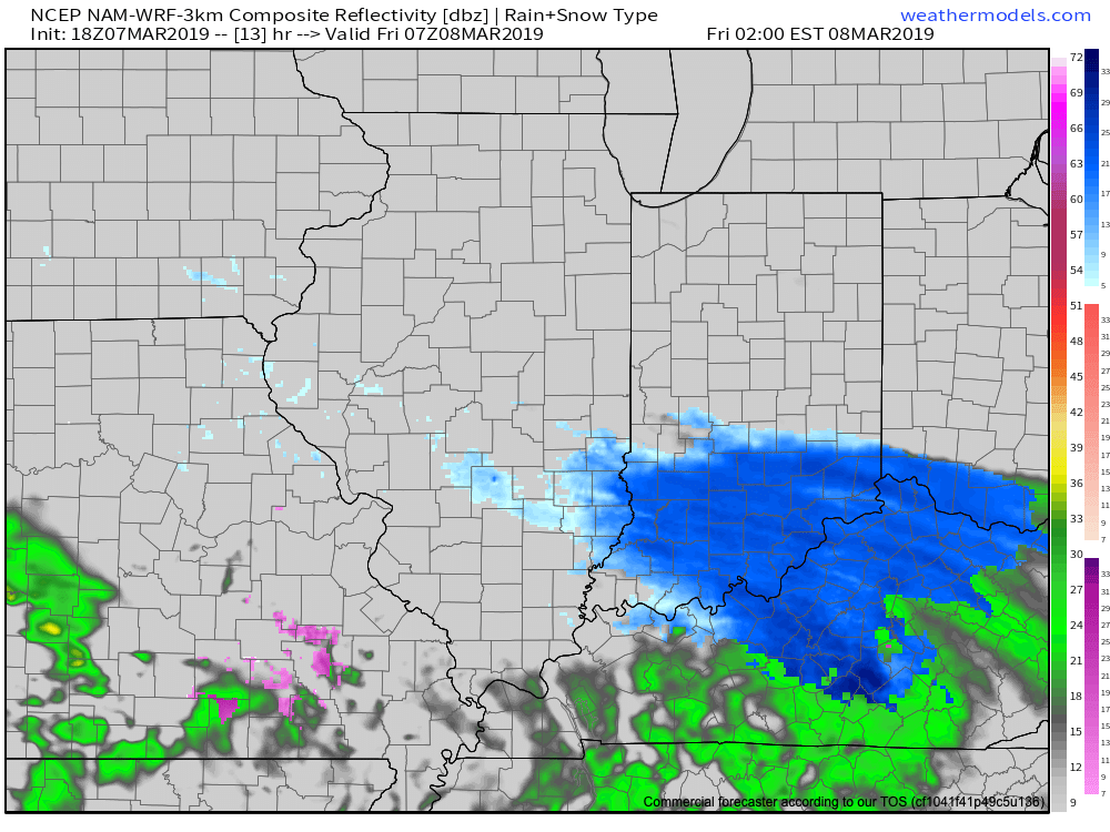
Computer guidance has continued to shift the swath of 1″ to 3″ of snow south over the past 12 hours. Accordingly, we’ve shifted things south about 3-4 county rows with our updated snowfall forecast this evening. The steadiest snowfall will occur during the overnight hours into the predawn Friday. For places around Indianapolis and points north, this won’t be a significant event, however, if your travels take you south, roadways are expected to become slick and hazardous tonight into Friday morning. Improving conditions will develop by late morning into Friday afternoon as temperatures “warm” above the freezing mark. Highs tomorrow will top out in the upper 30s to lower 40s with significant melting expected by afternoon.
Confidence: High
(We’ll have our updated long range forecast online later tonight).
Leave a Reply