Brief: Accumulating Snow
Forecaster: McMillan
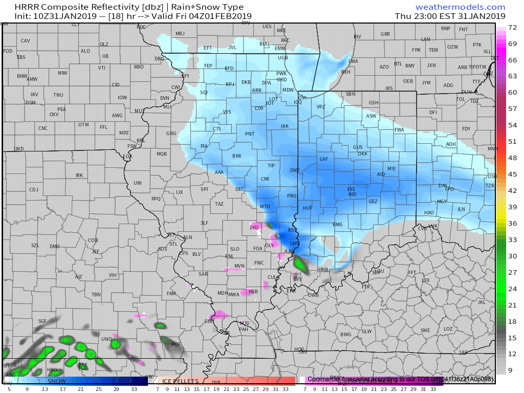
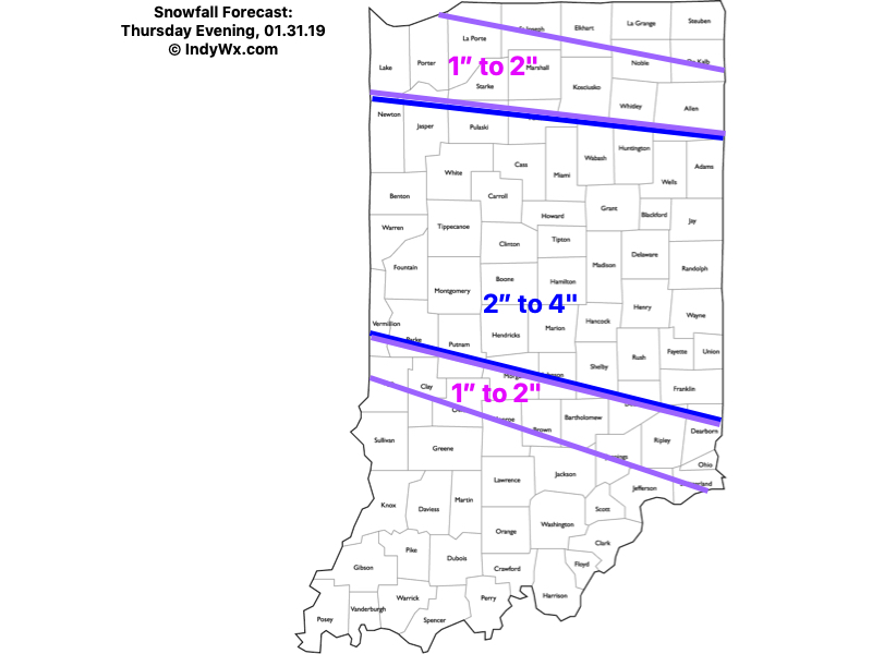
What: Accumulating snow
When: This evening into the predawn hours Friday
Temperatures: 15 to 18 F
Wind: ESE 5-15 MPH
Blowing/ drifting: Minimal
Attention will shift from the dangerous cold to an accumulating snow event across central and north-central Indiana this evening into the predawn hours Friday. We expect snow to begin reaching the surface (may take a little longer than models suggest due to the dry air in place initially) in western portions of the viewing area between 6p-7p and into central Indiana between 8p and 9p. Heaviest snow still looks to fall during the hours of 10p and 3a. Banding may result in periods of moderate to heavy snow during this time frame. Light snow will be ongoing across southeast Indiana around 7a Friday before departing the state shortly thereafter.
Confidence: High
Next Update: 6:30p Thursday
Leave a Reply