Meteorological fall begins Saturday, but Mother Nature has other plans in store as we move through the next 2-3 weeks. If you’re a fan of summer, you’ll like what’s in store, as a dominant eastern ridge grabs the headlines. Sure, the “axis” of the ridge will retrograde Week 2, but the pattern will likely remain significantly warmer than average through the first couple weeks of September, overall.
Both the GEFS (courtesy of Tropicaltidbits.com) and EPS (courtesy of weathermodels.com) show the overall warm pattern as we approach mid-September.
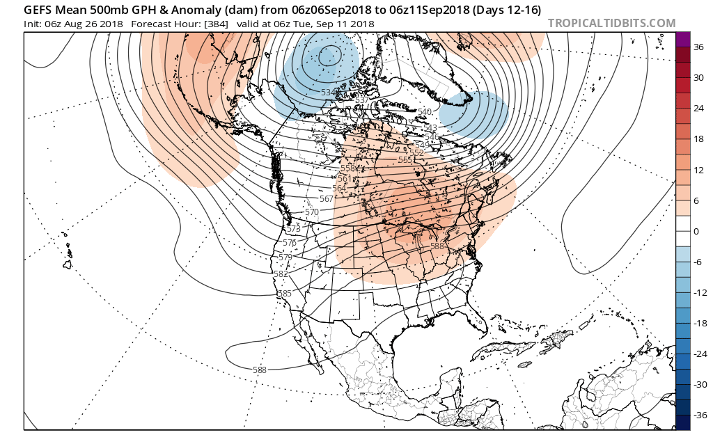
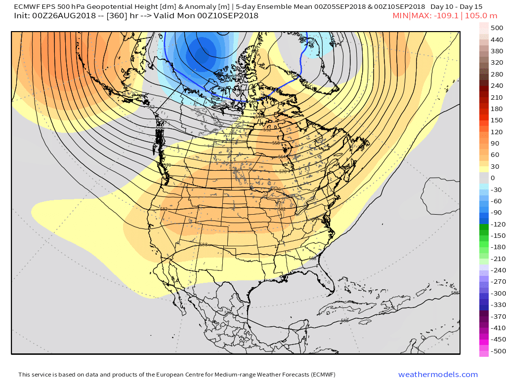 Averages begin to fall in more significant fashion as we transition through the month of September. More specifically, average high temperatures of 83° on the 1st fall to 78° on the 15th. Given the looks of the pattern, highs in the mid to upper 80s (and perhaps a couple of 90° days) will likely be common through the first couple weeks of the new month. Overnight lows will remain oppressive, as well.
If you’re longing for cooler, more fall-like, air, hang in there. Pattern drivers are likely to become more conducive for increasingly refreshing times around these parts as mid-September approaches.
PS: Can you believe we’re only (5) days away from the return of college football?! That alone will help us traverse the next couple weeks of warmer times.
Leave a Reply