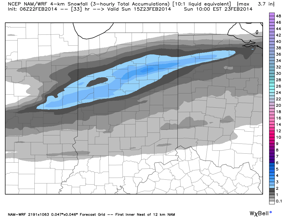
Latest high resolution data overnight suggests we focus our attention from Indianapolis and points north for tonight’s light snow event. Before that, be sure to get out today and enjoy the sunshine and one last day of relative warmth as highs zoom close to 50 for many throughout central Indiana on a gusty southwest wind this afternoon.
Light rain moves in this evening- initially around 6-7 for north-central Indiana, but may not reach the city, itself, until mid to late evening (more like 8 to 9 o’clock). Rain will then mix with and change to snow (from north to south) during the overnight. Our official accumulation idea looks very much like the latest high resolution NAM model.
Specific snowfall forecasts from a few select locations for tonight into early Sunday:
- Indianapolis: 0.50-1″
- Northern ‘burbs (Zionsville, Carmel, Westfield): 1″-1.5″
- Lafayette: 2-3″
In other words, this isn’t anticipated to be a huge snow event by any means. That said, we’ll keep a close eye on things as we fine tune the timing between the arrival of the cold air and departure of precipitation tonight. We’ll fine tune later this evening if needed.
Enjoy your Saturday!

