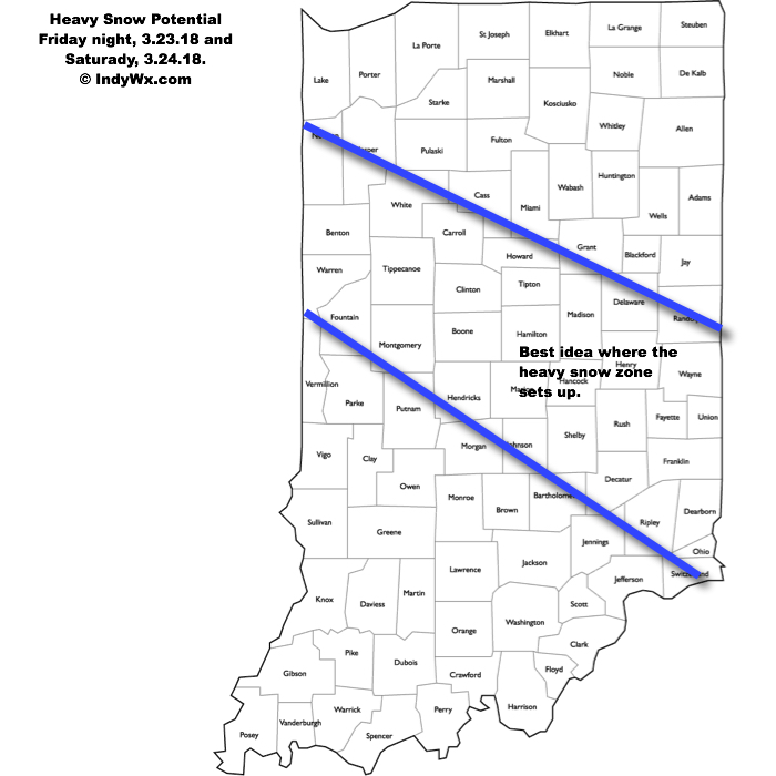
A significant winter storm will impact the heart of the state Friday night into Saturday evening. The National Weather Service has already hoisted Winter Storm Watches, and for good reason, as significant impacts are expected from this system, including in and around the Indianapolis area.
An area of low pressure will track off the lee of the Rockies Friday morning, central Plains Friday afternoon, and southeastern Illinois Saturday morning. A tight thermal gradient will result in temperatures into the lower 70s just to the south of the track, while areas north of the low remain around freezing, including central Indiana. This gradient will also support banding features and incredibly heavy snowfall rates late Friday night and Saturday within the heavy snow zone. Snowfall rates of 1″ to 2″ per hour are possible, leading to very difficult travel Saturday, and total accumulations in the range of 6″ to 10″. Add in a gusty wind over 30 MPH and you have the makings for a day that’s best served off the roads and indoors Saturday.

Just south of where the heaviest band of snow sets up, a period of sleet and freezing rain is also possible before a cold rain falls far downstate. Precipitation will end from northwest to southeast Saturday night and the weekend will wrap up dry Sunday- when the heart of the state will be digging out from a significant snow event. We’ll continue to keep a close eye on things.
