While we continue to believe more of a wholesale pattern change awaits early-mid April, we still have a long way to go before we can shake the overall wintry pattern. When the pattern does flip, the potential is certainly there (as alluded to last weekend) for a rather “turbulent” time, including an uptick on the severe front.
Before we get to April, we still have a prolonged period of overall colder than normal conditions to deal with. We don’t have any changes to the idea the northern Plains are ground-zero for coldest anomalies, but, it’ll also be plenty chilly, locally, as well.
 A couple of storm systems continue to have our attention over the upcoming week:
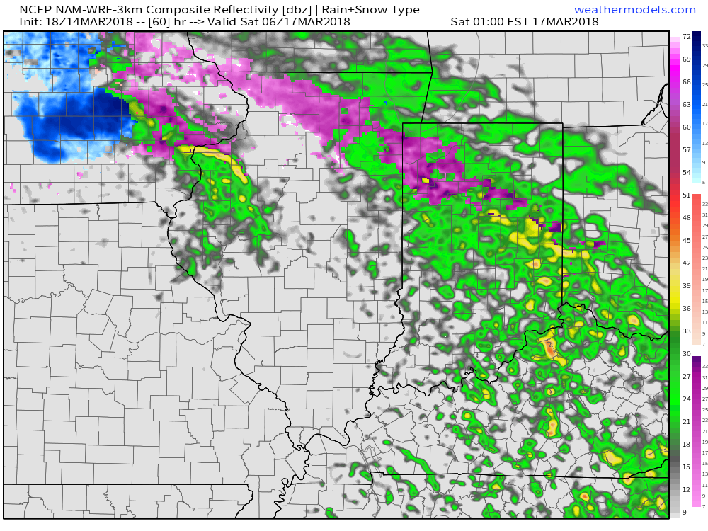
Potential of freezing rain, especially across the northern half and northeastern parts of the state Friday night into the morning hours Saturday.
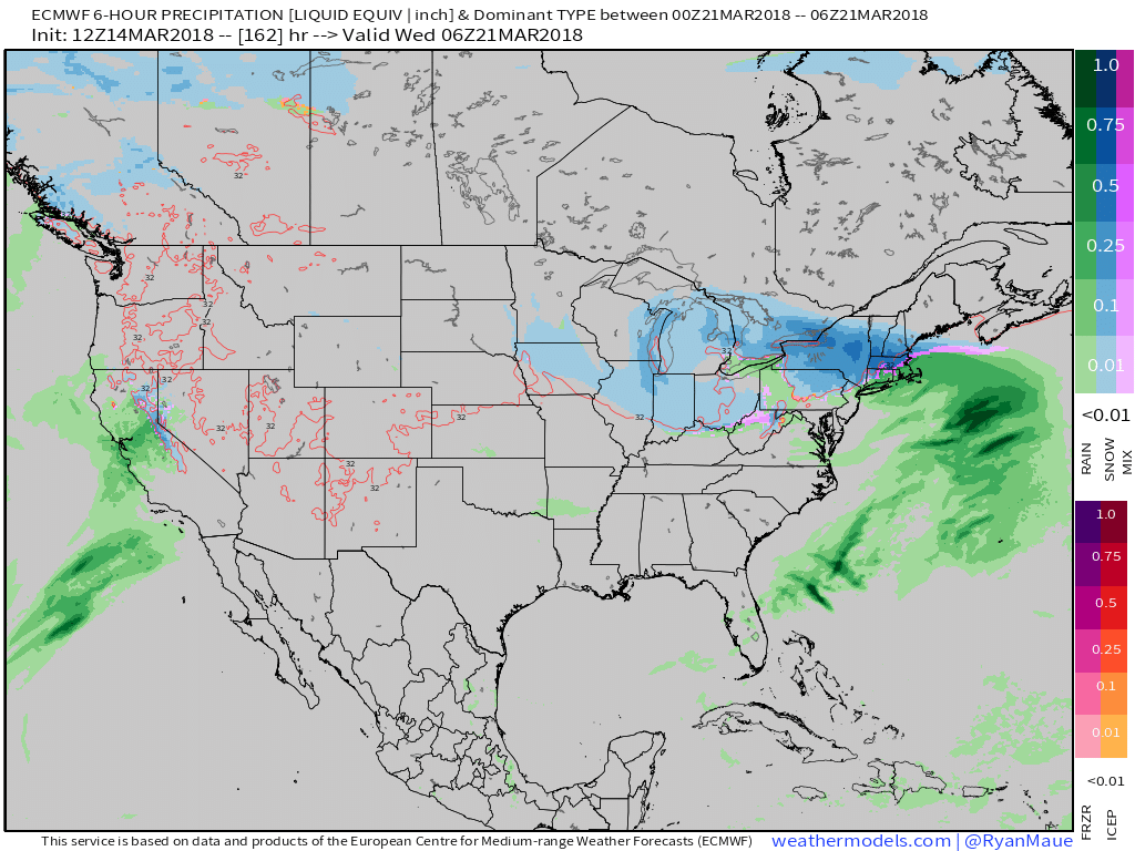
Secondly, rain arriving on the scene Monday that will transition to wet snow Tuesday into Wednesday morning, as illustrated by the European model below.
 From this distance, neither storms seem to be a “big deal” for central Indiana. However, we know March storms can “surprise.” Just ask our friends across KY earlier this week. 🙂 Spring warmth attacking south of systems combined with unusually cold air, associated with the blocking, just to our north can lead to all sorts of fun and models may have to play catch up last minute in some areas. At the very least, we recommend keeping an eye on the forecast over the next week, or so.
On a more positive note, it still looks like we’ll enjoy plentiful sunshine tomorrow and after a raw, damp start to our St. Patrick’s Day, drier times should win out Saturday afternoon into Sunday.
Much more later!
Leave a Reply