Updated 03.05.24 @ 7:53a
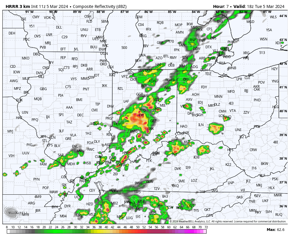
We’ve had a few storms north of the city, itself, early this morning, but for the bulk of the I-70 corridor, things are just now starting to get “busy.” Anticipate rain and storm coverage to continue to expand and grow heavier through the late morning into early afternoon before diminishing.

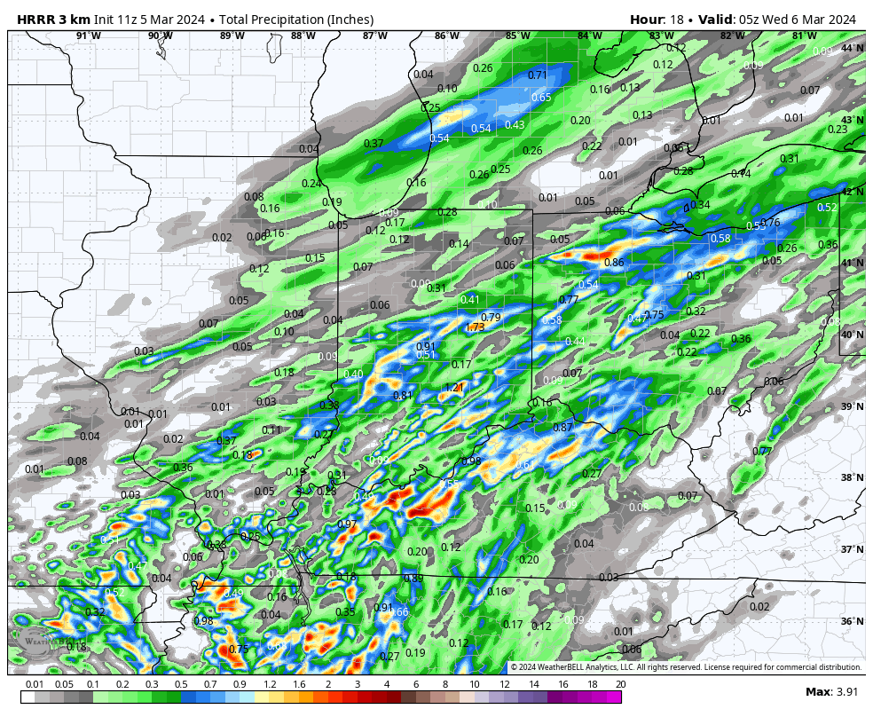
Rainfall totals of 0.25” to 0.75” will be most common with a few localized 1”+ reports. Rain and storm coverage will diminish through the afternoon and evening hours across the region.

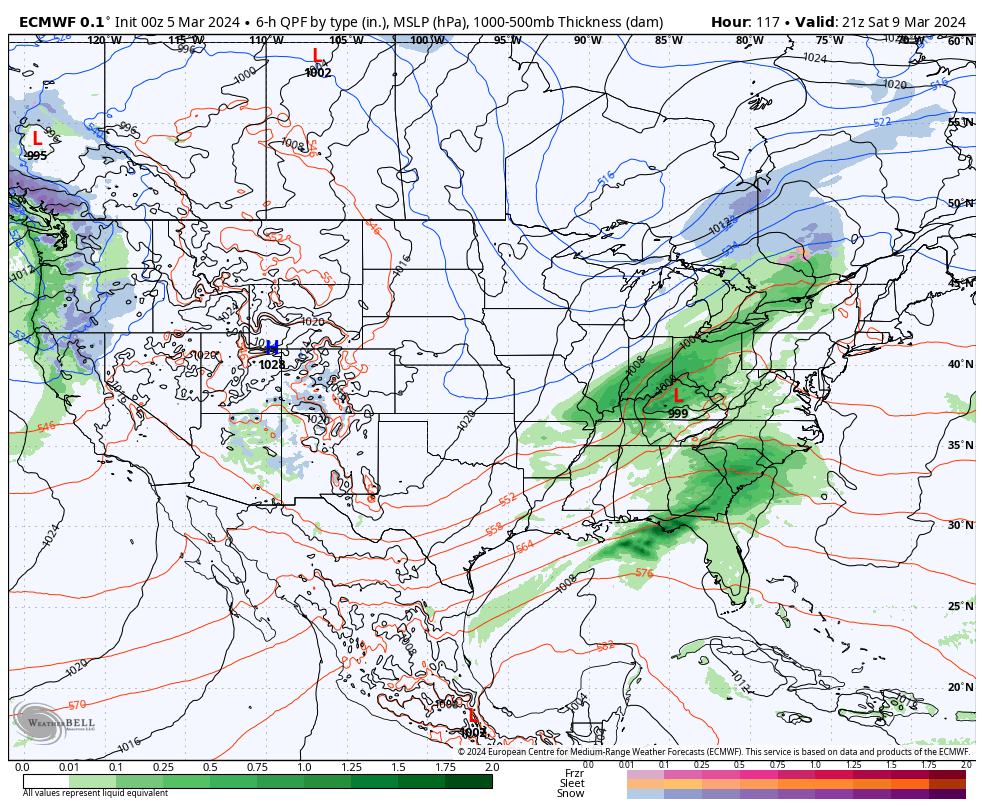
High pressure will briefly build into the region midweek, allowing for drying skies and pleasant early-March conditions. Enjoy, as another storm system will deliver a round of rain and embedded thunder Friday PM and Saturday.

We turn briefly colder Sunday (and windy) but by Monday, the next warm-up is already scheduled to be well underway. This is just another instance of a brief chilly blast without any legs.
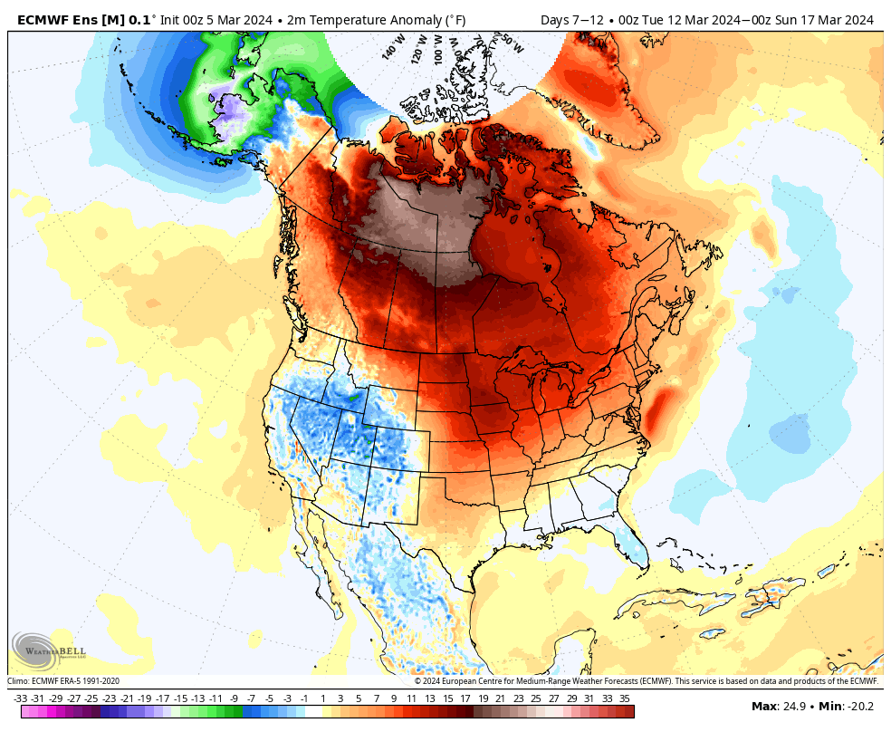
Speaking of cold, while there does remain a window of opportunity for a below normal regime to develop very late March and early April (if we can finally get the MJO to slide over into the colder phases), the short to medium term is still void of any sort of chill, at least for more than a day or 2 behind passing storms. Note the Week 2 ensemble data is still much warmer than normal for our neck of the woods. – A direct byproduct of the MJO rumbling through those classic warm phases.

