Updated 06.13.23 @ 7:42a
You must be logged in to view this content. Click Here to become a member of IndyWX.com for full access. Already a member of IndyWx.com All-Access? Log-in here.

Jun 13
Updated 06.13.23 @ 7:42a
You must be logged in to view this content. Click Here to become a member of IndyWX.com for full access. Already a member of IndyWx.com All-Access? Log-in here.
Permanent link to this article: https://indywx.com/2023/06/13/video-rainy-afternoon-and-evening-active-close-to-june/
Jun 12
Updated 06.12.23 @ 5:15a
You must be logged in to view this content. Click Here to become a member of IndyWX.com for full access. Already a member of IndyWx.com All-Access? Log-in here.
Permanent link to this article: https://indywx.com/2023/06/12/video-changeable-weather-through-the-new-week/
Jun 11
Updated 06.11.23 @ 10:14a
You must be logged in to view this content. Click Here to become a member of IndyWX.com for full access. Already a member of IndyWx.com All-Access? Log-in here.
Permanent link to this article: https://indywx.com/2023/06/11/video-good-riddance-boring-weather-pattern/
Jun 10
Updated 06.10.23 @ 7:14a
Today is easy. Despite some lingering haze, sunshine will be with us for the better part of the day along with unseasonably pleasant humidity levels. Highs will top out in the middle 80s for most of central Indiana.
Things begin to change overnight as moisture levels rise. For instance, about the time most head off to bed, dew points will still be quite low for this time of year (low 50s), but as we head through the morning and on into the afternoon Sunday, dew points will rise into the muggy 60s. This is all thanks to a surface area of low pressure and associated cold front. These 2 features will deliver the best opportunity for a widespread, soaking rain we’ve seen around these parts in close to 2 months.
We think rain showers early Sunday morning congeal into a more widespread, area-wide rain with embedded thunder late morning into the afternoon and evening hours.
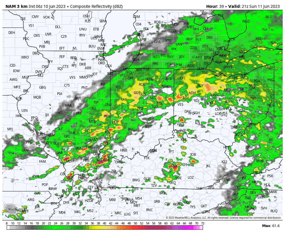
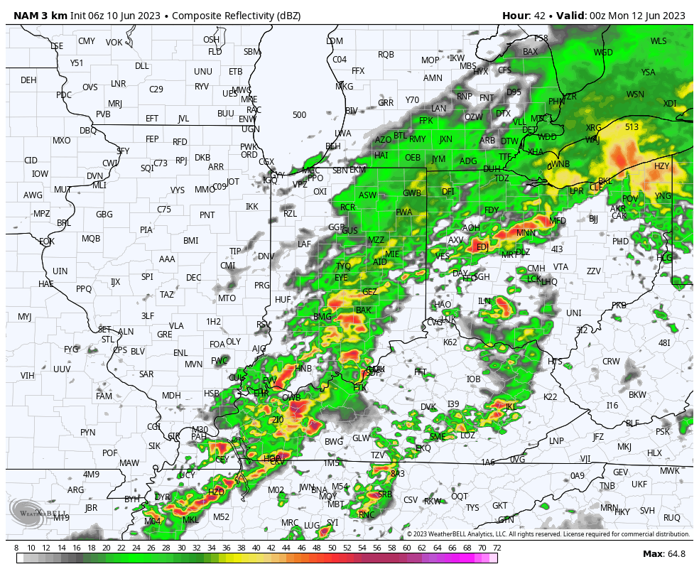
There will also be an opportunity of some stronger storms downstate during this time period.
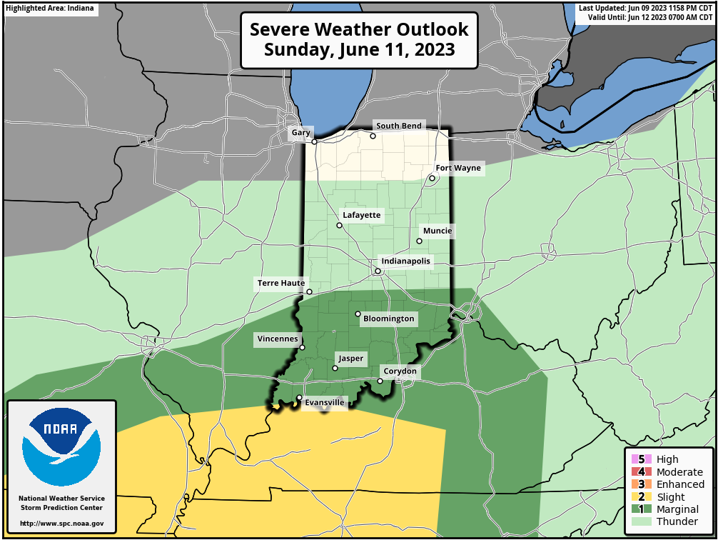
Rain will end from west to east late Sunday evening into the overnight hours and we’ll be left with an unseasonably cool but dry Monday. By that point, most area rain gauges can expect to pick up between 0.50″ and 1.00″ of badly needed rain, but there will be a few “winners” with amounts well in excess of 1″. Despite the timing of this occurring during the weekend, I don’t suspect we’ll hear many complaints…

More on the week ahead a bit later today in our updated client video discussion.
Permanent link to this article: https://indywx.com/2023/06/10/nice-saturday-gives-way-to-a-wet-and-stormy-sunday/
Jun 09
Updated 06.09.23 @ 5a
You must be logged in to view this content. Click Here to become a member of IndyWX.com for full access. Already a member of IndyWx.com All-Access? Log-in here.
Permanent link to this article: https://indywx.com/2023/06/09/lr-update-pattern-poised-for-a-changeable-2nd-half-of-june-open-to-july/
Jun 08
Updated 06.08.23 @ 6:22p
Many areas across immediate central Indiana are running anywhere from 4” to 7” below normal rainfall since April 1st. Despite a few localized “splash and dash” events it’s been a dry and uneventful time of things in the good ole weather department. Thankfully, it still appears as if this upcoming weekend, namely Sunday into Monday morning, will offer up the best opportunity we’ve seen for a more widespread rain of 0.25” to 1” (localized heavier amounts) in quite some time. We note both the GFS and European are in relatively good agreement.
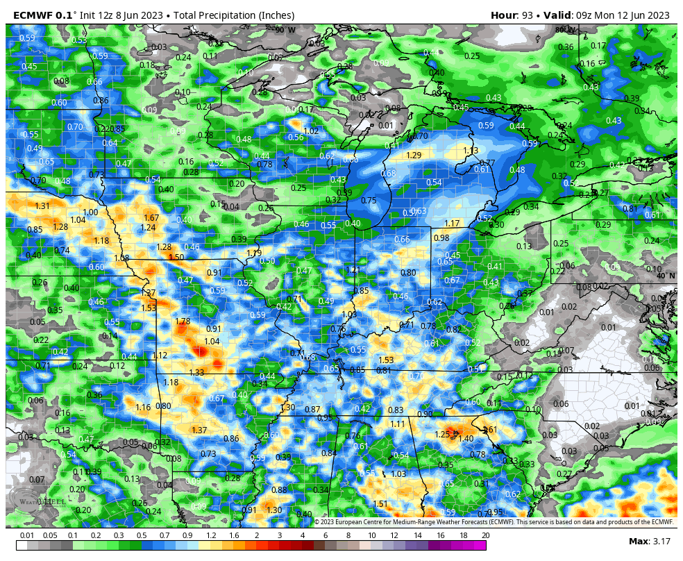
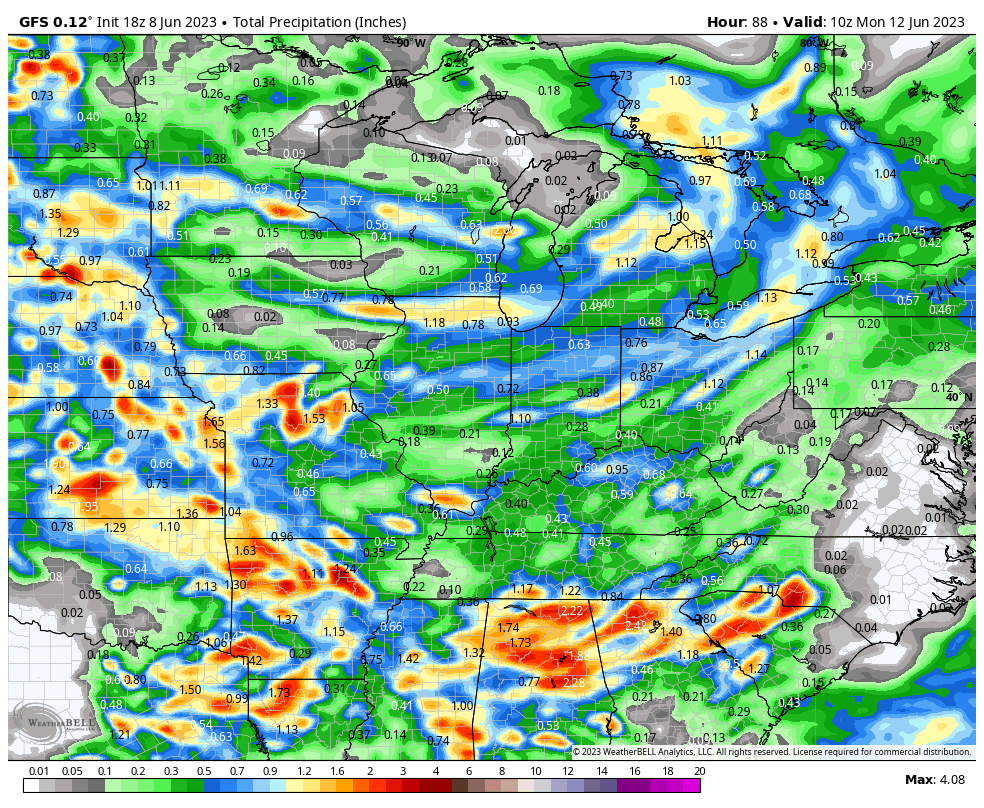
Most widespread rain should fall Sunday afternoon and overnight. At least it’s a start to what should be a more active 2nd half of June. Much more in the AM around this and the longer range pattern that includes early July.
Permanent link to this article: https://indywx.com/2023/06/08/at-least-its-a-start/
Jun 07
Updated 06.07.23 @ 5:58a
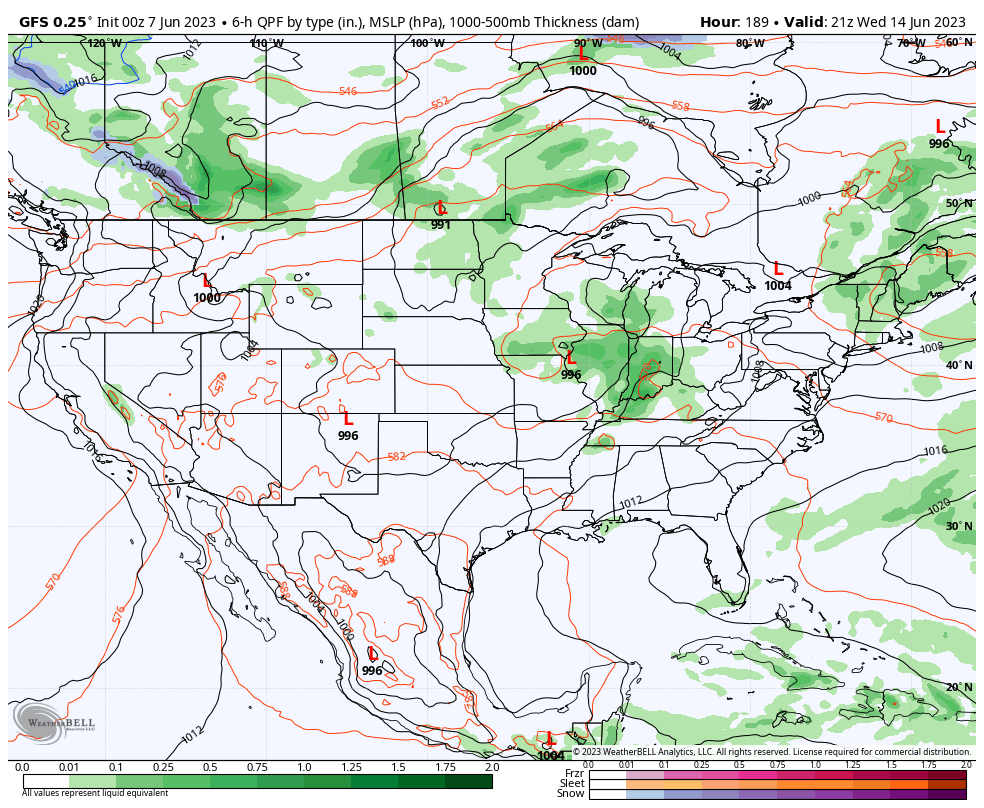
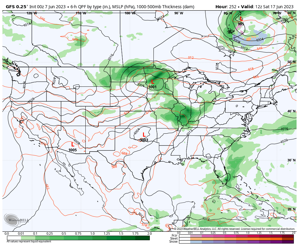
While some backyards have been lucky enough to cash in on downpours over the past several weeks, the large majority of our region has suffered through a dry, to much drier than average, period. Thankfully, the evolving pattern over the next couple weeks will begin to provide much better opportunities of more widespread, organized rain. While still not yet considered a truly “wet” pattern (remember, we believe that kicks in mid to late summer), it certainly will be much more active than what we’ve seen over the past 4-6 weeks, overall.
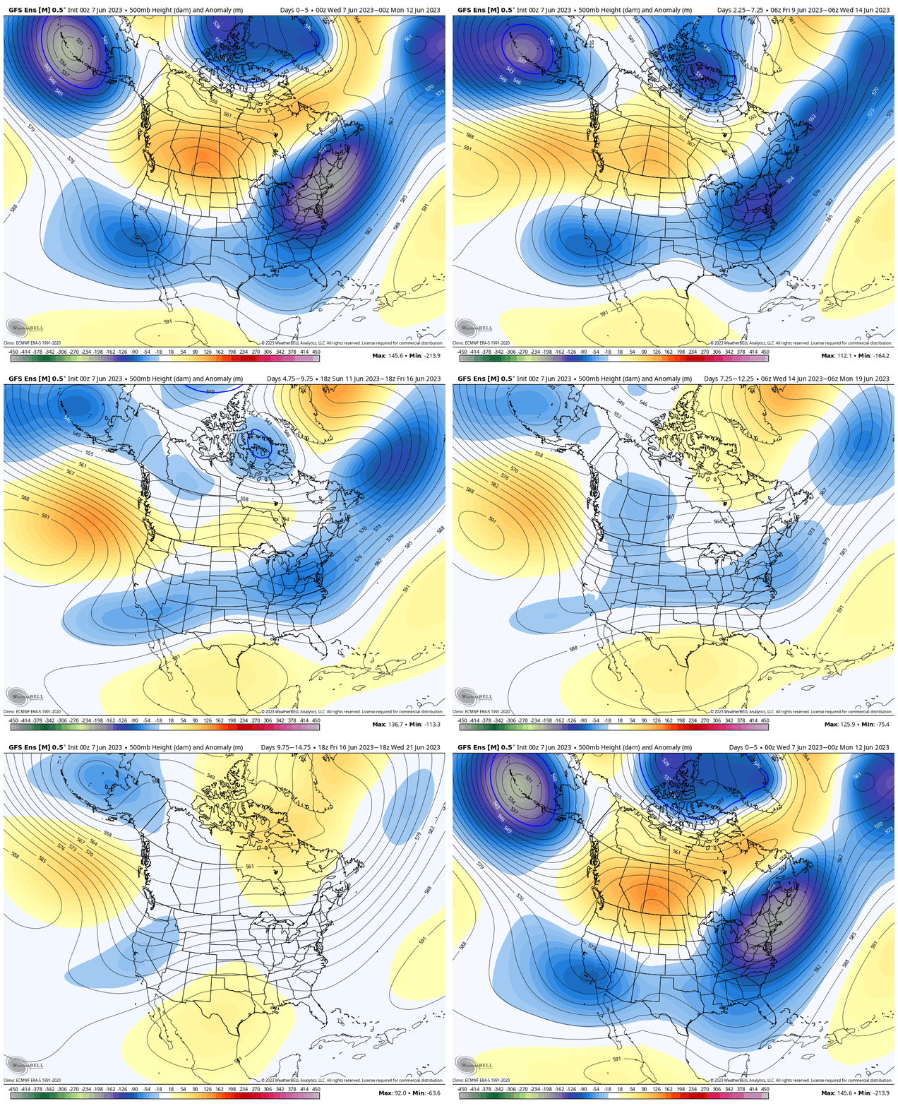
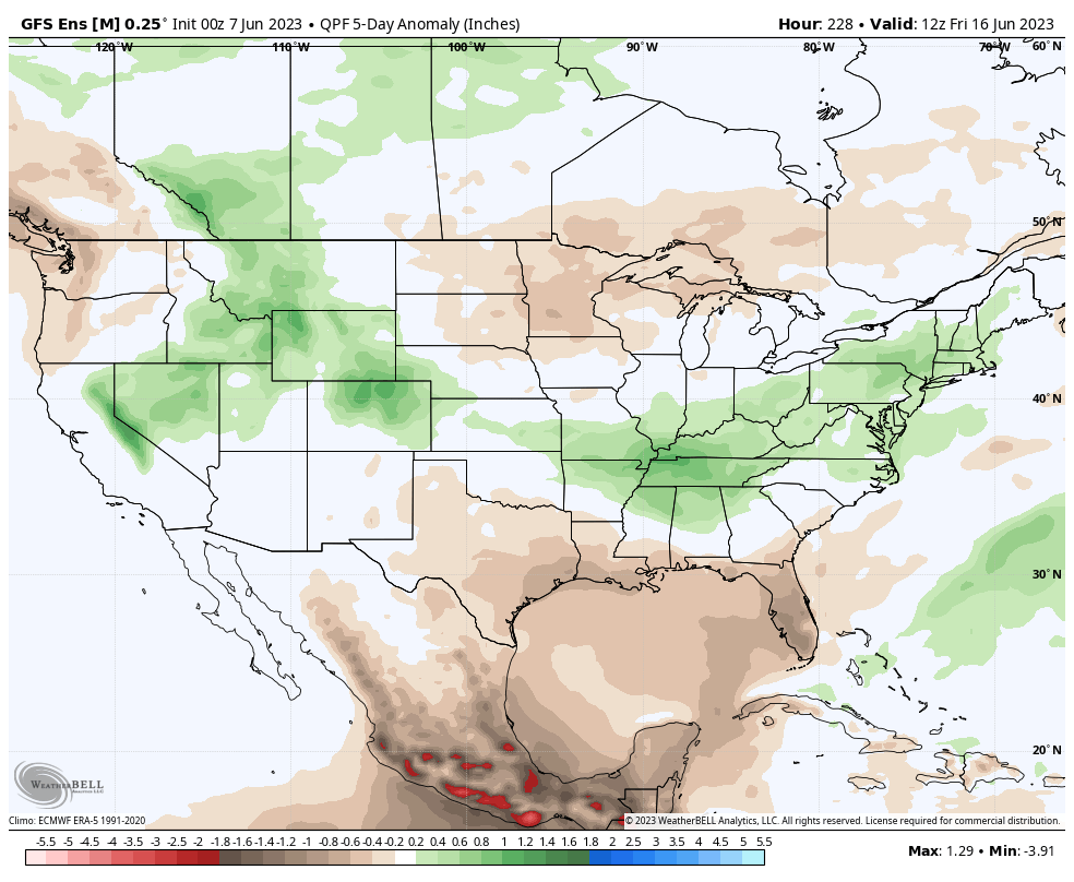
More specifically, we’re targeting this upcoming Sunday to get the wetter party started. While still too early for specific rain amounts, a good chunk of central Indiana and the Ohio Valley as a whole should enjoy a widespread rain.
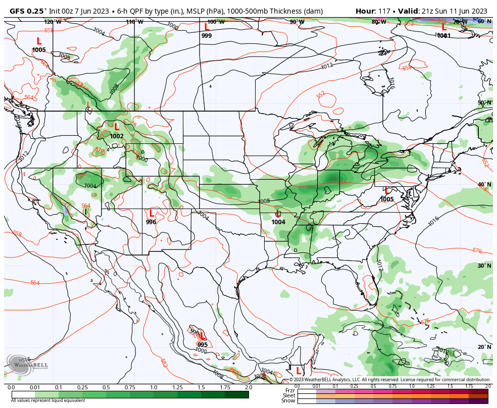
Additional organized rain events are then slated for the middle of next week and the following weekend.
Permanent link to this article: https://indywx.com/2023/06/07/wetter-pattern-on-deck/
Jun 06
Updated 06.06.23 @ 5:13a
You must be logged in to view this content. Click Here to become a member of IndyWX.com for full access. Already a member of IndyWx.com All-Access? Log-in here.
Permanent link to this article: https://indywx.com/2023/06/06/video-lack-of-heat-and-better-rain-chances-headline-extended-pattern/
Jun 05
Updated 06.05.23 @ 7:52a
You must be logged in to view this content. Click Here to become a member of IndyWX.com for full access. Already a member of IndyWx.com All-Access? Log-in here.
Permanent link to this article: https://indywx.com/2023/06/05/video-unseasonably-refreshing-week-better-opportunity-for-more-in-the-way-of-a-widespread-rain-event-over-the-weekend/
Jun 04
Updated 06.04.23 @ 7:40a
You must be logged in to view this content. Click Here to become a member of IndyWX.com for full access. Already a member of IndyWx.com All-Access? Log-in here.
Permanent link to this article: https://indywx.com/2023/06/04/video-cooler-than-normal-week-on-deck-dry-pattern-continues/