Updated 05.19.23 @ 8:58a
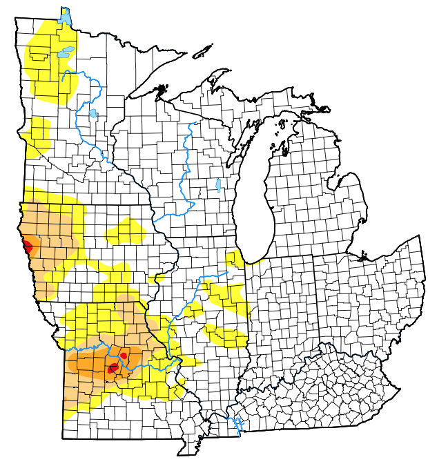
The latest drought monitor (from May 18th) only shows portions of far western Indiana in “abnormally dry,” or D0 intensity.

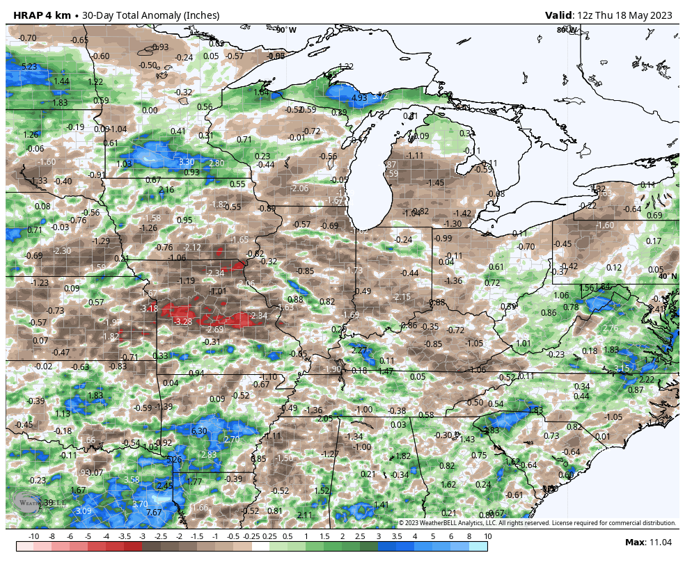
Rainfall over the past (30) days has been hit and miss- not what one ideally wants to see this time of year as feedback can take hold quickly.

Officially, IND is running 3.4″ below normal in the rainfall department since April 1st.
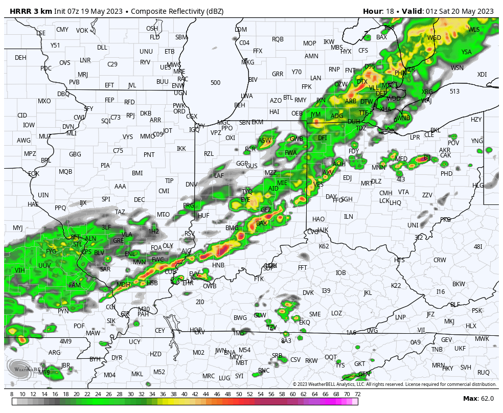
A cold front will press through central Indiana this evening and offer up a smattering of showers and thunderstorms. While some lucky folks will pick up a half inch, or so, most will likely only accumulate rainfall totals between 0.10″ and 0.30″.


After this, dry times return through the weekend and next week, as a whole. In fact, the pattern long term looks significantly drier than normal through the month of June.

Without question, we’ll see the drought monitor begin to include more of the Ohio Valley in abnormally dry or “droughty” conditions in the coming weeks.
As the Nino matures, the middle and back half of summer should take on an increasingly wet look, but that’s not before 4-6 weeks of the current dry pattern getting even drier…
