Updated 04.12.23 @ 7:27a
We’re in cruise control until the weekend. A ridge of high pressure will continue to provide us with dry conditions. After seasonably cool air over the weekend and to open this week, we’ll kickstart the mercury this morning and eventually lead to highs in the 75° to 80° range each afternoon into Saturday. The only request (rather “order”) you have from us is to get outside and enjoy these unbelievable conditions!
Moisture levels will slowly increase over the weekend ahead of an approaching cold front. Clouds will increase Saturday and rain (maybe some scattered thunder) will follow Saturday night into Sunday morning.

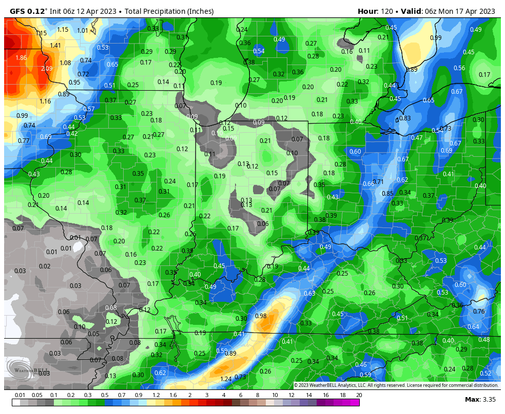
Forecast models continue to remain rather “unexcited” on rainfall amounts: 0.10” to 0.25” expected for most area rain gauges.

While cooler air will follow early next week, data has backed away from the idea of a frost or freeze for now.
That leads us into a couple questions come mid to late next week. The GFS model keeps us high and dry- not delivering another round of precipitation until early to mid Week 2. Meanwhile, the European model drives a couple fast moving systems into our region as early as next Wednesday night/ Thursday, followed by a second feature Friday.
More on this and the long range pattern inside our Client video discussion Thursday evening.
