Updated 04.06.22 @ 6a
When we look at the “big driver” teleconnections over the next 10-14 days, it’s easy to understand why the active weather pattern is expected to continue. The NAO is expected to run predominantly negative over the next couple weeks (which favors eastern chill), but the EPO is expected to fluctuate between positive and negative phases and the MJO is showing signs of pushing into Phases 7 and 8 (favors eastern warmth this time of year).
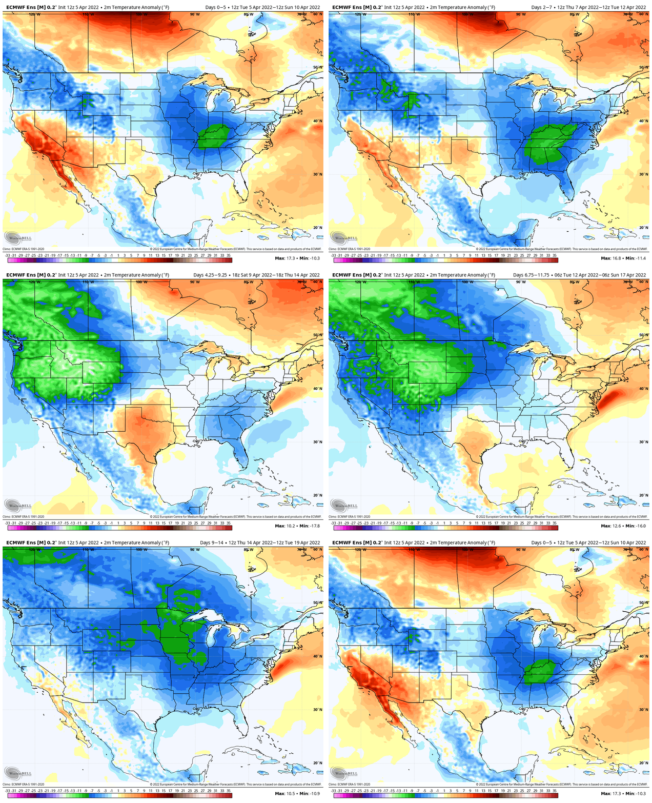
The temperature regime over the next couple of weeks will fluctuate between periods of above normal warmth and well below normal chill. Despite a significant bump in the temperature regime next week, the unseasonably chilly conditions will return with authority late next week, including the threat of frost.

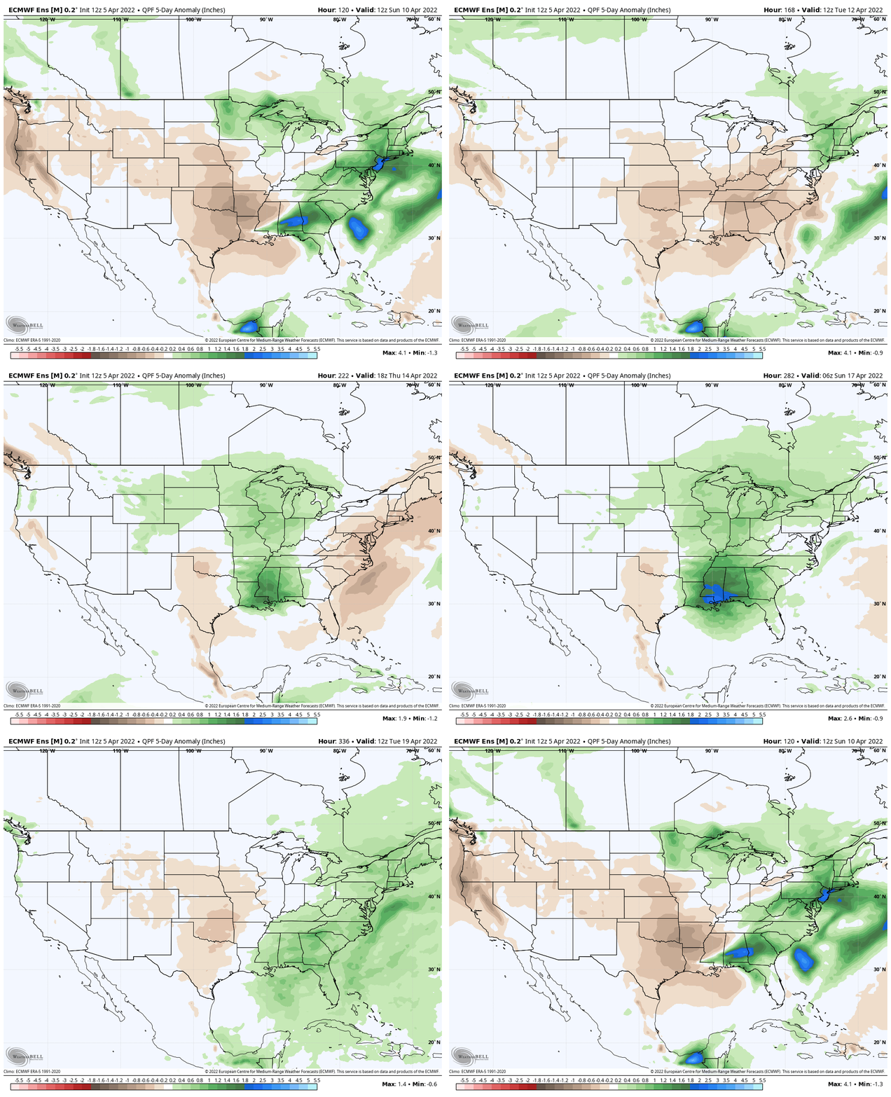
As you’d imagine in this kind of setup, the precipitation pattern will also go through a period of fluctuation. The heaviest precipitation anomalies will center in on the middle of next week through the latter part of the week and may also be met with the potential of severe weather during this time frame (targeting next Thursday for this threat, though this is subject to change as we draw closer and may have to be fine tuned).

Much more in tomorrow’s long range video discussion which will be posted Thursday night due to morning travel.
