Updated 02.03.22 @ 7:05a
You must be logged in to view this content. Click Here to become a member of IndyWX.com for full access. Already a member of IndyWx.com All-Access? Log-in here.

Feb 03
Updated 02.03.22 @ 7:05a
You must be logged in to view this content. Click Here to become a member of IndyWX.com for full access. Already a member of IndyWx.com All-Access? Log-in here.
Permanent link to this article: https://indywx.com/2022/02/03/video-let-it-snow-let-it-snow-let-it-snow/
Feb 02
Updated 02.02.22 @ 8:47p
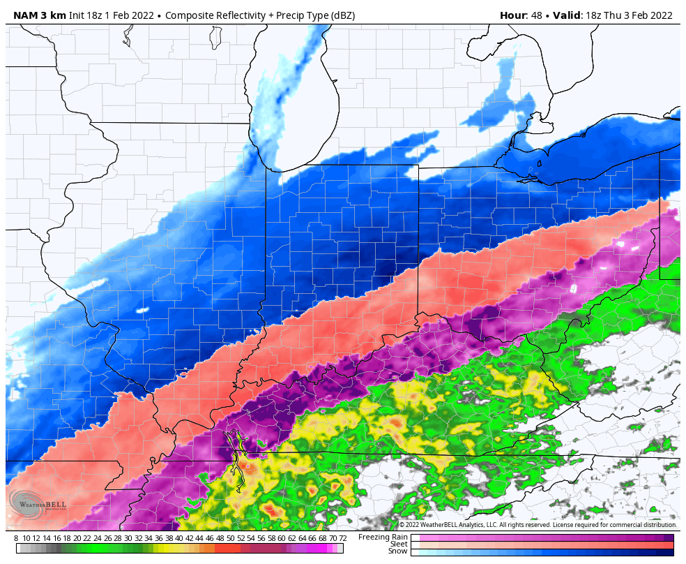
After reviewing the latest data, we have no reason to adjust our ongoing ideas from our latest Client Brief or this morning’s video discussion. Thursday will feature a prolonged period of heavy snow into the evening hours, along with an increasingly stiff NNE wind that will lead to significant blowing and drifting issues- especially during the afternoon and evening. Much more in the AM, friends!

Permanent link to this article: https://indywx.com/2022/02/02/video-its-show-time/
Feb 01
Updated 02.01.22 @ 7p
Type: Severe Winter Weather

What: Heavy mixed precipitation, heavy snow, & strong winds
When: Wednesday afternoon through predawn Friday
Temperatures: Mid 30s, falling into the upper 10s Thursday night
Wind: NNE 15 – 25 MPH (gusts up to 30 MPH Thursday)
Blowing/ Drifting: Significant to severe (especially on east-west roadways)
Pavement Impacts: Plowing and salting will be required
Summary: While we don’t have any significant changes to this morning’s video update, we continue to draw that much closer to “show time” with this winter storm. Conditions will deteriorate from northwest to southeast as we progress through the day tomorrow, but the “main show” for immediate central IN will come late tomorrow night and through the day Thursday. It’s during this time where snowfall rates will exceed 1″/ hour for a widespread portion of the region. Simply put, if you don’t have to travel, please don’t. The added concern also remains present of blowing and drifting issues that will likely develop during the day Thursday. This will be from a byproduct of an increasingly fluffy snow (anything that falls tomorrow will be of the wet, slushy nature), thanks to higher ratios, as the arctic air pours into the region. Add in a stiff north, northeast wind of 15-25 MPH with gusts to 30 MPH and you can easily see where the problems are likely to ensue. In particular, east-west roadways in the open country are likely to drift shut by late morning or afternoon Thursday. Snowfall coverage and intensity will finally begin to diminish from northwest to southeast Thursday night. By that point, it’ll be time to bring the heavy equipment out to engage in removal of the “BIG SNOW.” We still anticipate bitterly cold (5° to 15° below zero) temperatures to take up shop Saturday morning across the region.

Confidence: High
Next Update: 7a Wednesday
Permanent link to this article: https://indywx.com/2022/02/01/client-brief-all-systems-go-for-highly-impactful-winter-storm/
Feb 01
Updated 02.01.22 @ 7:14a
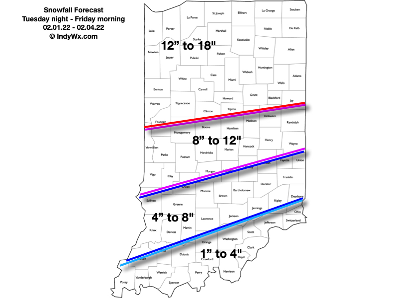
Here’s our snowfall forecast. Most of what accumulates through the heart of the 8″ to 12″ zone and points south will fall with “round 2” Wednesday night and Thursday. This morning’s video update has the details!

Permanent link to this article: https://indywx.com/2022/02/01/video-conditions-deteriorate-wednesday-mixed-precipitation-gives-way-to-heavy-snow-wednesday-night-across-central-in/